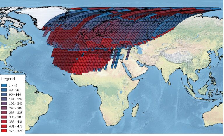
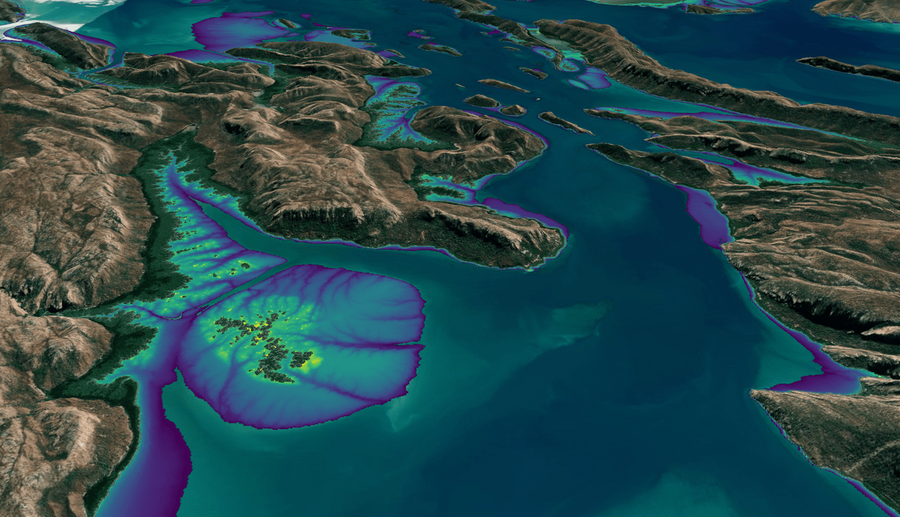
Data Wrangling with Dana Ostrenga
Data interoperability expert Dana Ostrenga explains how government and commercial Earth observation satellites provide broader support to the scientific community when used together.
This month, the Digital Earth Australia (DEA) team released a new Landsat and Sentinel-2 based intertidal data product. The new data set characterizes the tidal shoreline zone of Australia in more detail than ever before.
The research teams who help sustain the largest freshwater reserve in the world are developing a new tool to promote more resilient farming systems in Brazil. The goal is to help farmers better handle changes in the water cycle, deal with droughts, and adapt to a changing climate.
Practitioners managing the wellbeing of wetlands have a new tool at their disposal. The Wetland Insight Tool, developed by Geoscience Australia, provides a visual summary of 35+ years of wetland dynamics.
Opening the Landsat archive has benefited science and society.
Open science principles are being leveraged in a variety of NASA programs, including NeMO-Net, Landsat, and the SERVIR program, which are using artificial intelligence, satellite imagery, and machine learning to better understand and protect our planet’s ecosystems.
The collaboration between NASA and IBM is a unique application of artificial intelligence (AI) foundation model technology to NASA Earth observation data.
Thirty-meter Landsat 8 and 9 data have been added to NASA’s Fire Information for Resource Management System (FIRMS).
This webinar provides an introduction to HLS data, services, and tools and shows you how to find resources to work with the data; visualize, search for, and access the data through NASA Worldview and Earthdata Search; it also demonstrates how to use the Fire Information for Resource Management System (FIRMS) tool to visualize HLS data to monitor fires and floods.
Wu wants anyone to be able to derive meaningful information from geospatial data like Landsat.
The Harmonized Landsat Sentinel-2 (HLS) project offers daily, 30-meter global land surface data products to facilitate a wide range of terrestrial Earth science research.
Justin Braaten is a code wizard, helping everyone from wildlife ecologists to machine learning experts more easily use Landsat.
The Harmonized Landsat Sentinel-2 dataset has been provisionally released. Come explore Landsat 8 and Sentinel-2 data… together.
Many of the Greenland’s glaciers are retreating while also undergoing other physical changes.
A number of new data products with information derived from Landsat inputs have become available recently.
Learn more about the atmospheric transmission data used for our Landsat spectral band comparison graphic.
LANDFIRE has released its Remap dataset; new techniques and new data provide significant improvement.
Dr. Eric Bullock uses Earth observation data to explore the consequences of land use and land cover change in high biodiversity areas.
Invasive species cost the U.S. economy approximately $120 billion a year and disrupt the dynamics of ecosystems. Researchers are increasingly using remote sensing to map where invasive species are and where they could spread in order to minimize their damage.
ESA has processed its historical collection of Landsat MSS data (collected by ESA ground stations) so that it can be easily compared to later Landsat data sets and Sentinel-2 data.
IndigoAg is using HLS data to help fulfill its mission of making farms more profitable and sustainable.
New time-lapse videos of Earth’s glaciers and ice sheets as seen from space are providing scientists with new insights into how the planet’s frozen regions are changing.
Landsat, Sentinel-2, and ASTER confirm a rare lava lake in Mt. Michael’s crater on the sub-Antarctic Saunders Island—a “remarkable geological feature.”
Harnessing 30 years of Landsat data, a team of researchers from Australia has created the first 3D model of Australia’s entire coastline.
Keeping Landsat data free and open is the right path forward, a federal advisory panel has concluded.
Aaron Gerace and Matthew Montanaro earned the 2019 USGIF Academic Achievement Award for their work on the Landsat 8 TIRS stray-light issue.
USGS released the latest edition of the National Land Cover Database (NLCD) for the U.S.—the most comprehensive land cover database that the USGS has ever produced.
Over the last 20 years, a new thermal area has developed in Yellowstone. Landsat 8 is on the case.
The resounding takeaway from a recent paper authored by Landsat Science Team members: Keep Landsat data free and open.
Two new Landsat-based data products and a mapping tool provide data on man-made impervious surfaces and urban extents throughout the world.
Evolving technology, free data and robust calibration have helped make Landsat the cornerstone of global land imaging.
Webinar described the production of the Global Man-made Impervious Surface dataset and its companion urban extent dataset called Human Built-up And Settlement Extent.
An international group is working together to find the best atmospheric correction techniques for Landsat 8 and the Copernicus Sentinel-2 satellite series.