A number of recently released data products use NASA/USGS Landsat inputs. The free and open Landsat archive enables a proliferation of data products that provide novel knowledge about Earth.
Here are some of the products that Landsat data assists:

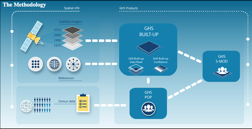
The European Commission’s Global Human Settlement Layer
“A new open and free tool for assessing the human presence on the planet.”
University of Maryland’s GLAD Global Forest Canopy Height Map
“A new, 30-m spatial resolution global forest canopy height map was developed through the integration of the Global Ecosystem Dynamics Investigation (GEDI) lidar forest structure measurements and Landsat analysis-ready data time-series (Landsat ARD).” *Note: this GLAD forest height map is not a GEDI mission product.
Radiant Earth Foundation’s Western USA Live Fuel Moisture
U.S Forest Service manually-collected live fuel moisture measurements for the western United States and remotely-sensed observables from satellites (e.g., Sentinel-1 and Landsat-8) or maps (e.g., soil texture).
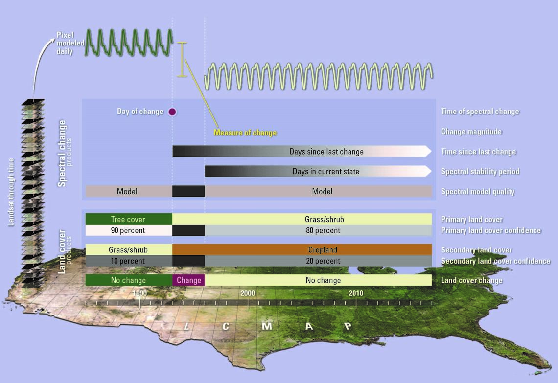
USGS Land Change Monitoring, Assessment, and Projection (LCMAP) land cover change products:
“LCMAP now offers a suite of 10 annual science products that depict land-cover and land-surface change from 1985 to 2017. The products are derived from the U.S. Landsat Analysis Ready Data (ARD). Landsat ARD are produced from data acquired by the Landsat 4-5 Thematic Mapper (TM), Landsat 7 Enhanced Thematic Mapper Plus (ETM+) and Landsat 8 Operational Land Imager and Thermal Infrared Sensor (OLI/TIRS) instruments.”
NASA JPL’s Inter-mission Time Series of Land Ice Velocity and Elevation (ITS_LIVE)
“The ITS_LIVE project facilitates ice sheet, ice shelf and glacier research by providing a globally comprehensive and temporally dense multi-sensor record of land ice velocity and elevation with low latency.”


