By Laura E.P. Rocchio, Landsat Communication and Public Engagement
Harnessing 30 years of Landsat data, a team of researchers from Australia has created the first 3D model of Australia’s entire coastline.
The seashore with its dancing tides has long held a special place in human’s imagination. Thanks to the moon, sun, and gravity, this place where land meets sea is not a fixed point, but a region between low and high tides—the intertidal zone.
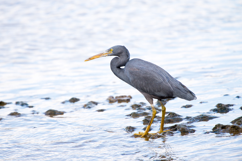
The intertidal zone encompasses an array of ecosystems: sandy beaches, rocky shores, tidal pools, mudflats, seagrass beds, mangrove forests and fringing coral reefs. Life here, where Earth’s terrestrial and aquatic realms join, is adapted to this transitional place. The dynamic organisms that call this region home serve a critical role in nutrient and carbon cycling and as a link in the food chain.
For shorebirds—including a number of endangered species—the intertidal zone is an indispensable feeding ground during migration. For humans, the intertidal zone provides recreational spaces and the first line of defense against storm surges.
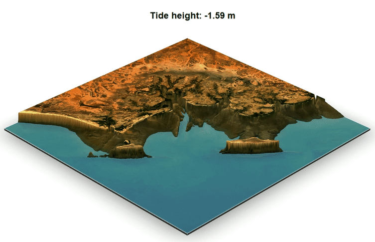
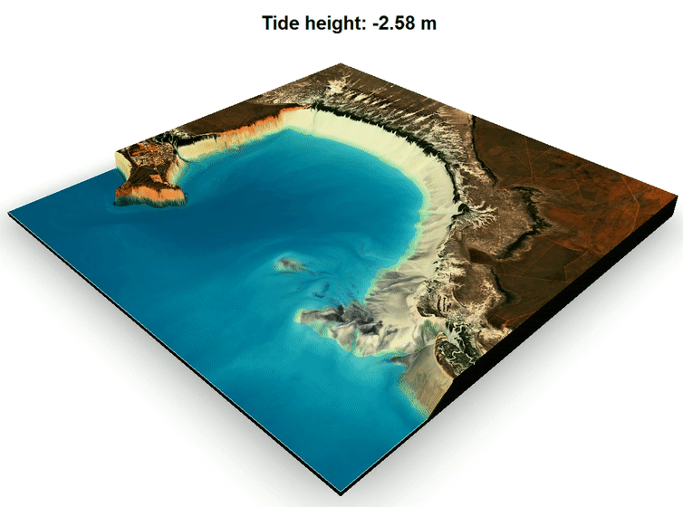
Yet in terms of elevation, the intertidal coastal zone is not very well known. We tend to think of the shoreline as a line, but that line we see on a map is just a representation of where mean sea level is found. The actual intertidal zone itself stretches in either direction depending on the shore’s slope and the tidal range.
Knowing the intertidal zone’s elevation aids tsunami preparedness, storm surge risk management, current modeling, and ecological habitat mapping. But, in the world of elevation information, the intertidal zone has largely been missed, falling between well mapped dry land and bathymetry measurements of the ocean.
Measuring the elevation of this tidally-influenced terrain is difficult, but necessary.
Now, a team from Geoscience Australia has used Landsat data to create the first automated, open source method for deriving intertidal zone elevations. The team, led by Robbi Bishop-Taylor and Stephen Sagar, has produced the first nationwide coastal elevation model for Australia, called the National Intertidal Digital Elevation Model, or NIDEM. NIDEM covers over 15,000 square kilometers (~5800 square miles) of coast. Details of this work have recently been published in the journal Estuarine, Coast and Shelf Science.
Measuring between the tides
“The rise and fall of tides can be used to trace the 3D shape of the intertidal zone,” Bishop-Taylor explained. “By sorting 30 years of Landsat satellite images using a tidal model, we can reveal exactly what areas of the coastline are exposed at different levels of the tide.”
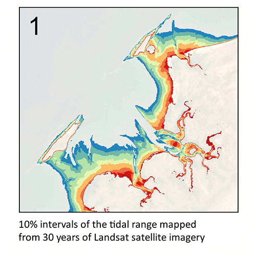
Building on earlier work that used Landsat to map the extent—the x,y location—of the intertidal zone, this new research used knowledge of the tidal range and the presence or absence of seawater during the tidal cycle to model the elevation (the “z”) of the intertidal zone relative to mean sea level.
The accuracy of this approach for tidal flats and sandy shores is high, approaching that of lidar-derived elevations. For rocky shores and places where the tidal model doesn’t capture the complex or extreme tidal patterns, NIDEM accuracy suffers.
For example, in the Buccaneer Archipelago reef in the far north of Western Australia there is an extreme tidal regime—the planet’s largest tidal range for a coral reef system—and strong currents. Here, the tidal model doesn’t accurately show that there is a rapid tidal inundation followed by a slow 10 hour draining period in some places; this uncoupling of the tidal model with the local tidal process hurts NIDEM’s accuracy.
“For these rocky shores and reefs, we saw a decrease in accuracy due to the increased likelihood that the tidal water behavior was unsynchronized with the tidal model,” Sagar explained.
Better local tidal modeling in the future could lead to better accuracy in these areas.
For much of the Australian coast, however, NIDEM provides accurate elevation data—providing information that didn’t exist before.
Benefits of knowing the intertidal zone better
The intertidal zone is counted among the world’s most vulnerable ecosystems. Another Landsat-based study published earlier this year, found that coastal development, erosion, and lack of replenishing river sediments, led to a loss of 16% of the planet’s tidal flats between 1984 and 2016; these problems will compound with sea level rise.
From coastal risk mitigation to ecological conservation, NIDEM stands ready to help coastal managers.
At James Cook University the full NIDEM data set has been incorporated into the elevation model for the Great Barrier Reef (known as the GBR30 grid), covering the entire Queensland coast and the reefs that make up the Great Barrier Reef.
“As a complimentary data source, we are introducing NIDEM to the hydrographic surveying community as a cost-effective means to help fill the gap between ship-based bathymetry measurements and terrestrial elevation data.” Sagar said.
The Queensland Government used an earlier version of this elevation model for regional habitat mapping.
“In an environmental context, knowledge of the elevation nuances of the zone enables a better understanding of how it functions as a habitat for the wealth of species it supports,” Sagar explained.
With the coastal elevation data now spanning the whole of the country, the NIDEM team foresees it assisting in similar projects nationwide.
Making NIDEM possible
The long, dense Landsat data archive coupled with tidal models, and the Digital Earth Australia data cube architecture made this technique and the resulting NIDEM creation possible. Thirty years’ worth of Landsat coastal data was tidally-tagged and sorted, providing enough data to create topographic waterline contours for each of 10 tidal stages between highest and lowest observed tides.
Landsat was used because of its long archive, the reliable continuity between the program’s satellites, and its relatively high 30-m spatial resolution.
“The Landsat archive enables us to develop products that tackle problems and address issues at a continental scale,” Sagar said. “For a country the size of Australia, this would simply not be possible without free and open access to the full time-series that the Landsat archive provides.”
The free and open Landsat archive has been seminal for Open Data Cube initiatives such as Digital Earth Australia and Digital Earth Africa, allowing pioneering techniques and products like NIDEM to be created.
“The long-term acquisition strategy of the Landsat program and the continuity provided by the Landsat 9 mission enable innovative approaches such as NIDEM, giving us insight into otherwise cryptic areas such as intertidal zones.” shared paper co-author and Landsat Science Team member Leo Lymburner.
The world is a better known place because of open Landsat data.
Anyone can explore the NIDEM data via Australia’s National Map.
Reference:
Bishop-Taylor, Robbi, Stephen Sagar, Leo Lymburner, and Robin J. Beaman. 2019. “Between the tides: Modelling the elevation of Australia’s exposed intertidal zone at continental scale.” Estuarine, Coastal and Shelf Science 223:115-128.