
Source: U.S. Department of the Interior
The Department of the Interior today announced the Landsat 2030 International Partnership Initiative, which will enhance U.S. and partner governments’ ability to sustainably manage their land, surface water and resource use. The announcement was made as part of the third convening of the Biden-Harris administration’s National Space Council, chaired by Vice President Harris.
Landsat – a partnership between the U.S. Geological Survey (USGS) and National Aeronautics and Space Administration (NASA) – is the only U.S. satellite system designed and operated to collect essential data on Earth’s geologic formations, natural habitats, farmlands, cities, lakes, glaciers, coastlines and other surface features. Landsat provides imagery at landscape-scale resolution that can be used to support the Department’s efforts to improve environmental sustainability, climate change resiliency, and economic growth – all while expanding an unparalleled record of Earth’s changing landscapes.
“Earth observations are vital in the face of a changing climate,” said Principal Deputy Assistant Secretary for Water and Science Michael Brain. “By combining Landsat’s long-term dataset and legacy of excellence with global partnership, the 2030 Initiative will provide actionable science that can help other science agencies, stakeholders, industry and academics tackle complex questions about how change is affecting landscapes, waterways and wildlife around the globe.”
“As the impacts of the climate crisis intensify in the United States and across the globe, Landsat satellites are crucial to providing data and imagery to help make science-based decisions on key issues including water use, wildfire impacts, coral reef degradation, glacier and ice-shelf retreat, and tropical deforestation,” said USGS Director David Applegate. “The U.S. Geological Survey is proud to support the continued science and understanding of environmental and climate changes that are occurring—not only on the public lands managed by the Department of the Interior—but throughout the United States and across the world.”
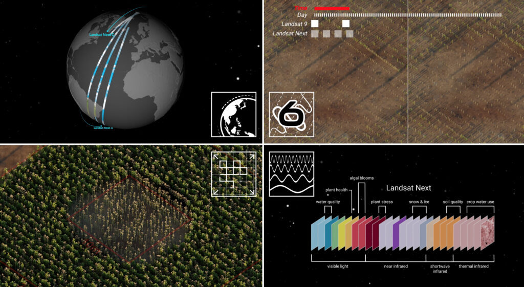
The 2030 Initiative focuses on the U.S. Landsat Next Earth observation satellite mission and will build on Landsat’s 52-year data record enabling users to record, study, understand and better manage landscape change at local, regional and global scales. The Landsat Next mission will provide a new and improved capability for the next generation of users, with higher spatial resolution, twice the current number of spectral bands and improved local revisit time.
The global Landsat data archive maintained by the USGS – Earth Resources Observation Science Center in Sioux Falls, South Dakota, is unparalleled in its length, breadth and quality. Today, Landsat is the most widely cited land-focused Earth observation satellite in the peer-reviewed scientific literature. The Landsat series of satellites have provided science-quality observations of the Earth’s land surfaces, surface waters, and coastal regions for more than five decades.


