
Landsat Observations Key Resource for Many Federal Agencies
In the FY23 Aeronautics and Space Report released on May 23, 2024, a multitude of Federal agencies report work informed by Landsat data.

In the FY23 Aeronautics and Space Report released on May 23, 2024, a multitude of Federal agencies report work informed by Landsat data.
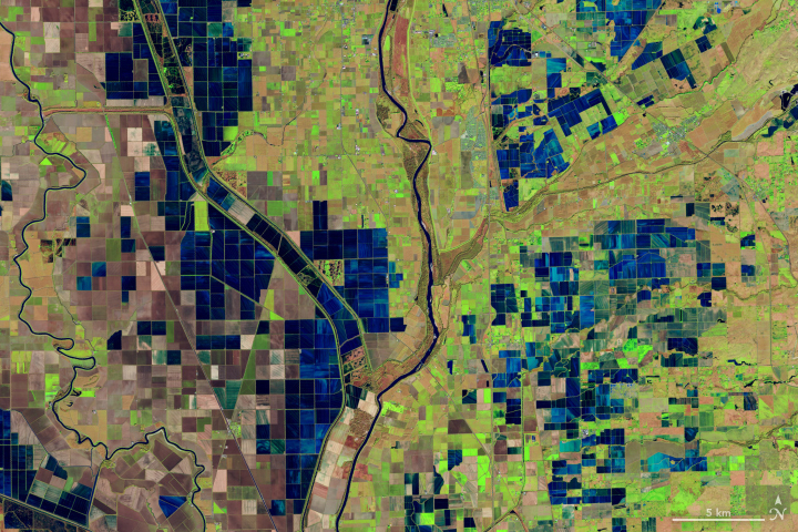
As the world looks for sustainable solutions, a system tapping into Landsat data for water management has passed a critical test.
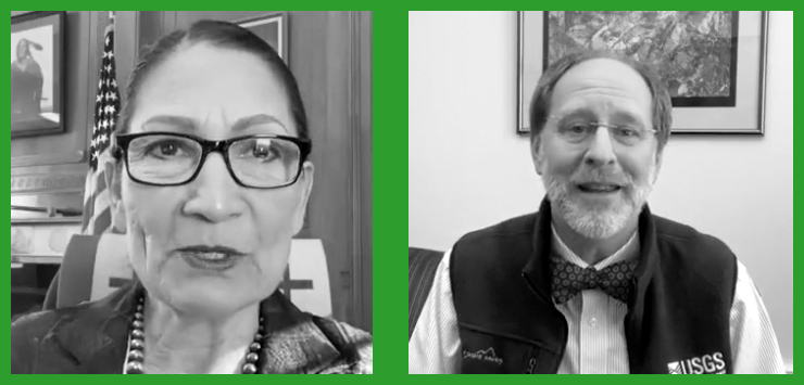
In an Instagram Live event titled “Guided by Science,” Deb Haaland, U.S. Secretary of the Interior, spoke with USGS Director Dr. David Applegate. The Landsat portion of that discussion is shared here.
The Landsat 2030 International Partnership Initiative will enhance U.S. and partner governments’ ability to sustainably manage their land, surface water and resource use.

At a recent Group on Earth Observations Ministerial Summit, DOI Assistant Secretary Cantor and USGS Director Applegate highlighted the Landsat program.

Opening the Landsat archive has benefited science and society.

This February marks the 10th anniversary of the launch of Landsat 8, launched by NASA in 2013 and operated by the US Geological Survey.
More than 100 countries at the UN Climate Change Conference this past year made the bold commitment to halt and reverse deforestation by 2030.
The resounding takeaway from a recent paper authored by Landsat Science Team members: Keep Landsat data free and open.
Evolving technology, free data and robust calibration have helped make Landsat the cornerstone of global land imaging.
Landsat is a gold standard for calibration that adds value and reliability to other satellite systems.
National Park Service cartographer Tom Patterson’s mapmaking process often incorporates information from Landsat.
Landsat 9 Project Scientist Jeff Masek discusses the ways Landsat data is used and how important it is to have high quality data.
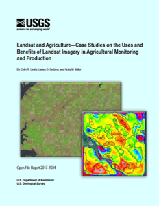
A team of economists from the USGS Fort Collins Science Center has published a new report on Landsat imagery use in agriculture.
Tom Loveland, research scientist with the USGS Earth Resources Observation and Science Center, explains how he uses data — both past and present — to help scientists, natural resource managers, and the public better understand how the face of the planet is shifting and what that change means.
Peter Miller writing for National Geographic, included Landsat as one of ten critical Earth-observing satellites for monitoring our planet. Miller’s article appeared online in mid-October as well as in the November 2015 print edition of National Geographic Magazine.
U.S. Secretary of the Interior Sally Jewell, leading the U.S. delegation to the 2015 Ministerial Summit of the Group on Earth Observations (GEO), today signed an agreement with Mexico serving as a regional milestone for international cooperation in using land-surface satellite images for the benefit of effective land use planning and sustainability.
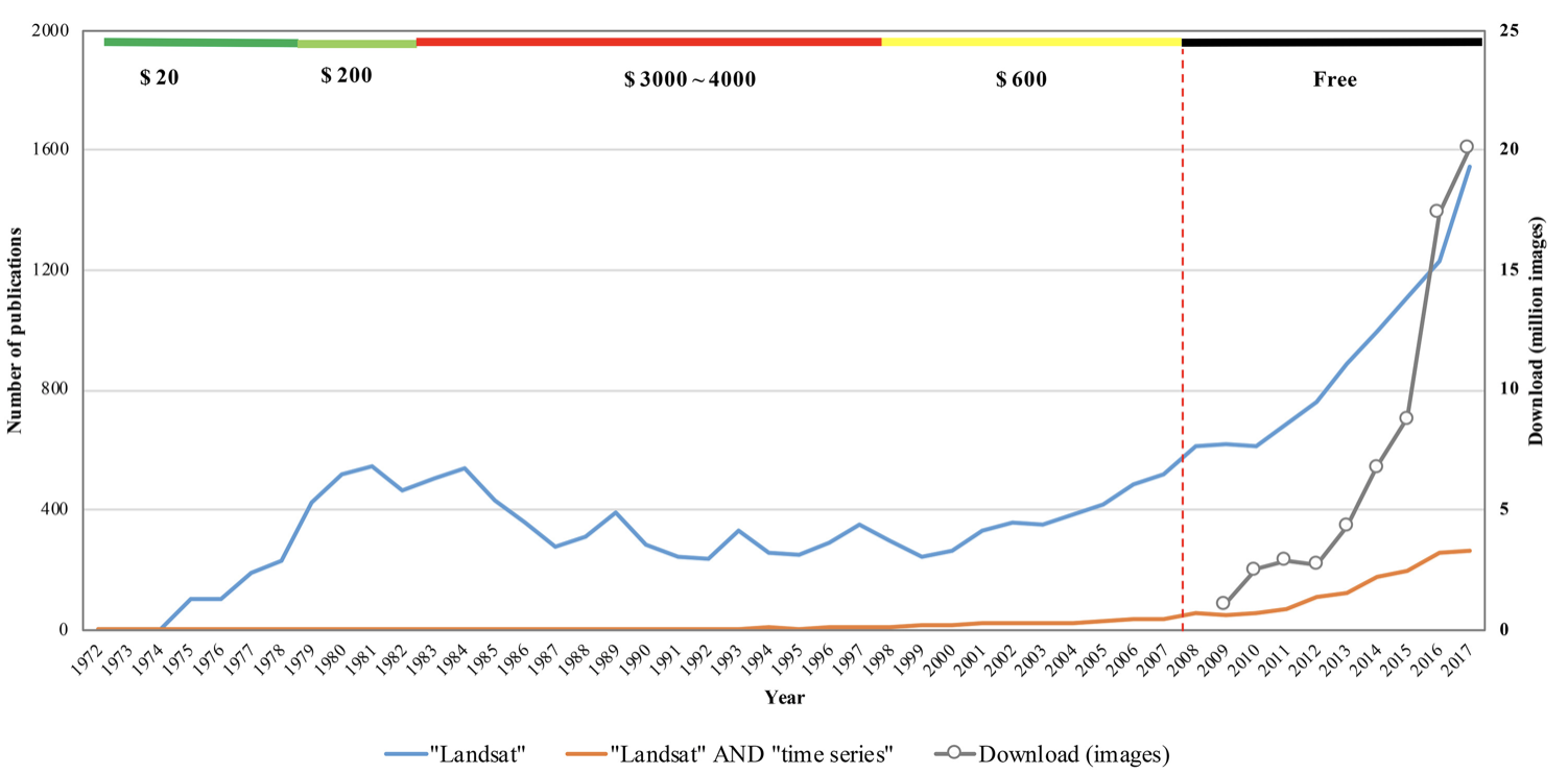
Since late 2008, when Landsat earth observation images were made available to all users free of charge, nearly 30 million Landsat scenes have been downloaded through the U.S. Geological Survey portal – and the rate of downloads is still increasing.
The 2.38 million Landsat images freely downloaded in 2011, benefited the U.S. economy by $1.8 billion found a new study published this month by a team of economists from Colorado State University and the USGS Fort Collins Science Center.
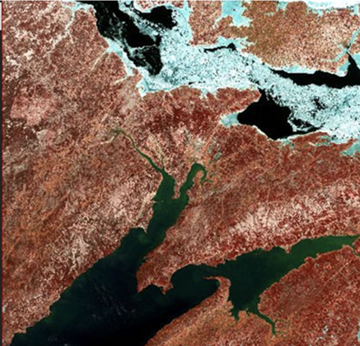
On the most recent nautical chart of the Beaufort Sea where the long narrow Tapkaluk Islands of Alaska’s North Slope separate the sea from the shallow Elson Lagoon (Nautical Chart 16081) a massive shoal is immediately noticeable just west of the entrance to the lagoon. On the chart it looks like a massive blue thumb jutting out into the sea. The National Oceanographic and Atmospheric Administration (NOAA) identified this prodigious, 6-nautical mile-long, 2-nm-wide shoal using Landsat satellite data.
In 2008, the U.S. Geological Survey took 3.6 million images acquired by Landsat satellites and made them free and openly available on the Internet.
Last Thursday, Amazon Web Services (AWS) announced that it is now hosting Landsat 8 imagery on its publicly accessible Simple Storage Service (S3).
Landsat is a key data input for many products developed and used in water resources, agricultural monitoring, land use and land cover monitoring, forest management, and development planning.
Orbiting Earth more than 400 miles away in space, far from human view; recording repeated images of land around the globe for more than 42 years; offering customers petabytes of historical and current data for free, the Landsat program of Earth observing satellites could be seen as the personification of the most single-minded office worker — tirelessly systematic, yes, but after so many years, perhaps less than dramatic.
Mapbox is a cloud-based map platform startup that creates custom maps with open source tools. The team at Mapbox consists of over fifty cartographers, data analysts and software engineers, located in Washington, D.C. and San Francisco, California. One of the open-source tools used by Mapbox is Landsat imagery. The company has a satellite team consisting of five employees dedicated to projects that use Landsat imagery to develop new products and enhance existing imagery.
SilviaTerra is a four-year-old start-up company with five full-time employees that is contributing to the change in the way forests are managed in the United States. The company provides next-generation, highly accurate forest inventory data to fifteen users of various sizes. The customer base includes national and international timber companies. SilviaTerra is profitable and continues to grow.
Dr. Robert Anemone is the head of the Department of Anthropology at the University of North Carolina at Greensboro. But he works out of a pretty standard office. The administrative assistant greets you in the outer office before gesturing toward the next door.
A recent White House-led assessment found that Landsat is among the Nation’s most critical Earth observing systems, second only to GPS and weather. A new USGS study, Landsat and Water — Case Studies of the Uses and Benefits of Landsat Imagery in Water Resources, provides examples of why Landsat is so valuable.
Humans have been observing Earth for a very long time simply because the conditions of the Earth are basic to our survival and our prosperity. Even the most ancient written records are filled with accounts of great floods, famines, and earthquakes. When to plant and when to harvest, how to use precious water resources most effectively, and ways to avoid natural disasters are all age-old challenges that have encouraged Earth observation from the beginning of civilization.
In 1972 NASA launched the Earth Resources Technology Satellite (ETRS), now known as Landsat 1, and on February 11, 2013 launched Landsat 8. Currently the United States has collected 40 continuous years of satellite records of land remote sensing data from satellites similar to these. Even though this data is valuable to improving many different aspects of the country such as agriculture, homeland security, and disaster mitigation; the availability of this data for planning our nation’s future is at risk.
