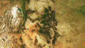
Charlie Loyd, a member of the satellite team at Mapbox, points out that Landsat imagery is an integral part of the satellite base layer which is a vital part of the business. “There are more than 800 billion Landsat-derived pixels of land in our imagery. If we printed out just our Landsat-based world map at poster resolution, it would cover two acres,” says Loyd.
Internal estimates at Mapbox show that licensing commercial imagery equivalent to Landsat would cost $4 million per year for the base layer alone. The company would face costs beyond $4 million to produce the current cloudless basemap product, which requires more input pixels than output pixels. These costs would prohibit further development of medium-resolution products. “In other words,” Loyd notes, “we make goods with Landsat that otherwise would not get made.”
Landsat data served by Mapbox is employed by users from USA Today to small environmental monitoring nonprofits to support their missions. Mapbox has been involved in two major humanitarian emergencies since Landsat 8 became operational: the 2013 Typhoon Haiyan in Philippines and the 2014 Ebola outbreak in West Africa. In both cases Landsat 8 proved to be the best imagery source for mapping major roads, rivers, and land use. These capabilities are extremely important for disaster response in the first few days of the crisis. Under both scenarios, Landsat 8 provided the only readily available imagery with the coverage and frequency required for disaster assessment. The imagery served as the backbone of relief mapping until higher resolution commercial imagery became available at a later point in the process.
Mapbox believes that these non-revenue generating, humanitarian uses of Landsat are important. “An additional, 100% operational Landsat satellite joining Landsat 8 in orbit would provide orders of magnitude greater benefits to society in cases like these,” says Loyd.
Additionally, Landsat imagery is extremely important for education and outreach. Mapbox uses the imagery as a demonstration dataset, knowing it will be freely available to any user in a given area of interest. “There is simply no comparable alternative at medium or high resolution,” says Loyd of Mapbox.
Loyd also adds that as a well understood and validated dataset, Landsat provides hundreds of thousands of dollars of “behind the scenes” value per year, including its use as data to scale-test pipelines designed for sources that are not yet operational, and data to calibrate against. For example, USDA’s National Agriculture Imagery Program (NAIP) imagery is another free source of data, but at times the color in the photo drifts and becomes washed out. Although not necessarily detectable in a single photo, the discrepancies are visually noticeable at the borders of stitched-together images. Such imperfections can be prohibitive for some uses of commercial imagery. However, NAIP imagery is improved by Mapbox through matching it to Landsat to adjust the color. This could potentially be done using data from NASA’s MODIS sensor, but the finer resolution of Landsat works much better to match the true color and produce a visually appealing, value-added product. Thus, Landsat is not only valuable for the data it provides, but for the quality that enables improvement of other imagery.
Like many users of Landsat imagery, Mapbox also experiences a set of challenges associated with the imagery. The bottleneck the company faces is the infrequent repeat cycle of the imagery. Landsat 7 is impractical for the purposes at Mapbox at this point due to its faulty scan line corrector. Although the 16-day site-revisit cycle of Landsat 8 can provide quality imagery, cloud cover in some regions often makes the imagery unusable, resulting in few, if any, useful images per month. A higher revisit frequency would allow Mapbox to develop a new class of products, for example, seasonal cloudless imagery layers. Mapbox estimates that the market for products developed using higher frequency Landsat imagery reaches well into the tens of millions of dollars. Beyond the new product potential, Mapbox’s biggest interest is in seeing two fully functional Landsat satellites on orbit. In the meantime, they must hedge against the risk of a current satellite failing.
As the company continues to grow and produce value-added products using Landsat and other imagery, it also remains a strong proponent of free open-source data.
References:
+ Loyd, Charlie, Mapbox, (oral and written commun., 2014)
Any use of trade, firm, or product names is for descriptive purposes only and does not imply endorsement by the U.S. Government.

Be Part of What’s Next: Emerging Applications of Landsat at AGU24
Anyone making innovative use of Landsat data to meet societal needs today and during coming decades is encouraged to submit and abstract for the upcoming “Emerging Science Applications of Landsat” session at AGU24.


