
Landsat Observations Key Resource for Many Federal Agencies
In the FY23 Aeronautics and Space Report released on May 23, 2024, a multitude of Federal agencies report work informed by Landsat data.

In the FY23 Aeronautics and Space Report released on May 23, 2024, a multitude of Federal agencies report work informed by Landsat data.
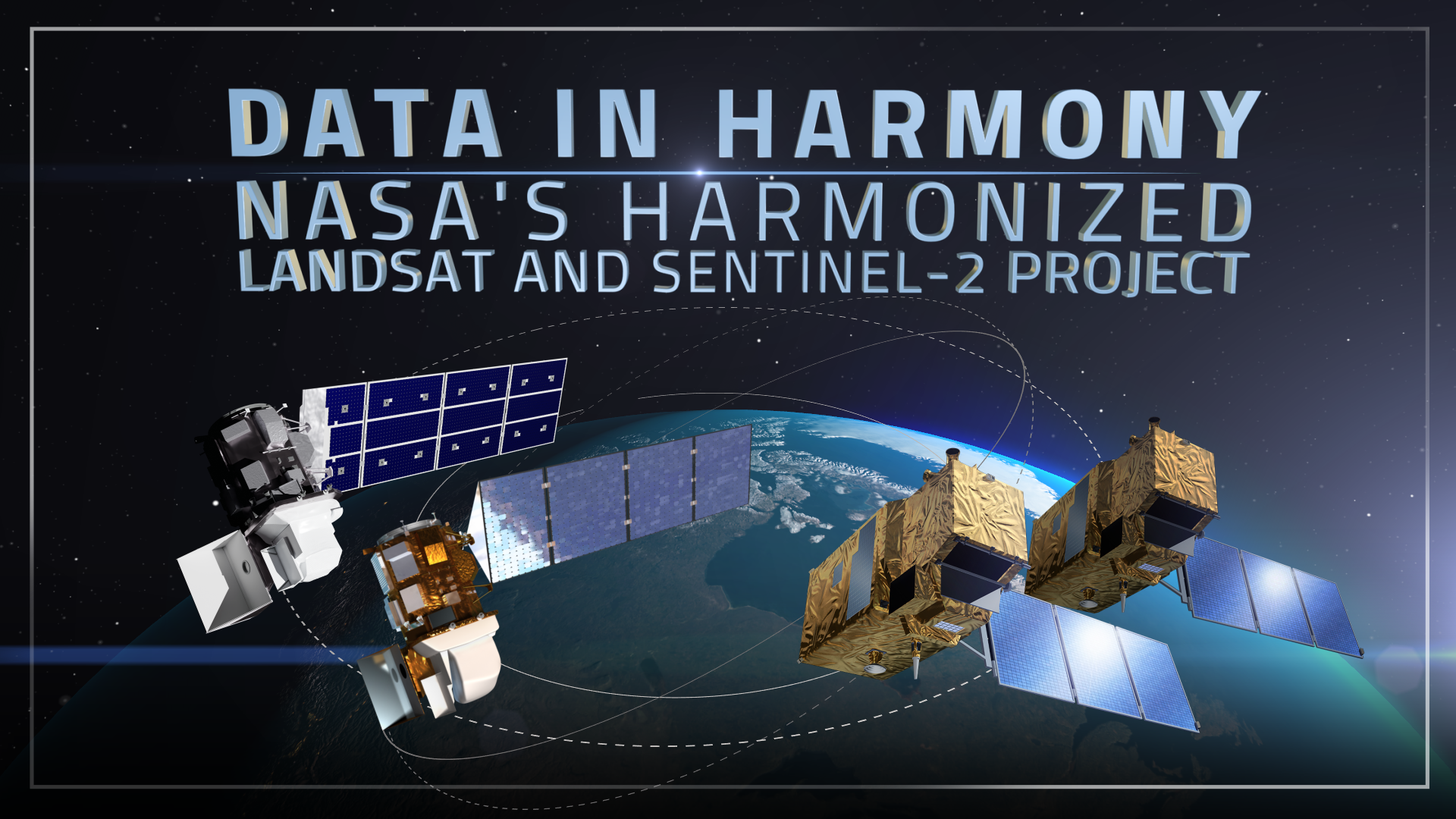
NASA’s Harmonized Landsat and Sentinel-2 (HLS) project is a groundbreaking initiative that combines data from Landsats 8 & 9 with the European Space Agency’s Sentinel-2A & 2B satellites.
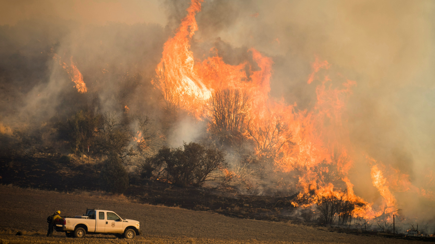
A new study using NASA satellite data reveals how drought affects the recovery of western ecosystems from fire, a result that could provide meaningful information for conservation efforts.
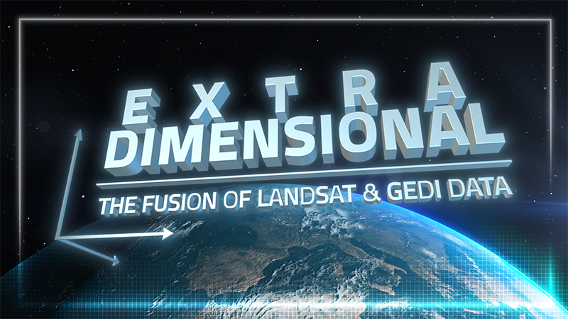
When Landsat’s vast decades-long archive is combined with data from other instruments it can provide amazing insight into how our world is evolving with us and around us. Here are some of the ways Landsat and GEDI data are being harnessed to help us better understand the complex relationship between humanity and nature.
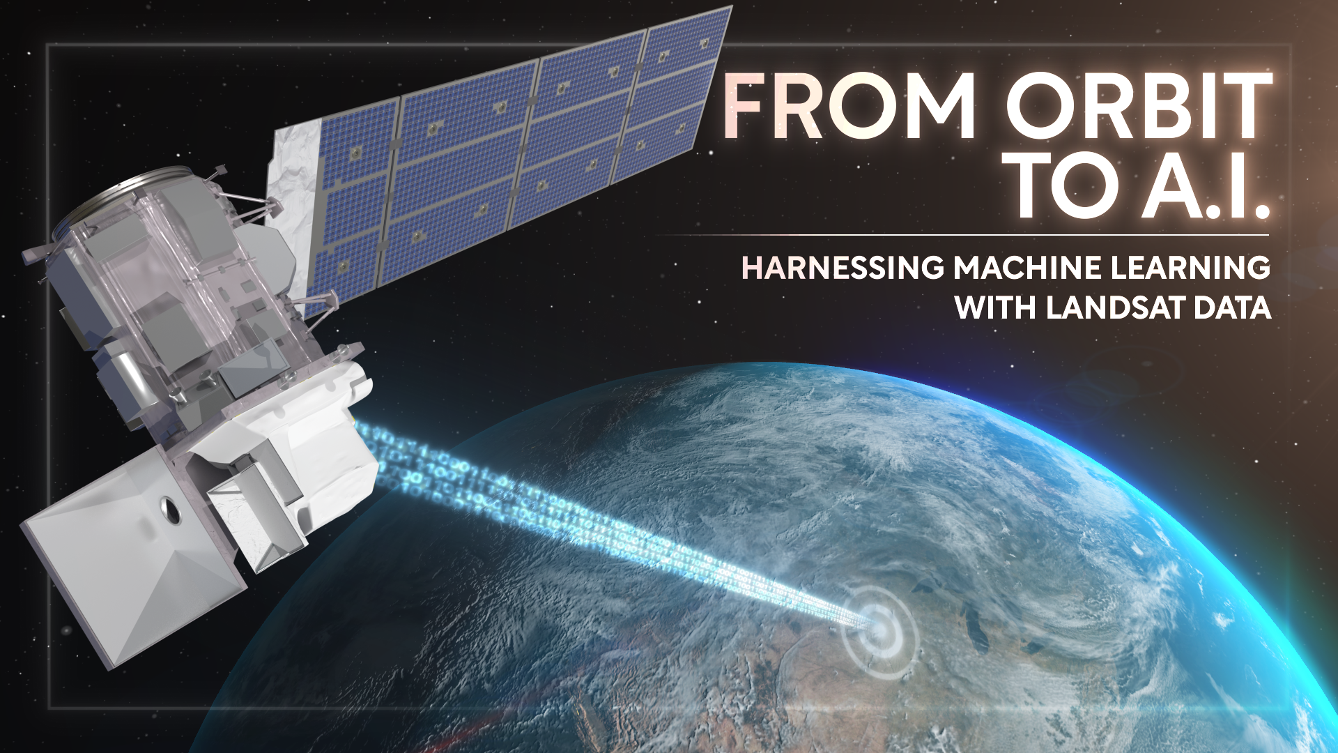
Over the past few years, machine learning techniques have been increasingly used to analyze the vast amount of data collected by the Landsat mission, which has been circling the globe for over 50 years.
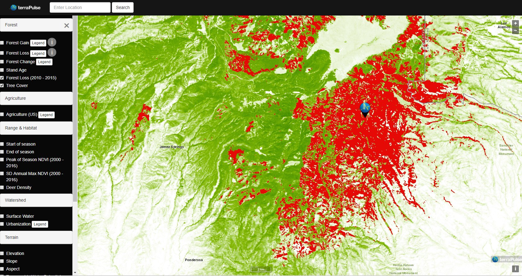
Applying AI to Earth data—including Landsat—helps terraPulse reveal sustainable options for farming, reforestation, and land management.
Merging data from multiple satellites, OPERA can help government agencies, disaster responders, and the public access data about natural and human impacts to the land.

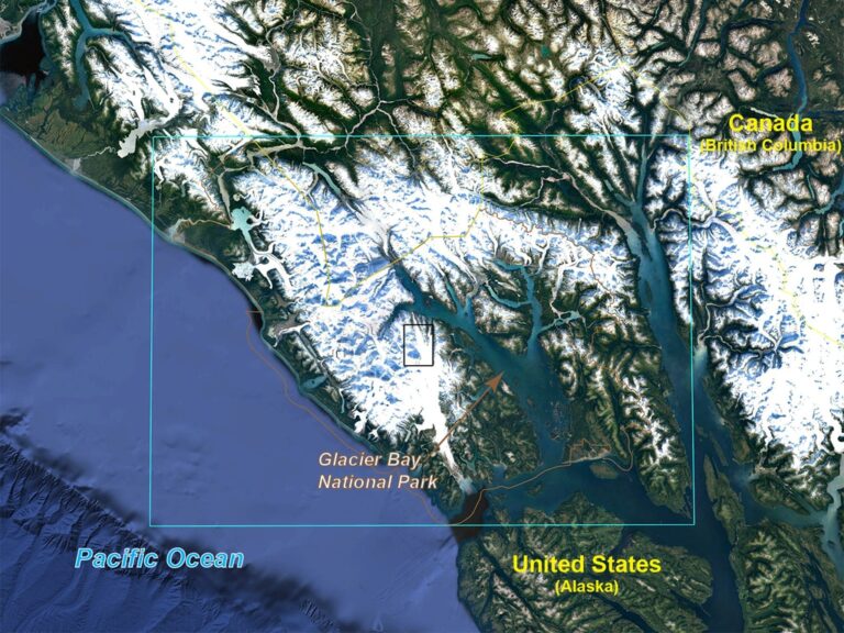
Nestled in the science-based information that park rangers share with visitors to Glacier Bay National Park and Preserve are insights from Landsat satellites and NASA climate scientists.
UCONN remote sensing experts used Harmonized Landsat Sentinel-2 imagery to quickly assess damage caused by the storm’s aftermath, providing spatially-relevant situational awareness that could aid rescue efforts.
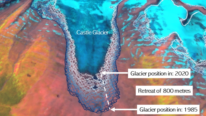
A new mapping tool developed by UNBC researchers shows that western Canadian glaciers are shrinking at an increasing rate.

Using 30 years of Landsat data, researchers have found that the volume of glacial lakes worldwide has increased by about 50% since 1990.
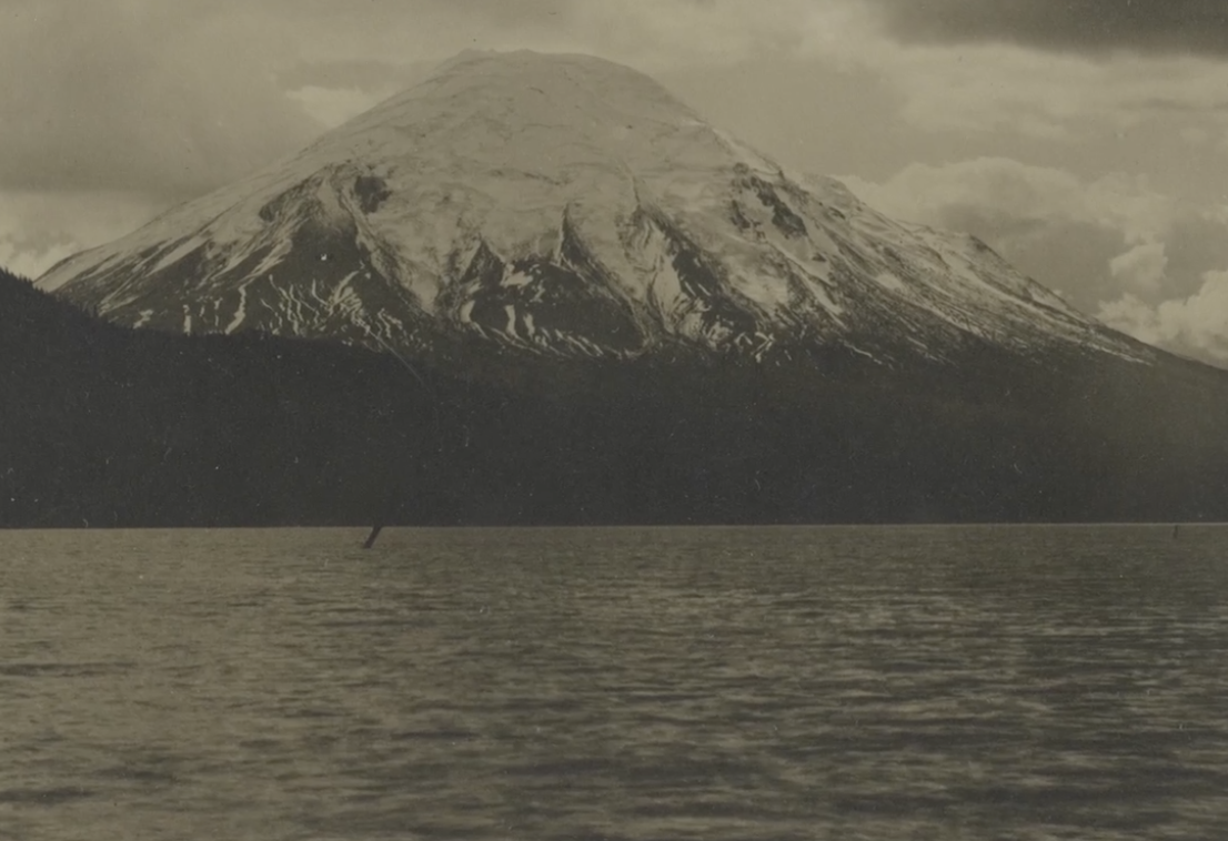
Landsat data (since 1972) is helping scientists Sean Healey and Zhiqiang Yang of the Rocky Mountain Research Station (U.S. Forest Service) study the long-term impact of the May 18, 1980, eruption of Mount St. Helens.
Landsat continues to support the International Disaster Charter.
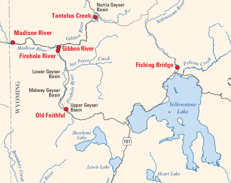
Landsat is among the resources that scientists are using to assess hazards and track volcanic activity in Yellowstone.
December 11, 2019 • Dr. Christopher Shuman is a glaciologist with NASA Goddard Space Flight Center and the University of Maryland at Baltimore County. Here is
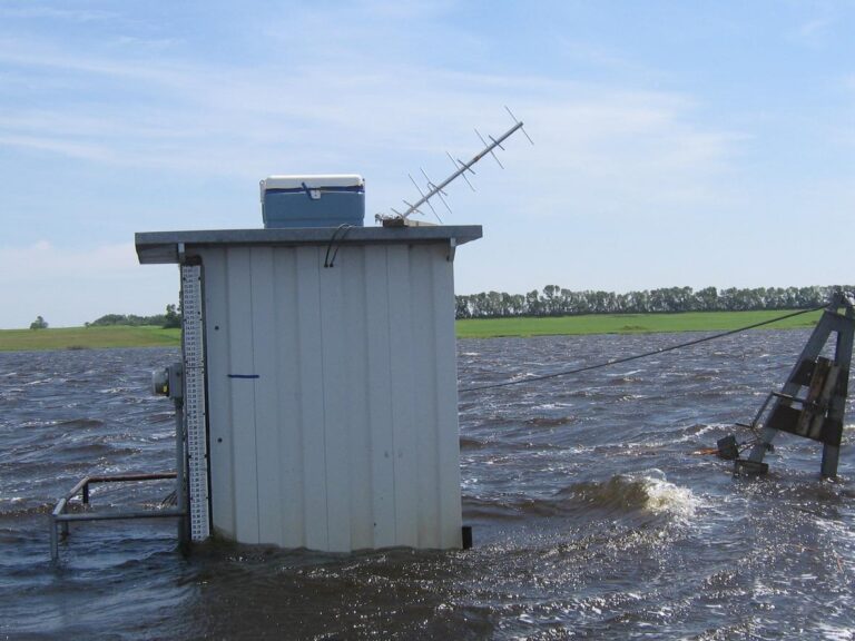
Landsat has enabled a more thorough understanding of how the Central Valley landscape is impacted by floods.
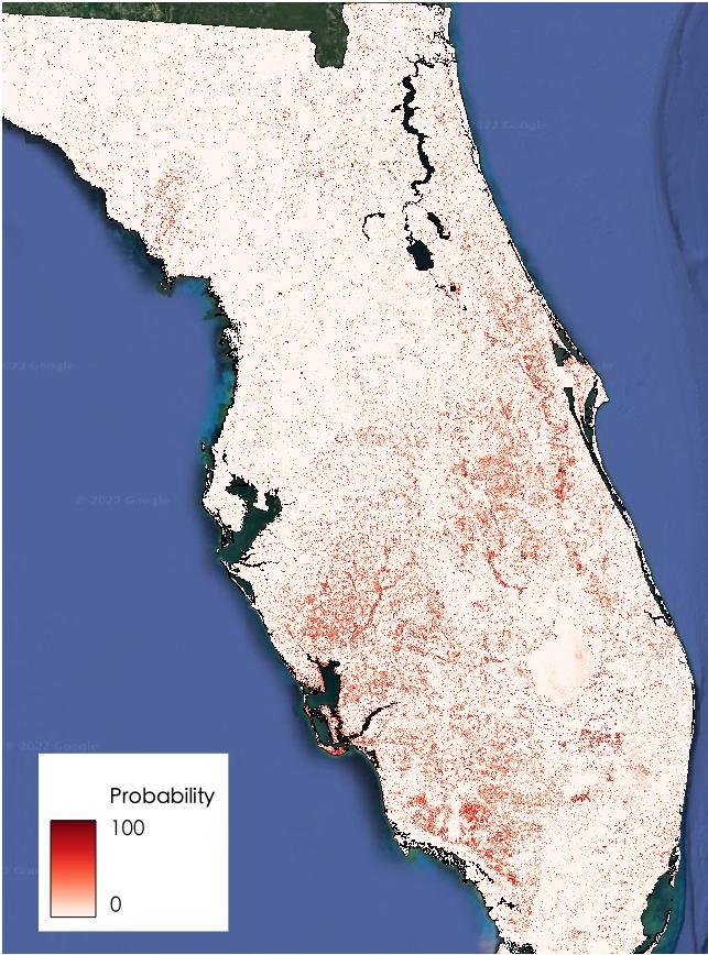
A new longitudinal study from Australia has harnessed thirty years of NASA/USGS Landsat data to map the nationwide movement and migration of mangrove forests.
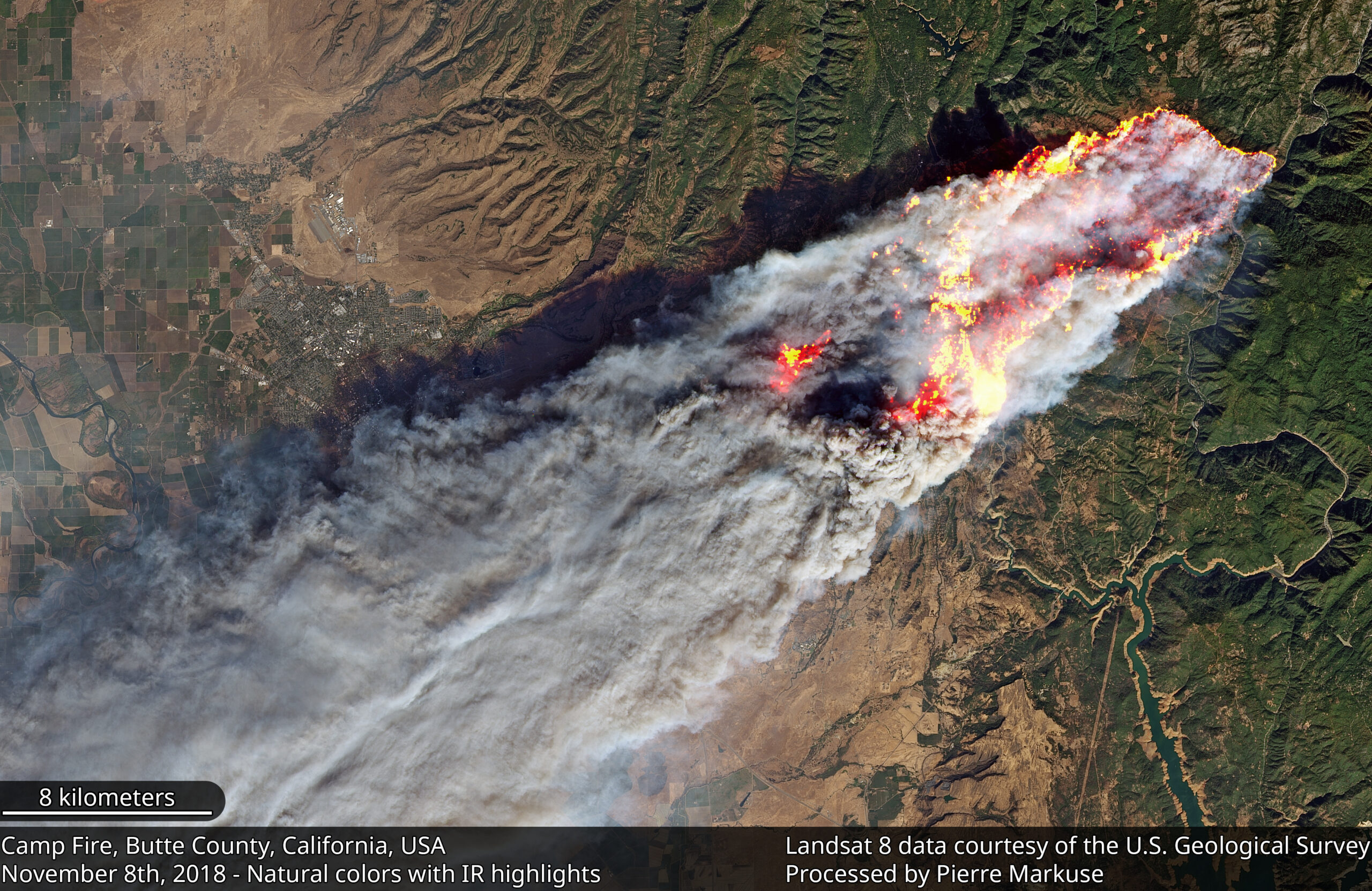
Sprawling urban fires that once plagued civilization were thought to be a thing the past—the Camp Fire let us know they are back.
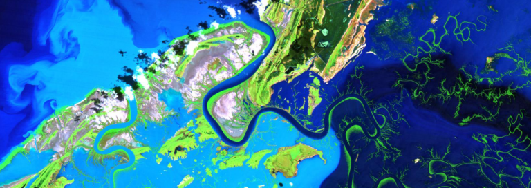
For larger rivers, Landsat provides a rich dataset to define spatiotemporal patterns of channel shifting.
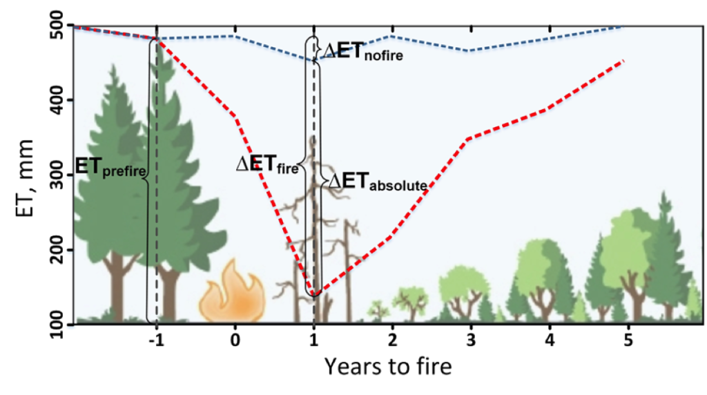
Fires play an important role in regulating forest density, vegetation water use, and runoff.
A new Burned Area algorithm has been developed by USGS to identify burned areas in images across the Landsat archive.
As global temperatures rise, melting permafrost is expected to cause more frequent and hazardous landslides.
Scientists at Berkeley Lab have produced a rapid mapping of the disturbance intensity across Puerto Rico’s forests with the help of Google Earth Engine and Landsat 8.
Using Earth Observation data to monitor volcanic eruptions.
Hurricane Maria tore across Puerto Rico on September 20, 2017, ravaging both urban and rural areas with category 4 winds and intense rainfall for several days.
Irma battered several Caribbean islands in September 2017; when the clouds cleared the destruction became obvious even from space.
The Disaster Charter used Landsat 8 data to map flooding on the Orinoco and Caroni Rivers.
Landsat 8 data was used to map the fire extent, measuring some 16,000 hectares of destruction.
Burned Area Emergency Response teams—one of most important parts of wildfires that you’ve probably never heard of.
This month, 34 Landsat scenes were ingested by the USGS Hazard Data Distribution System to provide data for Charter activations.
In the decades since the Mount St. Helens eruption, scientists have studied the recovery of the ecosystem around the mountain using the Landsat series of satellites.
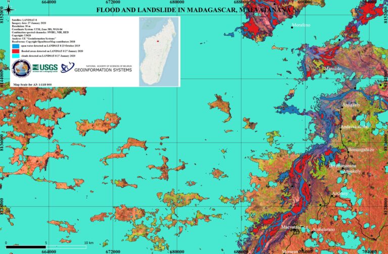
A Landsat 8-based map showing regions south of Iran’s Lake Urmia that have been effected by recent flooding has been created for UN decision makers.
This month, 37 Landsat scenes were ingested by the USGS Hazard Data Distribution System to provide data for Charter activations.
