
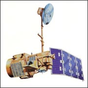
On March 1, 1984, NASA launched Landsat 5, the agency’s last originally mandated Landsat satellite. Landsat 5 was designed and built at the same time as Landsat 4 and carried the same payload: the Multispectral Scanner System (MSS) and the Thematic Mapper (TM) instruments.
In 1988, Landsat 5’s primary TDRSS transmitter (Ku-band) failed, then in July 1992, the redundant Ku-band transmitter failed. This failure made downlinking data acquired outside of the U.S. data acquisition circle (i.e., range of U.S. ground receiving antennas) impossible; Landsat 5 had no on-board data recorder to record acquired data for later downlink.
The MSS instrument was turned off in August of 1995.
In November 2011, the TM instrument stopped acquiring images due to a rapidly degrading electronic component. A few months later, engineers turned the MSS instrument back on, and implemented new capabilities to ingest the raw instrument data at the ground station.
On Dec. 21, 2012, the USGS announced Landsat 5 would be decommissioned after the failure of a redundant gyroscope. The satellite carries three gyroscopes for attitude control and needs two to maintain control. In January 2013, Landsat 5’s instruments were powered off and the satellite was moved in to a lower orbit. Mission operators conducted several burns to use all of the excess fuel, and put the satellite into a disposal orbit in June 2013. They sent the last command to power off the transmitter on June 5, 2013.
Outliving its three-year design life, Landsat 5 delivered high-quality, global data of Earth’s land surface for 28 years and 10 months, officially setting a new Guinness World Records title for “Longest-operating Earth observation satellite.”
The era of privatization
The year Landsat 5 was launched Congress decided that land satellites could be privatized (1984 Land Remote Sensing Commercialization Act). NOAA, the agency in charge of all Landsat operations, was instructed to find a commercial vendor for Landsat data. NOAA selected Earth Observation Satellite Company (EOSAT).
The contract gave EOSAT the responsibility for archiving, collecting and distributing current Landsat data as well as the responsibility for building, launching and operating the following two Landsat satellites (with government subsidies).
Commercialization proved troublesome; EOSAT had limited commercial freedom due to provisions of the 1984 law. Given these constraints, NOAA and then EOSAT raised image prices from $650 to $3700 to $4400 and restricted redistribution. While the U.S. monopoly of Landsat-like data made this 600% increase feasible, the practice priced out many data users. (As a result, many data users migrated to the free low-resolution land data being captured by meteorological satellites.) In 1986, a French Landsat-like satellite launch broke the U.S. monopoly.
During the EOSAT commercialization era, Landsat coverage standards languished. Many observations from 1984 to 1999 were missed because there was no obvious and immediate buyer. With commercial data marketing, it makes sense to only collect data for which there is an established customer, whereas a true scientific mission collects as much global data as possible for future scientific study. Landsat 4 and 5 system calibration and characterization lapsed during this period as well.
By 1989, with two aging satellites and no operatonal budget, NOAA directed EOSAT to turn off the satellites (no government agency was willing to commit augmentation funding for continued satellite operations and data users were unwilling to make the hefty investments in computer processing hardware if future data collection was uncertain). The program was only saved by a strong protest from Congress and foreign and domestic data users, and an intervention by the Vice President.
Given this outcry and the unexpected outcome of privatization, Congress facilitated the Land Remote Sensing Policy Act of 1992, which instructed Landsat Program Management to build a government-owned Landsat 7.
Two years after the launch of Landsat 7, Space Imaging (formerly EOSAT) returned operational responsibility for Landsat 4 and Landsat 5 back to the U.S. Government.
On July 1, 2001, when operational control was officially returned to the federal government, Space Imaging also relinquished their commercial right to Landsat data, enabling the USGS to sell all Landsat 4 and Landsat 5 data in accordance with the USGS pricing policy.
Quick Facts
- Launch Date: March 1, 1984
- Status: Decommissioned January 2013
- Sensors: TM, MSS
- Altitude: 705 km
- Inclination: 98.2°
- Orbit: polar, sun-synchronous
- Equatorial Crossing Time: nominally 9:45 AM (± 15 min.) local time (descending node)
- Period of Revolution: 99 minutes; ~14.5 orbits/day
- Repeat Coverage: 16 days

