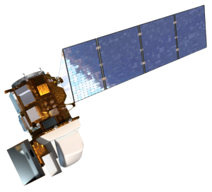
The transition followed a 100-day commissioning period during which NASA and the USGS systematically checked out all of the spacecraft and ground subsystems and raised the satellite to its operational orbit at 438 miles (705 kilometers) altitude. Analyses of data collected during this check-out period show that the satellite, sensors and ground system performance metrics exceed specifications in most respects.
Landsat 8 data products are now available to the public from the USGS Earth Resources Observation and Science, or EROS, Center in Sioux Falls, S.D. EROS opened the Landsat 8 data archive on the first day of normal operations, providing immediate access to more than 22,000 scenes collected since April 12, 2013, the day the satellite ascended to its operational orbit. Since May 30, EROS has added more than 400 Landsat 8 scenes per day to the archive. As with all the Landsat data in the EROS archive, anyone can search the archive and order Landsat 8 data products for free using search tools provided on the USGS website. These tools include EarthExplorer, GloVis and the LandsatLook Viewer.
On July 21, the flight operations team performed a maneuver to avoid a possible collision between Landsat 8 and another orbiting object. The maneuver also served to make up for atmospheric drag, and the satellite returned to its Earth-observing mode.

Be Part of What’s Next: Emerging Applications of Landsat at AGU24
Anyone making innovative use of Landsat data to meet societal needs today and during coming decades is encouraged to submit and abstract for the upcoming “Emerging Science Applications of Landsat” session at AGU24.


