
by Kate Ramsayer, NASA Goddard Space Flight Center
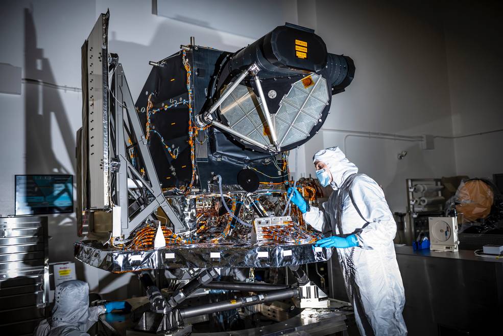
The Landsat 9 instrument that will help scientists detect deforestation, monitor crops and track potentially toxic algal blooms, among many other uses, is now built, tested, and in place to be assembled onto the spacecraft.
The Operational Land Imager 2, or OLI-2, will detect visible and infrared light from Earth’s surface, providing data on our changing planet. Like its predecessor that launched in 2013 on the Landsat 8 satellite, OLI-2 contains thousands of sensors that view a swath of Earth’s surface in nine spectral bands, optimized to detect different features on the surface.
OLI-2 is shown in this photo at Ball Aerospace in Boulder, Colorado, where it was built and tested. On Sept. 18 it was trucked from Boulder to the Northrop Grumman facility in Gilbert, Arizona, arriving the next day. At Northrop Grumman, engineers will assemble and then test the complete Landsat 9 spacecraft with OLI-2 and another instrument, the Thermal Infrared Sensor 2, or TIRS-2, which was built at NASA’s Goddard Space Flight Center in Greenbelt, Maryland.
The Landsat series of satellites began with Landsat 1 in 1972, generating the longest continuous record of observing our planet’s land surface from space. Landsat 9, a partnership between NASA and the U.S. Geological Survey, is currently scheduled to launch in December 2020.
The Landsat 9 instrument that will help scientists detect deforestation, monitor crops and track potentially toxic algal blooms, among many other uses, is now built, tested, and in place to be assembled onto the spacecraft. The Operational Land Imager 2, or OLI-2, will detect visible and infrared light from Earth’s surface, providing data on our changing planet. Video credit: NASA Goddard
Related reading:
+ Bragging Rights … Ball Delivers Operational Land Imager 2 On Time and Under Budget, Satnews Daily


