Landsat 9: The Pieces Come Together

Landsat 9: The Pieces Come Together

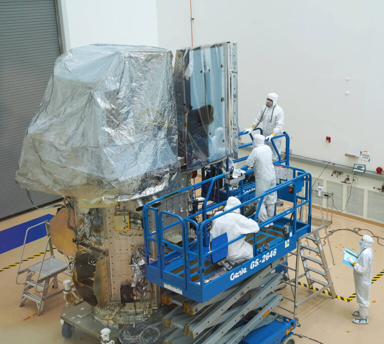
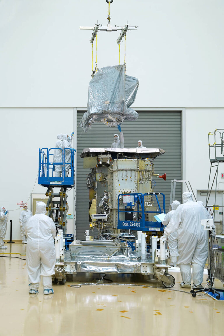
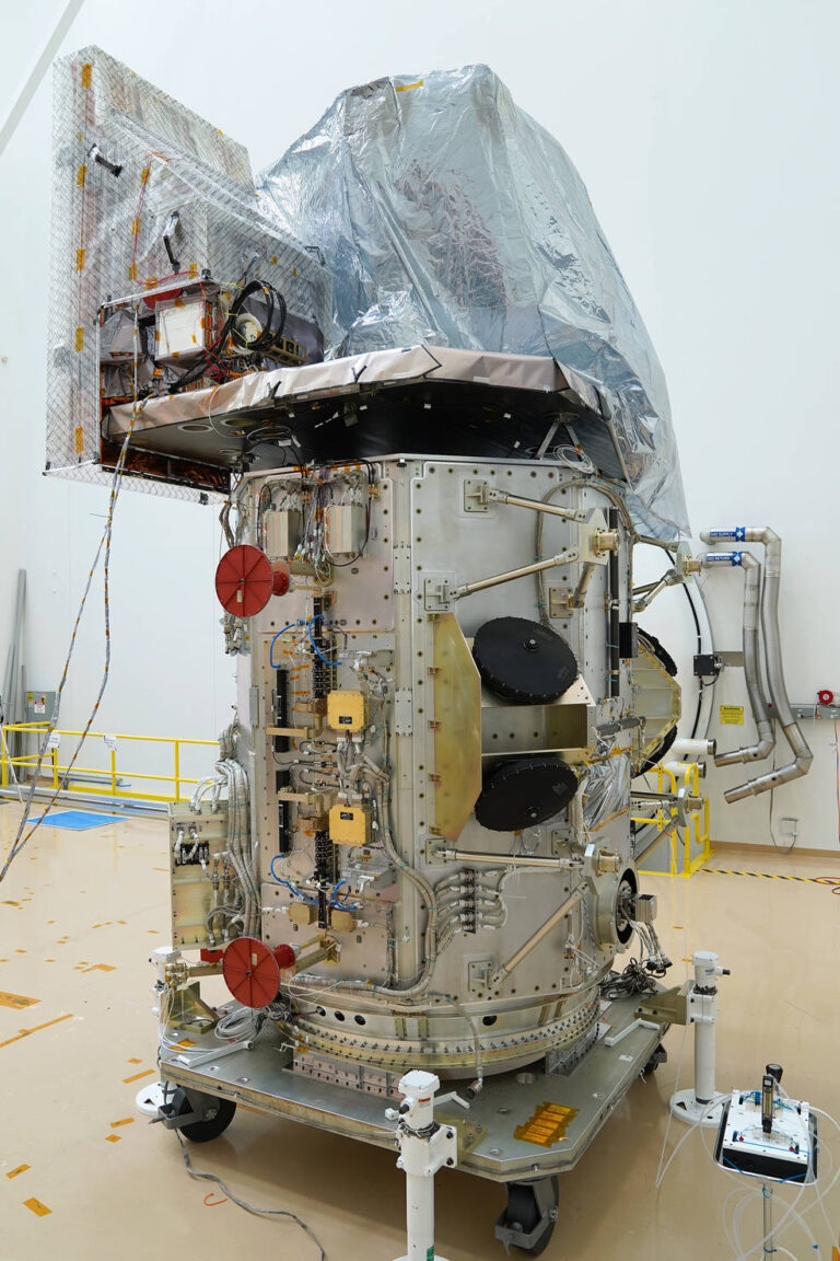
Landsat 9’s two science instruments are now attached to the spacecraft, bringing the mission one step closer to launch. In late December, the Operational Land Imager 2 (OLI-2) and the Thermal Infrared Sensor 2 (TIRS-2) were both mechanically integrated on to the spacecraft bus at Northrop Grumman in Gilbert, Arizona.

Engineers work on the newly integrated Landsat 9 satellite in a cleanroom
Engineers work on the newly integrated Landsat 9 satellite in a cleanroom at the Northrop Grumman facility in Gilbert, Arizona. In December, the team attached Landsat 9’s two instruments: OLI-2 (left) and TIRS-2 (right) to the spacecraft bus at the bottom of the image. The two instruments are covered to protect them from contaminants. Photo credit: Northrop Grumman


The Landsat 9 mission continues the nearly 50-year Landsat data record, providing actionable information to resource managers and policymakers around the world. Landsat 9 will record the condition of Earth’s ever-changing land surface, enabling scientists and others to monitor crops and algal blooms, to assess deforestation trends and urban growth, and to aid disaster management.

engineers attached the two Landsat 9 instruments – OLI-2 and TIRS-2 – to the spacecraft
In December, engineers attached the two Landsat 9 instruments – OLI-2 and TIRS-2 – to the spacecraft. Photo credit: Northrop Grumman


Landsat is a collaboration between NASA and the U.S. Geological Survey. NASA oversees the design, build, and launch; USGS operates the satellites on orbit, and manages the expanding data archive.

Engineers will next work on the electrical integration of the instruments, which includes getting power to the instruments and incorporating the satellite’s data-handling hardware.

The OLI-2 instrument makes measurements of Earth’s reflectance in the visible, near infrared, and shortwave infrared; the TIRS-2 instrument extends measurements made by Landsat 9 into the thermal infrared, providing information about the surface temperature. Water managers across the American West, as well as arid regions across the globe, rely on the highly calibrated measurements made by Landsat 8’s Thermal Infrared Sensor to monitor irrigation and water usage and they are eager to have the record continued by Landsat 9’s TIRS-2. Reflected light measurements by the OLI-2 instrument are in turn used to map global land cover, ecosystem health, water quality, glacier flow, and other critical Earth surface properties.

TIRS-2 is on the top left, and OLI-2 is on the top right; both are attached to the Landsat 9 satellite bus
In this photo, TIRS-2 is on the top left, and OLI-2 is on the top right; both are attached to the Landsat 9 satellite bus. Photo credit: Northrop Grumman


Related Reading:
+ Landsat 9 Instrument Ready for Spacecraft Assembly
New Landsat Infrared Instrument Ships from NASA

By: Laura E.P. Rocchio, NASA’s Goddard Space Flight Center

Get the latest from Landsat in your inbox.


By submitting this form, you are consenting to receive marketing emails from: Landsat Science. You can revoke your consent to receive emails at any time by using the SafeUnsubscribe® link, found at the bottom of every email. Emails are serviced by Constant Contact
On Key

Recent Posts

Map shows South Korea with waterways highlighted. In the top right corner is a north arrow and in the bottom left corner is a legend of different rivers in South Korea.

Monitoring Water Quality in South Korea

South Korea is facing a water quality problem. Researchers Hyunglok Kim and Seongjun Lee from the Gwangju Institute of Science and Technology (GIST) embarked on developing a model to predict water quality indicators in near real-time.

Read More »
Landsat outreach specialist Allison Nussbaum and GEDI/UMD Faculty Specialist Talia Schwelling hold Landsat/GEDI postcards at the NASA exhibit booth at AGU24.

Landsat at AGU24

The NASA Landsat Science and Outreach teams attended the American Geophysical Union’s annual meeting in DC in December. At AGU24, they shared research and educated the public about Landsat.

Read More »
On Key

Related Posts

Map shows South Korea with waterways highlighted. In the top right corner is a north arrow and in the bottom left corner is a legend of different rivers in South Korea.

Monitoring Water Quality in South Korea

South Korea is facing a water quality problem. Researchers Hyunglok Kim and Seongjun Lee from the Gwangju Institute of Science and Technology (GIST) embarked on developing a model to predict water quality indicators in near real-time.

Read More »