
By Ashley Balzer, NASA’s Goddard Space Flight Center
September 14, 2021 • Efforts to restore heavily degraded rural landscapes have been building momentum for more than a decade, but there hasn’t been much data showing how successful different measures are. Now, a team of scientists has demonstrated that remote sensing measurements using Landsat can help assess the effectiveness of various restoration interventions. Others can use their findings to improve policies and resource allocation, ultimately contributing to a healthier planet.
“When results are unclear, it’s very difficult to ensure that environmental efforts are creating a real impact on ecosystems,” said Trinidad del Río-Mena, a doctoral candidate at University of Twente in the Netherlands, who led the study. “We found that Landsat’s image archive offers a way to reliably measure long-term success, which can help people learn from experience and improve future restoration endeavors.”
Restoring the planet’s agricultural landscapes has both environmental and social impacts. Healing ecosystems provides numerous benefits to people, such as increased food and water security. Del Río-Mena and co-authors evaluated how successful such restoration efforts have been for both nature and the people supported by the restored landscapes.
“This research shows that technology can help people have a positive impact on nature,” said Louise Willemen, a professor of spatial dynamics of ecosystem services at the University of Twente and a co-author of the study. “It is important to show where, when, and how people can play an important role in restoring their landscapes.”
The team’s results are published in PLOS One.
Rehabilitating nature
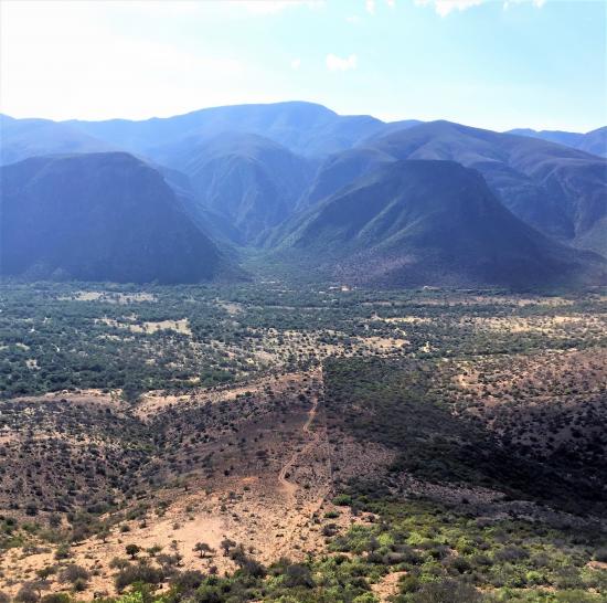
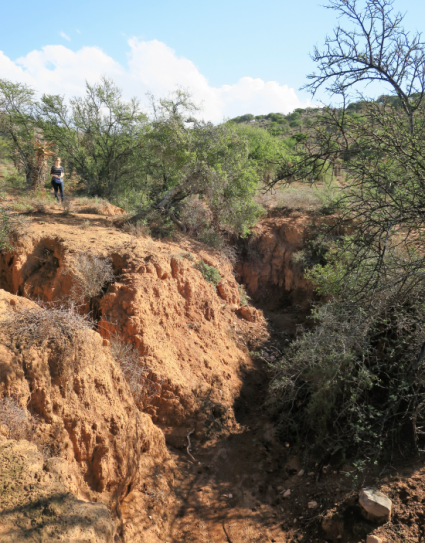
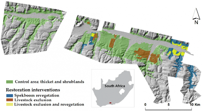
The team’s study focused on a region near the southern tip of South Africa called Baviaanskloof, where decades of unsustainable farming had led to extensive land degradation. Several initiatives were implemented to attempt to reverse the damage, offering a chance to compare the results of different efforts in a single ecosystem.
Historical Landsat data offered a way for the team to travel back in time and track the progress of each initiative. They focused on three intervention techniques: revegetation with local and native species, removing livestock from the land, and a combination of both. Revegetation efforts began about ten years ago while some farms halted livestock production on their land thirty years ago.
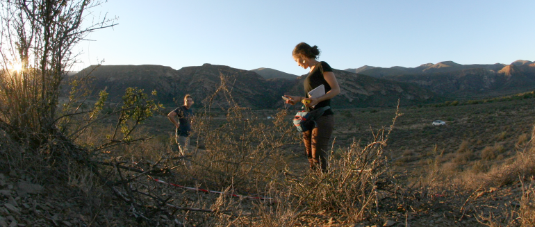
The team journeyed to Baviaanskloof to take field measurements from plots in areas where each of the efforts were underway, as well as a control area to ensure that the changes they recorded were truly linked to the restoration activities. They assessed how much of each plot was covered by vegetation, measured canopy dimensions, and counted how many species of vegetation were present.
Then they used Landsat 8 images from the same times and places that they gathered the field measurements. By comparing the images with their ground data, the scientists were able to build models to help translate the remote sensing images into usable information about what the study areas are like up close.
“Remote sensing is critical for analyzing areas that are large or difficult to access,” Willemen said. “With Landsat, we can also access historical information so we can look as far back as 30 years ago to see how ecosystems have changed. This approach is particularly helpful in heterogeneous landscapes, where the effectiveness of restoration could vary within small areas due to several factors.”
An especially important result of the study is that it highlights an approach that can be used to determine not only which restoration efforts are most effective, but also help us understand why they work. Follow-up studies could help identify factors that make certain initiatives more successful than others and use the findings to improve restoration techniques.
“To maximize the utility of satellite images for the evaluation of future restoration initiatives, it is critical to collect ground data with local stakeholders from the beginning of a project, ensuring that the Landsat models accurately represent what is on the ground over time,” del Río-Mena said. “This is something we need to continue to improve so we will have the most powerful positive impact on the planet that we can.”
Reference:
Del Río-Mena, Trinidad, Louise Willemen, Anton Vrieling, Andy Snoeys, and Andy Nelson. 2021. “Long-term assessment of ecosystem services at ecological restoration sites using Landsat time series.” PLOS ONE 16 (6):e0243020. doi: 10.1371/journal.pone.0243020.


