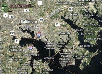
MSN® Virtual Earth™ is a web map server that offers search and mapping capabilities. As described in a July 2005 Microsoft press release, “the service enables users to search, discover, explore, plan and share information and activities relevant to specific U.S. locations by combining aerial imagery, detailed maps and precise local search capabilities.”
Landsat data features prominently into Virtual Earth™. Landsat 7 data from the GeoCover 2000 mosaic are used as the mid-resolution aerial imagery for Virtual Earth™. The GeoCover 2000 false-color (ETM+ 7,4,2 +pan) data was converted to a pseudo-natural color data set called TerraColor by a San Diego-based geospatial company called Earthstar Geographics LLC.
Contributor: Laura Rocchio
For more information about MSN® Virtual Earth™ and TerraColor see:
- TerraColor website (external link)
- TerraColor white paper
- MSN® Virtual Earth™ press release (external link)


