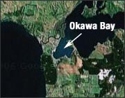
Every summer in New Zealand, recreational swimming in Okawa Bay is often prohibited because of toxic algal blooms. According to a Jan. 20 article in the New Zealand Herald, Waikato University biologist Brendan Hicks is using Landsat data to both map historical water quality deterioration and to monitor the effects of recent mitigation measures on water quality improvement.
+ Read full New Zealand Herald article (external link); PDF version

How Early Astronaut Photographs Inspired the Landsat Program
In the 1960s, NASA was pioneering a new era of human spaceflight—and astronaut photography—that would change Earth observation forever.


