Meat of the Matter: Colorado River Over-Consumed
More water is taken from the Colorado River than it has to give. Better water use accounting made possible by Landsat provides needed guidance for difficult water use decisions.

More water is taken from the Colorado River than it has to give. Better water use accounting made possible by Landsat provides needed guidance for difficult water use decisions.
While floating algae, emergent aquatic vegetation, and historic surface scum can be tracked throughout the Landsat record, researchers warn data users that older Landsat sensors lack the precision needed to be used for water-column studies.
New Michigan State University research found that incorporating in-season water deficit information into remote sensing-based crop models significantly improves corn yield predictions.
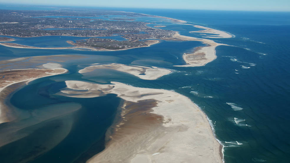
Using 30 years of Landsat data, a team of scientists and engineers from the Netherlands determined how Earth’s sandy beaches are changing.
Montanaro and Gerace’s stray light “exorcism” has now placed the Landsat 8 thermal bands in-line with the accuracy of the previous (ghost-free) Landsat thermal instruments.
In the first study of its kind, researchers from the University of Maine have demonstrated that Landsat 8 satellite data can be used to find locations where oysters farms should thrive.

Using 28 years of Landsat data, an Australian research team has created a continent-wide intertidal zone extent map for the whole of the Australian coast.
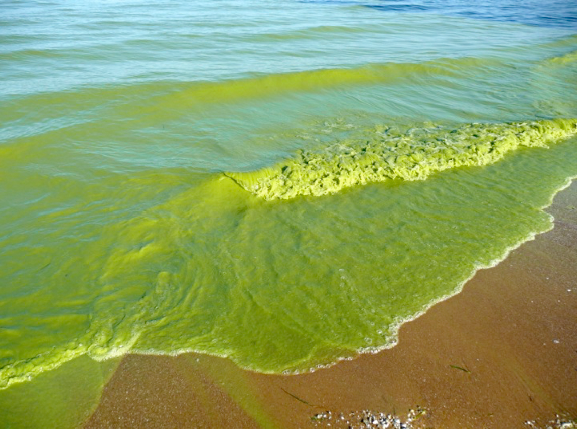
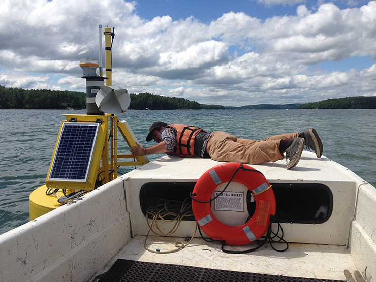
With the growing frequency and magnitude of toxic freshwater algal blooms becoming an increasingly worrisome public health concern, Carnegie scientists Jeff Ho and Anna Michalak, along with colleagues, have made new advances in understanding the drivers behind Lake Erie blooms and their implications for lake restoration.
Australia turned to Landsat. At Geoscience Australia, Landsat 8 Science Team member Leo Lymburner works with the flood mapping team headed by Norman Mueller that conceived of the Water Observations from Space project, or WOfS.
Since record keeping began in 1860, no period has been drier for southeastern Australia than the decade-long Millennium Drought. The lack of rain between 1997 and 2009 led to livestock losses, crop failures, and percentage drops in the Australian GDP.
Nearshore shipwrecks can leave telltale sediment plumes at the sea’s surface that reveal their location. Using Landsat 8 data, researchers have detected plumes extending as far as 4 kilometers (~2.5 miles) downstream from shallow shipwreck sites. This discovery demonstrates that Landsat and Landsat-like satellites can be used to locate the watery graves of coastal shipwrecks.
Capitalizing on the long Landsat data record and the human brain’s capacity to recognize movement, Frank Paul from the University of Zurich has created glacier animations that enable viewers to witness the complex flow of glaciers.
Ice sheets are in perpetual motion, making their way downslope like a river. If the amount of snow that an ice sheet accumulates does not keep pace with its loss to the sea, sea level will rise. As temperatures have climbed, positive feedback loops have led to an accelerated loss of ice sheet sections that touch the sea, but in an unexpected twist to the global warming saga, scientists have just discovered a negative feedback loop that is slowing down the Greenland Ice Sheet sections that end on land—a sliver of good news for sea-level rise.
Using the world’s first global, Landsat-based 30-meter resolution map of tree cover, researchers found that ambiguity of the term “forest” has the potential to create 13 percent discrepancies in forest area maps. While ecologists have long understood the complexity comprised by the concept of “forest”, and while geographers have called for the term to be more uniformly defined across monitoring entities, no one had quantified the scope of the problem.
The 2.38 million Landsat images freely downloaded in 2011, benefited the U.S. economy by $1.8 billion found a new study published this month by a team of economists from Colorado State University and the USGS Fort Collins Science Center.
Forest resource managers, natural resource policy makers, and global change scientists need comprehensive, consistent, and up-to-date information on trends in forest cover and condition. This information is essential for understanding carbon budgets, predicting fire behavior, quantifying biodiversity, and hydrologic modeling.
Hydrologists from the University of North Carolina have come up with an innovative way to estimate the size of rivers via satellite images. Combing through data acquired by Landsat satellites, George Allen and Tamlin Pavelsky have compiled a new database of river widths for North America.
Researchers and citizens have known for some time that Turkey’s glaciers are shrinking. Now scientists have calculated the losses and found that more than half of the ice cover in this mountainous country has vanished since the 1970s.
In Australia, the Unlocking the Landsat Archive (ULA) project has created a “living and accessible” archive of Landsat 5 and 7 data, for years 1998–2012.
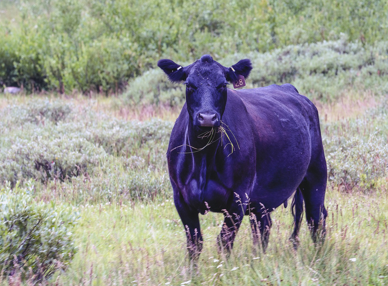
Scientists for the first time have simultaneously compared widespread impacts from two of the most common forest insects in the West—mountain pine beetle and western spruce budworm – an advance that could lead to more effective management policies.
Each year the U.S. Forest Service takes a census of trees, chronicling the nation’s forest heath and timber resources. Forest managers use this information to project what U.S. forests will be like in coming decades and, if needed, to adjust their forest management practices in order to safeguard sustainability.
Shortly after the launch of Landsat 8, the calibration team noticed something strange: bright and dark stripes, or “banding” was showing up across certain images collected by the satellite’s Thermal Infrared Sensor (TIRS). Prelaunch testing of the sensor had indicated that highly accurate measurements (within 1 Kelvin) with little “noise” could be expected—what was going on?
Along the sea’s edge in Bangladesh, India, Pakistan, and Sri Lanka, the dense coastal population lives largely in symbiosis with the region’s mangrove forests.
Mangroves—a vast network of intertidal trees and shrubs with their characteristic tangle of above ground roots—give safety, sustenance, and spectacle to coastal denizens in a multitude of ways. Namely, by stabilizing shorelines, safeguarding water quality, influencing stable microclimates, controlling flooding, and providing transportation, forest products, hunting and fishing grounds, and recreation and protecting people and property from storms.
The Landsat calibration team published a number of papers in the SPIE Conference Volume 9218: Earth Observing Systems XIX. Our calibration team (or cal team) is a group of scientists and engineers who work together to ensure the scientific quality of Landsat data—they are the people who make it possible for us to compare Landsat images day-to-day and year-to-year. Simply said, they make change-over-time research possible.
This month in Nature, an emphatic plea to make more Earth satellite imagery free was made by Michael Wulder, a senior research scientist with the Canadian Forest Service and Landsat Science Team member; along with Nicholas Coops, a remote sensing professor at the University of British Columbia.
A group of researchers from the University of Maryland, the Indonesian Ministry of Forestry, and the World Resource Institute joined forces to remedy the lack of consensus about the amount of old-growth forest clearing occurring in Indonesia.
The U.S. Geological Survey released a report this week assessing terrestrial and aquatic greenhouse gas fluxes for the Eastern U.S., specifically focusing on carbon dioxide, methane, and nitrous oxide. An area of 3.05 million square kilometers east of the Mississippi was assessed.
Using Landsat time series data, a group of Australian and British ecologist have found that the Yellow Sea has lost 28% of its tidal flats in the last three decades.
One year ago today, Landsat 8 blasted off from California’s Vandenberg Air Force Base and arched over the shimmering Pacific on its way into orbit. Landsat 8’s main sensor, the Operational Land Imager (OLI), is the latest model in the long line of Landsat Earth-looking radiometers—sensors that have been measuring visible and infrared light reflected from our planet since 1972.
In the July issue of Nature Climate Change, Tandong Yao and colleagues report on the changing status of Tibetan Plateau glaciers over the past three decades.
Have you ever walked along a California coast and wondered about all of the kelp washed-up on shore? In winter when storms are more frequent,
Permafrost—ground that remains frozen for at least two years—allows soil substrate to act like bedrock. So when permafrost thaws there can be major problems for
Trembling aspen are dying. No tree species in North America has a broader habitat and no other is as large (a single clone can be
