
Why and how Landsat Science Team Member Leo Lymburner & Geoscience Australia are using Landsat for flood mitigation
by Laura E.P. Rocchio, NASA Landsat Project Science Office

–It all began with a flood–
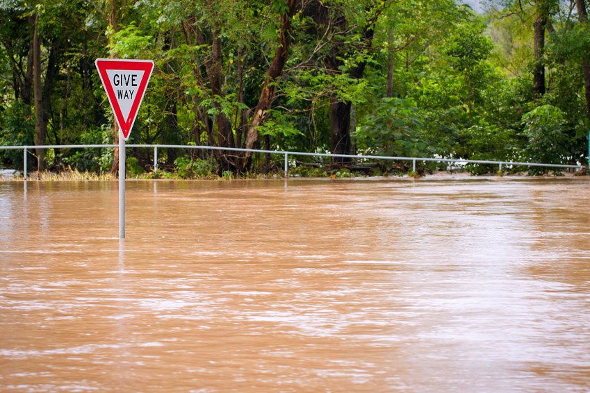
Rain, rain, more rain. In Australia as December 2010 turned into January 2011, torrential rains pummeled southeast Queensland and its capital, Brisbane. The result was devastating floods—the second highest flood Brisbane had faced since 1900.
“Almost every river in Queensland south of the Tropic of Capricorn and east of [the cities of] Charleville and Longreach recording major flood levels,” wrote researchers from Macquarie University’s Risk Frontiers group1.
Twenty-four people were lost to the floods and 18,000 properties were inundated in Brisbane—a city built on a floodplain. Across Queensland, 200,000 people were affected; 12,000 had to be evacuated; 11,800 miles (19,000 km) of roads were damaged as were over a quarter of the state’s railways.
Mining, agriculture, and tourism sectors reported $4 billion of commercial losses. Insurers received over 56,000 claims and paid out $2.55 billion, but claims of about 15 percent of residents along the Brisbane River were denied because of their proximity to the river. Many of those residents did not know that their property was at risk for flooding and a large community backlash against the insurers ensued.
This led to the Natural Disaster Insurance Review in March of 20111. Australia has many regions that are highly vulnerable to flooding and, financially speaking, floods are often one of the most expensive natural disasters the country faces. This makes effective flood management crucial for many sectors of society including communities, governments, industries, and insurers2..
A number of suggestions resulted from the 2011 Insurance Review, including a call for coordinated countrywide flood mapping that would provide publicly accessible information on the inundation history and flood risk of an area. The ultimate goal of which was informed consumers and wise land-use planning decisions.
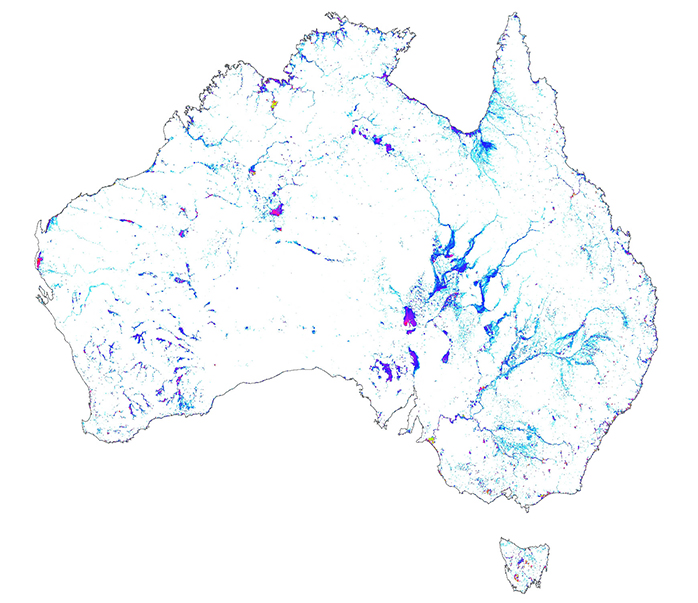
To accomplish a task as gargantuan as historical flood mapping of an entire continent, Australia turned to Landsat. At Geoscience Australia (much like the U.S. Geological Survey), Landsat 8 Science Team member Leo Lymburner works with the flood mapping team headed by Norman Mueller that conceived of the Water Observations from Space project, or WOfS.
Using time-series Landsat data reaching back to 1987, WOfS shows the behavior of past floods—where land has been inundated over the past three decades—and this information can help predict where future flooding may occur. There are limitations, the Landsat data acquisition pattern and cloud cover mean that some flood maximums may not show up in the data. Other data limitations mean that sometimes the WOfS water-mapping algorithm cannot distinguish between dark shadows and water. But largely, the product reveals where flood risks lurk.
The development of WOfS began in 2011 and released in 2014 and continues to be updated with newly acquired data. WOfS is Landsat-based as it provides a consistent, 29-year (and growing) measure of how often surface water has been seen anywhere in Australia. The Australian Geoscience Data Cube3 hosted on the National Computational Infrastructure has made the storage and processing of Landsat data uncomplicated and relatively easy to use in big-data applications like WOfS.
Today, WOfS is publicly available online through the Australian Flood Risk Information Portal. And as Lymburner explains, “it is proving itself not only useful for flood mapping, but also for water quality studies, groundwater recharge knowledge, and understanding of vegetation’s response to water conditions.”
The WOfS team includes Norman Mueller, Leo Lymburner, Adam Lewis, Dale Roberts, Rachel Melrose, Joshua Sixsmith, Alexis McIntyre, Alex Ip, Peter Tan, Steven Curnow and Steven Ring.
The WOfS product can be viewed online at http://www.ga.gov.au/flood-study-web/#/water-observations
The WOfS product generation process and accuracy assessment was published in 2016 by Mueller et al.4
References
1. Van den Honert & McAneney, 2011 ‘The 2011 Brisbane Floods: Causes, Impacts and Implications’ Water 3(4) 1149-1173 http://dx.doi.org/10.3390/w3041149
2. Mueller, N (2014) Water Observations from Space contribute to a greater understanding of flooding in Australia Geoscience Australia Insights. Accessed April 26, 2016.
3. Lewis, A., Lymburner, L., Purss, M.B., Brooke, B., Evans, B., Ip, A., Dekker, A.G., Irons, J.R., Minchin, S., Mueller, N. and Oliver, S., Roberts, D., Ryan, B., Thankappan, M., Woodcock, R., and Wyborn, L. (2015) ‘Rapid, high-resolution detection of environmental change over continental scales from satellite data–the Earth Observation Data Cube’ International Journal of Digital Earth. 9(1) 106-111 http://dx.doi.org/10.1080/17538947.2015.1111952
4. Mueller, N., Lewis, A., Roberts, D., Ring, S., Melrose, R., Sixsmith, J., Lymburner, L., McIntyre, A., Tan, P., Curnow, S. and Ip, A., (2016) ‘Water observations from space: Mapping surface water from 25years of Landsat imagery across Australia.’ Remote Sensing of Environment, 174, pp.341-352. http://dx.doi.org/10.1016/j.rse.2015.11.003
Further Reading
+ Thirsting for Equitable Water Distribution, Australia Turns to Landsat


