
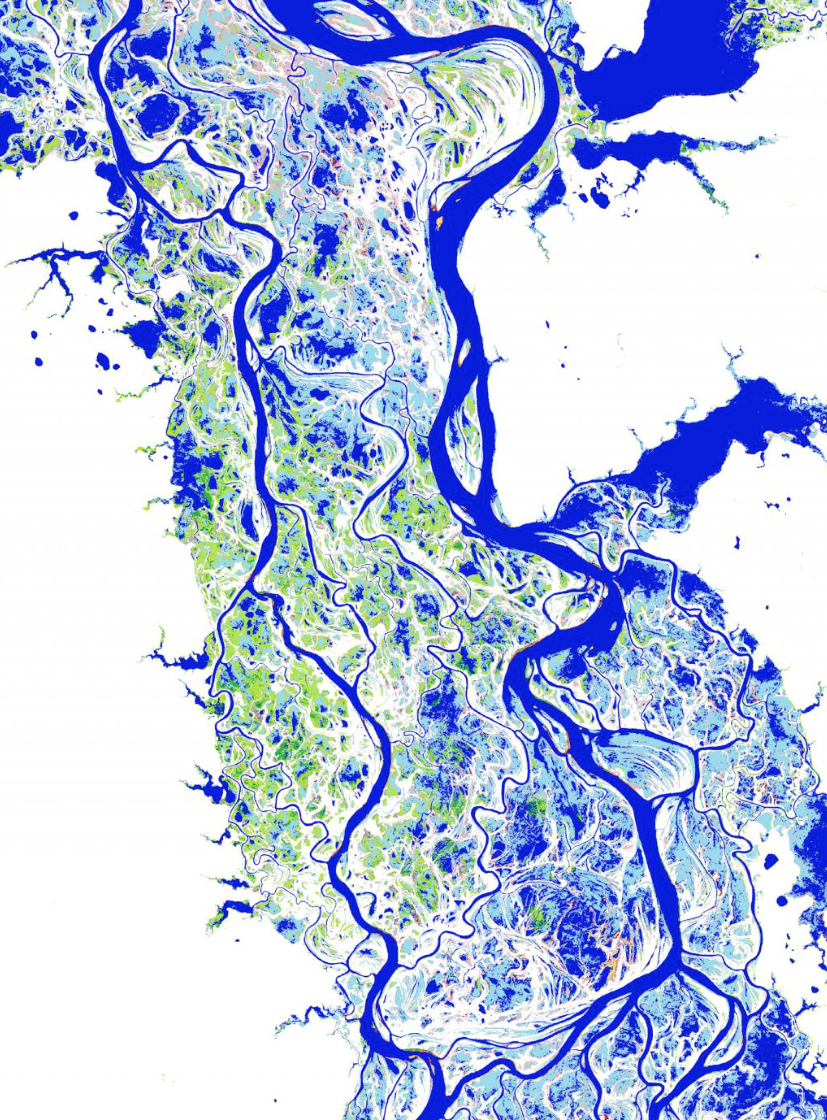
Based on over three million satellite scenes (1,823 Terabytes of data) collected between 1984 and 2015, the Global Surface Water Explorer was produced using 10,000 computers running in parallel. The individual images were transformed into a set of global maps with a 30-meter resolution, which enable users to scroll back in time to measure the changes in the location and persistence of surface water globally, by region, or for a specific area. The maps are available for all users, free of charge.
Where and when water is found on the planet’s surface is hugely important as it influences the climate system, the movement of species, sustainable development and social, institutional and economic security. While surface water is only a tiny fraction of the Earth’s water resources, it is the most accessible part, and provides wide-ranging ecosystem services.
This long-term history of the water-surface of the planet shows that total global surface water has increased over the past three decades, with over 180,000 km2 of new permanent water bodies forming in some parts of the planet and almost 90,000 km2 of permanent surface water disappearing from other areas. Much of the increase is linked to reservoirs and climate change (e.g. accelerated snow-and-glacier melt in Tibet), and the net loss (more than 70% of which occurred in Kazakhstan, Uzbekistan, Iran, Afghanistan and Iraq) is linked to drought and human activities such as river diversion, damming and unregulated use.
The data show that the impacts of climate on where and when surface water occurs can be measured, and that the presence of surface water can be substantially altered by human activities. It will help to improve modelling scenarios, show where changes are occurring, and inform water-management decision-making. Combining this with other datasets, such as satellite altimetry measurements, could lead to estimates of surface water volumes, river discharge and sea-level rise, that will have additional benefits in helping to understand the impacts of climate change.
Of immediate use in climate science, water resource reporting and monitoring and commitments to multilateral environmental agreements, the authors expect that it will also find many other uses, such as in risk, resilience and recovery linked to water movement, infrastructural planning and yet others that are still to be imagined.
Use of radar and optical satellite imagery from Sentinel-1 and Sentinel-2 of the EU Copernicus Programme will greatly help to improve the detail and accuracy of the information in the Explorer in the future.
Further Reading:
+ Mapping Three Decades of Global Water Change, The New York Times
+ High-Resolution Satellite Images Capture Stunning View of Earth’s Changing Waters, Smithsonian Magazine
+ Google unveils the most detailed view of Earth’s changing oceans, seas, rivers and lakes, Wired
+ Gorgeous New Maps Show How Dramatically Our Planet’s Surface Water Is Changing, Gizmodo
+ GRACE meets LANDSAT; Eyes in the sky monitoring long-terms changes in water resources, Geological Digressions blog
Reference:

Be Part of What’s Next: Emerging Applications of Landsat at AGU24
Anyone making innovative use of Landsat data to meet societal needs today and during coming decades is encouraged to submit and abstract for the upcoming “Emerging Science Applications of Landsat” session at AGU24.


