
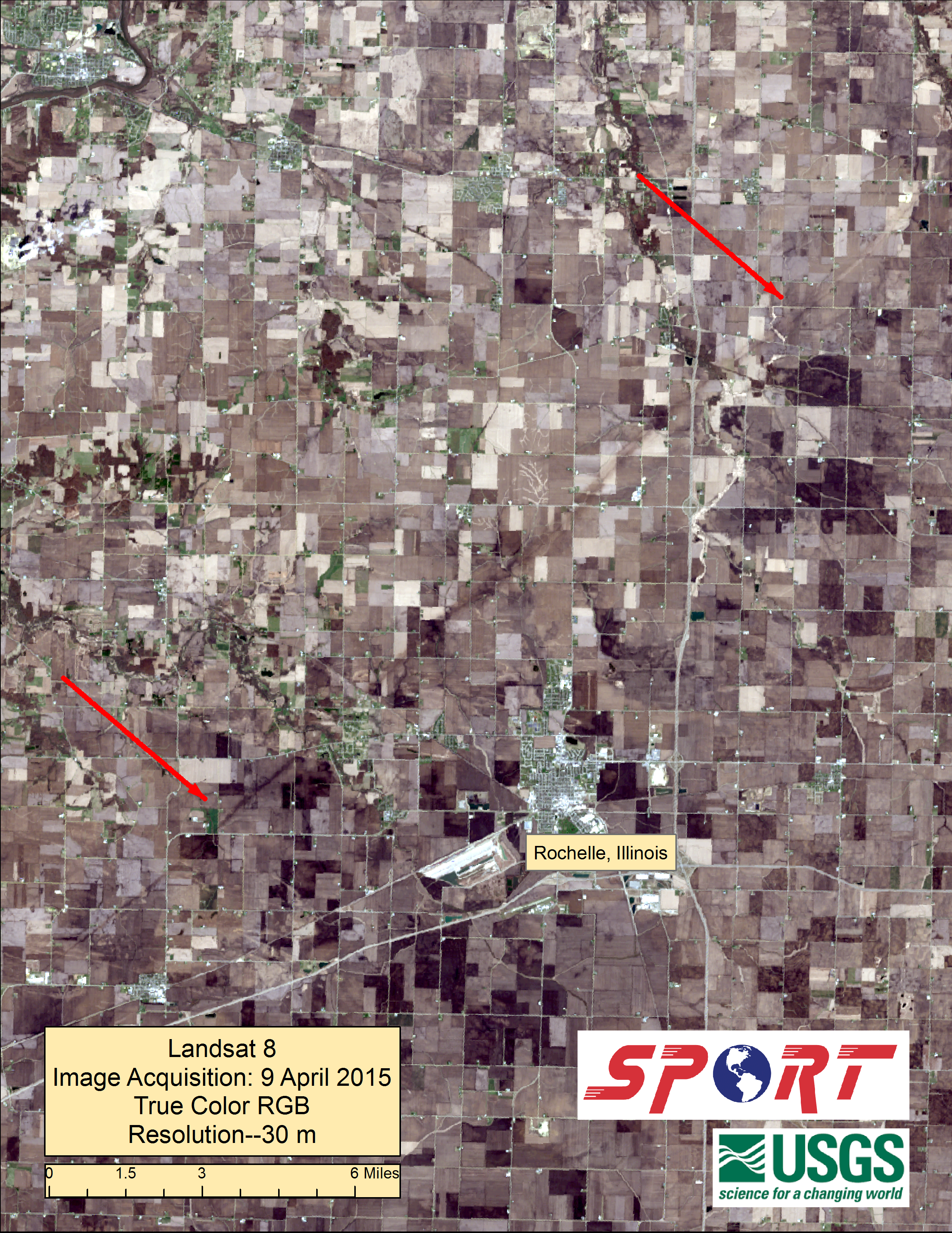
As part of an ongoing NASA Applied Sciences: Disasters funded project, the SPoRT/ Disaster Response team at the Marshall Space Flight Center in Huntsville, AL provided the Landsat 8 panchromatic and true-color images of the EF-4 tornado track within the NOAA/National Weather Service Damage Assessment Toolkit.
The U.S. Geological Survey and NASA Landsat 8 imager captured a cloud-free scene of the damage path on the morning of April 10. Images produced by the team were distributed by a web mapping service. Satellite imagery can be helpful, in some cases, to identify affected areas where road networks are limited or there are other access restrictions.
Colleagues at the NWS forecast office in Chicago used the satellite imagery to complement the April 10 ground survey of the tornado.
Further Reading:
+ The Wide World of SPoRT

Be Part of What’s Next: Emerging Applications of Landsat at AGU24
Anyone making innovative use of Landsat data to meet societal needs today and during coming decades is encouraged to submit and abstract for the upcoming “Emerging Science Applications of Landsat” session at AGU24.


