New York City in 1860 was thriving for some of the same reasons the city thrives today. The city’s location was then, and is now, central for the movement of people and freight to and from Europe and elsewhere. Waterways were the primary transportation pathways in 1860. New York’s deep and well-connected port, nearer to the ocean than the ports of other cities on the East coast of the United States, was a huge boon to shipping. The Hudson River connected New York City’s port to a wide gateway westward through the Erie Canal to Lake Erie and beyond. Europe sent and received goods and people across the Atlantic Ocean to New York. Cities on the Great Lakes could enjoy the benefits of shipping to and from Europe, completely by water!
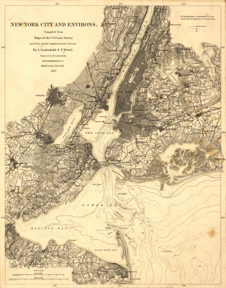
The 1860 map highlights the importance of bringing large ships into New York Harbor with its demarcations of shipping channels.
In 1860, almost 4,000 vessels entered the harbor carrying 2 million tons of cargo. The port served the sugar industry with its ready connections to the Caribbean. Other major industries in New York were publishing and garment making. Manufacturing transformed wool, cotton and silk from outside the United States to finished garments that were sold within the country and transported through New York’s harbor. Immigrants came to find work, stayed, and attracted more immigrants. Geography was destiny.
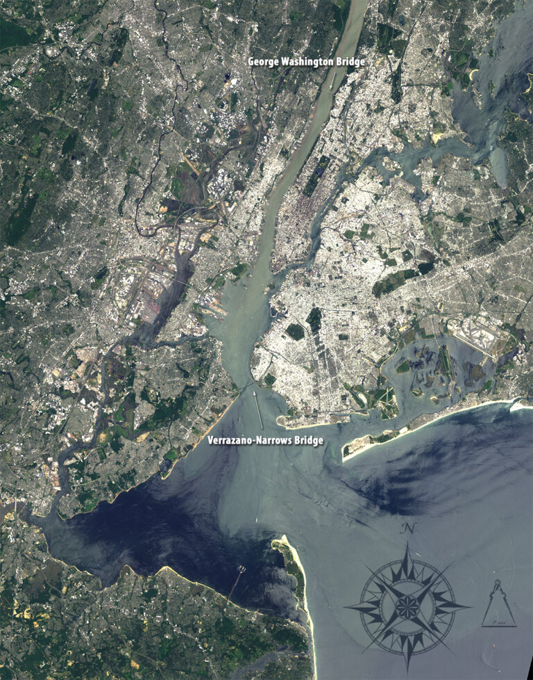
Comparing the 1860 map with the Landsat scene, clearly the general configuration of the area has not changed in 165 years, but wharfs and other structures have been added along the Hudson River, Newark Bay and elsewhere. Urban areas have expanded dramatically, exemplified by the cities of Newark and Elizabeth in New Jersey. The two cities appear as darkened areas on the left side of the 1860 map (Newark larger than Elizabeth), and in the Landsat scene they are represented by light gray colors that show an almost unbroken area of urbanization. Brown colors in the Hudson River show sediment being carried to New York Bay. Green areas indicate open spaces and small forests.
The importance of shipping to the city in 1860 is reflected by the presence of bathymetric lines and ship channels in the Lower Bay. In the contemporary Landsat scene two major bridges that are absent in 1860 map appear as thin lines across the water. George Washington Bridge opened to traffic in 1931, connecting Manhattan with New Jersey’s Palisades. In 1964, the Verrazano-Narrows Bridge connected the borough of Staten Island to Brooklyn. The Bridge is clearly visible in the satellite image at the narrowest point in New York Bay.
The Port Authority of New York and New Jersey builds, operates, and maintains critical transportation and trade assets around the region. Its network of seaport facilities, airlines, railroads and roads moves millions of people and cargo. New York also dominates the country in the fields of finance, business services, and corporate management, and extends its influence to the international stage
+ download large 1860 map
+ download large Landsat 8 image
Image created using Landsat 8 OLI bands 4,3,1 The image was collected June 1, 2013. Image by Mike Taylor using Landsat data available from the USGS archive. Caption by Jeannette Allen.