

With Sentinel-2B in orbit, for any point on Earth the Sentinel-2 satellite duo will have a combined revisit time of five days.
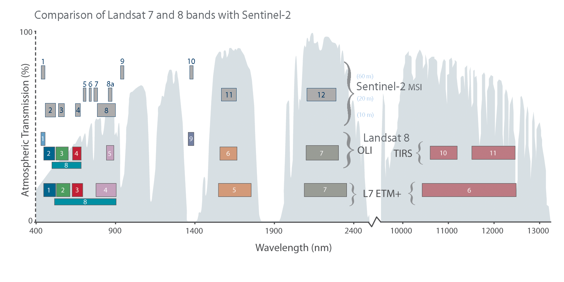
The Sentinel-2 satellites have spectral bands similar to Landsat 8’s (excluding the thermal bands of Landsat 8’s Thermal Infrared Sensor). The placement of the Sentinel-2 bands as compared to Landsat 8 and Landsat 7 bands can be seen in the graphic below.
The main visible and near-infrared Sentinel-2 bands have a spatial resolution of 10 meters, while its “red-edge” (red and near-infrared bands)—specifically designed to monitor vegetation—along with its two shortwave infrared bands have a 20-meter spatial resolution, and its coastal/aerosol, water vapor, and cirrus bands have a 60-meter spatial resolution.
During the development of Landsat 8 and Sentinel-2, calibration scientists from both projects worked together to cross-calibrate the sensors. Many scientists and researchers are looking forward to collectively using data from Landsat 8 and the Sentinel-2 constellation.
“We congratulate ESA on the successful launch of Sentinel-2b,” praised Jeff Masek, the Landsat 9 Project Scientist.
“This launch completes the Sentinel-2 constellation, providing a tremendous new resource for land management and science,” Masek continued.
“The Sentinel-2 constellation also provides great opportunities for fusion with Landsat 8 and the Landsat constellation, and US researchers look forward to continuing work with European colleagues on characterizing both sensing systems.”
Further information:
+ Second “color-vision” satellite launched for Copernicus, ESA
+ Sentinel-2 Teams Prepares for Space, ESA
+ Sentinel-2B satellite ready for launch from Kourou, Airbus press release

Be Part of What’s Next: Emerging Applications of Landsat at AGU24
Anyone making innovative use of Landsat data to meet societal needs today and during coming decades is encouraged to submit and abstract for the upcoming “Emerging Science Applications of Landsat” session at AGU24.


