
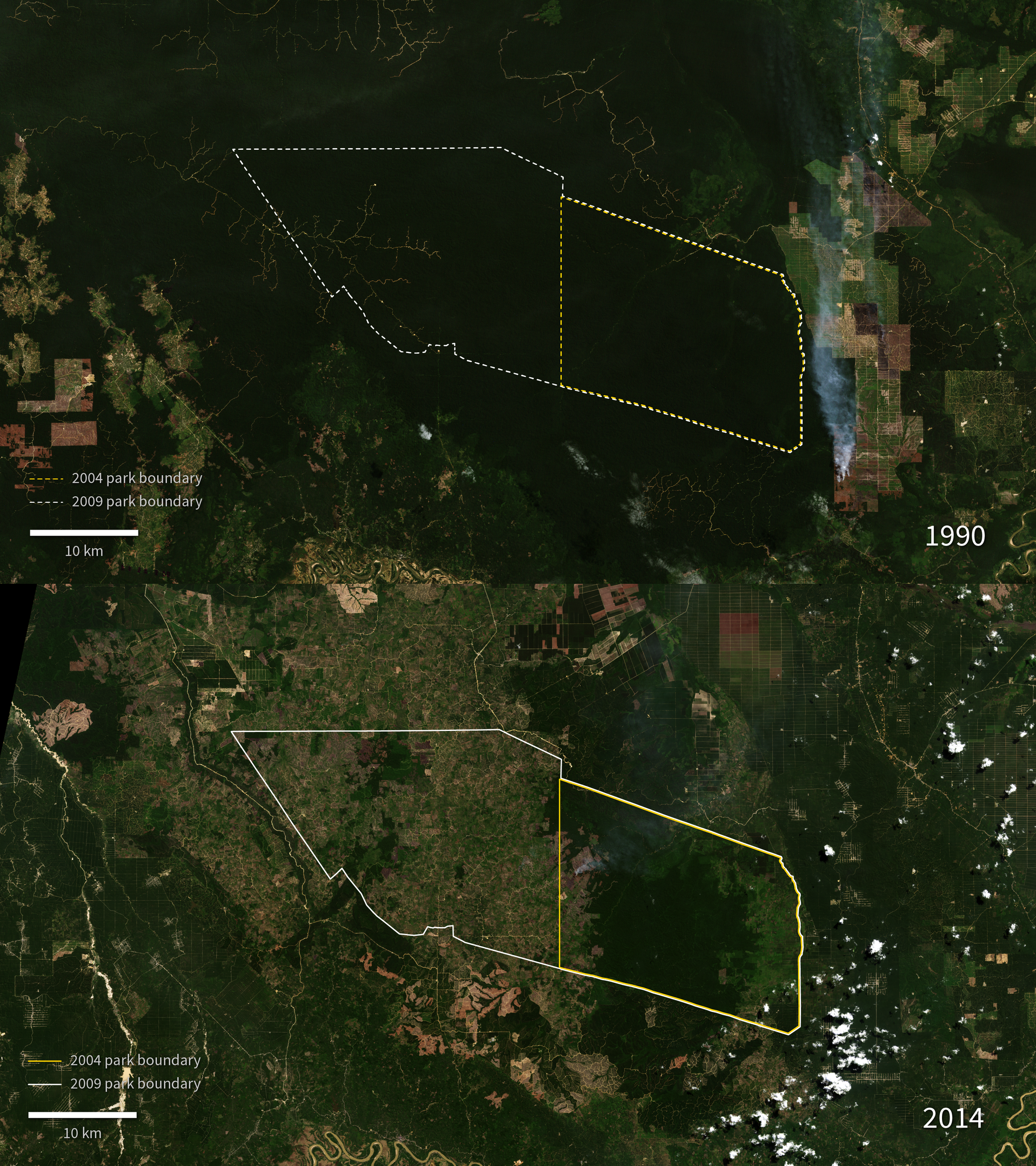
A new series of Landsat images begins in 1990, where it shows the relatively undisturbed natural forest in the area that would become the national park. In following years.
Landsat imagery shows a loss of natural forest in the park area and surrounding forest logging concessions. The logged areas initially appear brown or red, but take on a green color as the palm plantations which replace the original forest mature.
Though the replanted areas appear similar to the natural forest in Landsat imagery, they no longer support the original diversity of animal species.
Further information:
+ Tesso Nilo National Park, NASA SVS

Be Part of What’s Next: Emerging Applications of Landsat at AGU24
Anyone making innovative use of Landsat data to meet societal needs today and during coming decades is encouraged to submit and abstract for the upcoming “Emerging Science Applications of Landsat” session at AGU24.


