
From NPS:
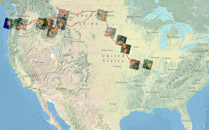
2018 marks the 40th anniversary of the Lewis and Clark National Historic Trail, the 50th anniversary of the National Trails System, and the 60th anniversary of NASA. In order to commemorate these historic events, the National Park Service, U.S. Geological Survey, and NASA have collaborated to assemble a collection of satellite images highlighting important sites along the route taken by Lewis and Clark and the Corps of Discovery during their expedition.
Satellite sensors and other modern instruments used to collect data and make scientific observations are much more sophisticated than the technology used by the Corps of Discovery. However, the spirit of exploration and sense of wonder remain the same today. Scientists at the National Park Service, U.S. Geological Survey, and NASA continue to follow in the footsteps of Lewis and Clark by making observations and collecting information about the world we live in.


