
By Laura E.P. Rocchio
This afternoon at #AGU16, Frazer Christie, a doctoral candidate at the University of Edinburgh, is presenting his work showing how the boundaries between grounded continental ice and floating ice shelves in West Antarctica are shifting. We spoke with Mr. Christie about this work, here’s what he told us:
Presentation Title
Landsat archive reveals 15 years of grounding line migration in the Marie Byrd Land Sector, West Antarctica
What are the major findings of this research?
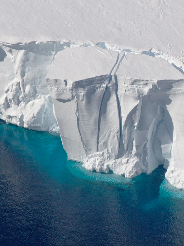
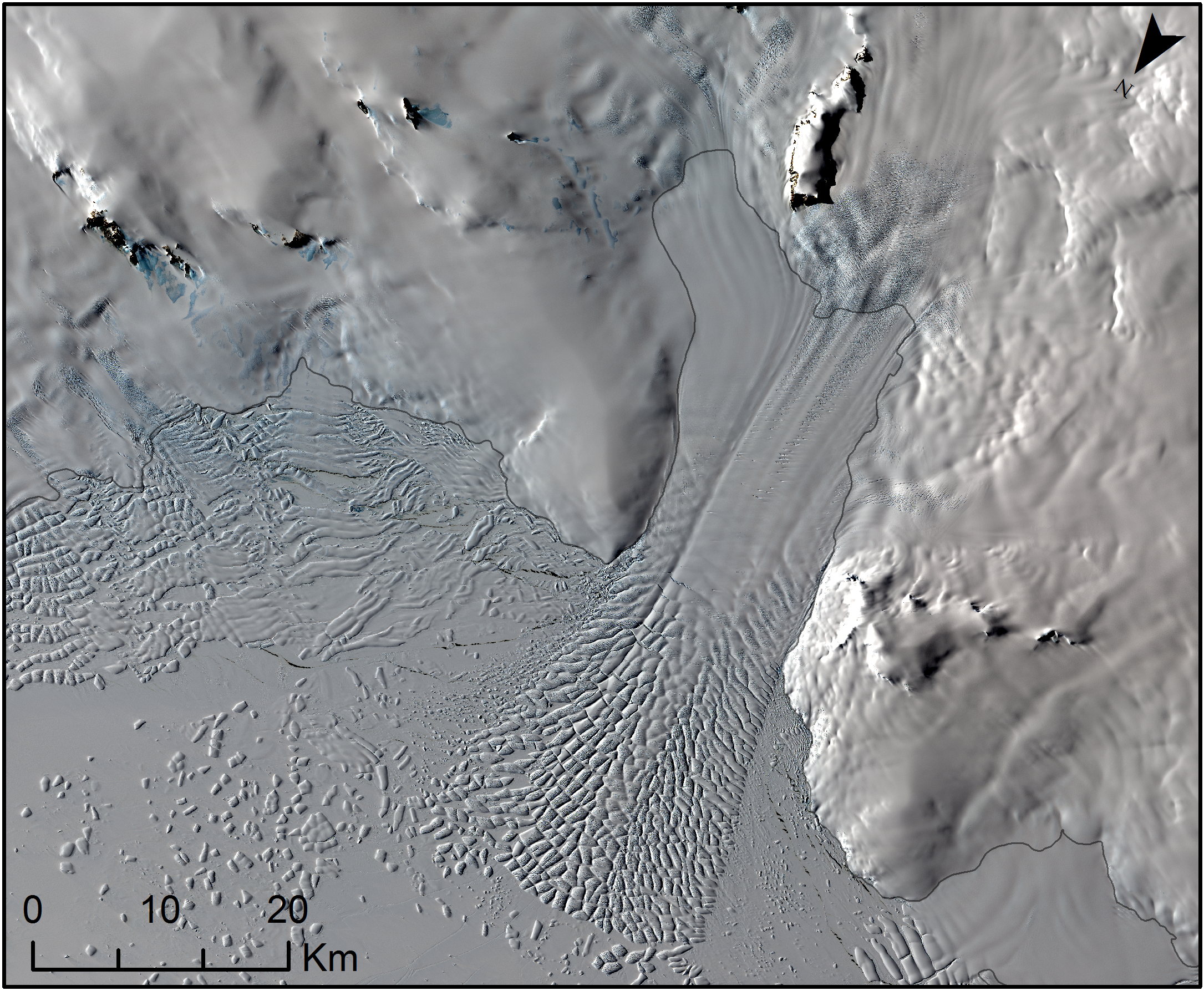
Using data from the freely-available Landsat 7 (ETM+) and 8 (OLI) archives, we have closely monitored changes in the position of the ‘grounding line’ (i.e. the boundary between grounded continental ice and the ocean, where ice begins to detach from the seafloor and float as ice-shelves), along the Marie Byrd Land Coastal Sector of West Antarctica. This part of Antarctica drains into the Amundsen Sea, close to Thwaites and Pine Island Glaciers which have experienced pronounced ice losses in the last half century.
Throughout our observational period (2000 to 2015), we have detected sustained grounding line retreat along the full length of the ~650 km Getz Ice Shelf. These findings correspond with other recent satellite-derived patterns of change detected over this region, including ice-flow speedup, surface thinning and large ice shelf basal melt rates.
However, neighbouring regions, including the glaciers and ice-streams draining into the Nickerson and Sulzberger Ice Shelves, have undergone little or no grounding line retreat over this time frame.
Overall, the contrasting responses along the margin of Marie Byrd Land suggest a complexity in ice-ocean interaction along West Antarctica’s coast, which requires further investigation.
What are the implications of your findings?
Having a comprehensive knowledge of grounding line change over space and time is critical for accurately elucidating the nature of dynamic change –and future stability of- the West Antarctic Ice Sheet. Our findings highlight that relatively large changes in grounding line position have occurred over a relatively short time window, and have occurred in tandem with other previously reported observations of glaciological change, including pronounced ice-thinning and ice-flow speedups over the same time.
Together, these observations are vital for accurately calculating ice-mass loss, and ultimately, global sea-level rise estimations, and so these findings collectively warrant the requirement for continued close observation of this dynamic sector in the future.
What insight did you gain from Landsat that would have been impossible to glean otherwise?
In order to monitor precise and continuous changes in the position of the grounding line across Marie Byrd Land, we required consistently high spatial-temporal resolution and accurately orthorectified data, across both multispectral and panchromatic wavelength bands. Encompassing all of these requirements, Landsat was therefore the only option for us to achieve this. This project would have been entirely impossible without the free and open-access data policy of the NASA/USGS Landsat-data archive.
Why have parts of West Antarctica traditionally received less attention?
Because ice is so clearly diminishing from what are now becoming the well-studied Pine Island and Thwaites Glaciers, a lot of attention has been drawn away from other sectors that are, in fact, also experiencing ice losses that are still globally significant, if not as large. In results we published in June 2016, we have already demonstrated that there has been pervasive loss of ice from the traditionally lesser-studied Bellingshausen Sea margin of West Antarctica, for example, and here again we are drawing attention to another margin of West Antarctica, Marie Byrd Land, where ice is being lost, even if the contributions to sea level are lower than from Pine Island and Thwaites Glaciers. Adequately understanding the nature of change across all regions of West Antarctica is crucial for accurately constraining ice-sheet model simulations and generating ice-mass-loss estimations.
Co-authors:
Robert G. Bingham
University of Edinburgh
Noel Gourmelen
University of Edinburgh
Rosie Bisset
University of Edinburgh
Dan Goldberg
University of Edinburgh
This research was supported by Carnegie Trust for the Universities of Scotland, the Edinburgh E3 U.K. Natural Environment Research Council Doctoral Training Partnership and the European Space Agency’s Support To Science Element CryoSat + CryoTop study.
Anyone can freely download Landsat data from the USGS EarthExplorer or LandsatLook.
Further Reading:
+ Landsat Abounds at #AGU16


