

Twenty years ago today, Landsat 7 first made its way into orbit. 106,380 orbits of Earth later, the 2.6 million images acquired by Landsat 7 have given us a fuller and more nuanced understanding of our planet.
Take for example the Millennium Coral Reef Mapping Project: in 2006, Landsat 7 data were used to create a first-of-its kind global survey of coral reefs. The research lead on this project, Frank Muller-Karger, commented in 2015 that, “Until we made the map of coral reefs with Landsat 7, global maps of reefs had not improved a lot since the amazing maps that Darwin drafted.”
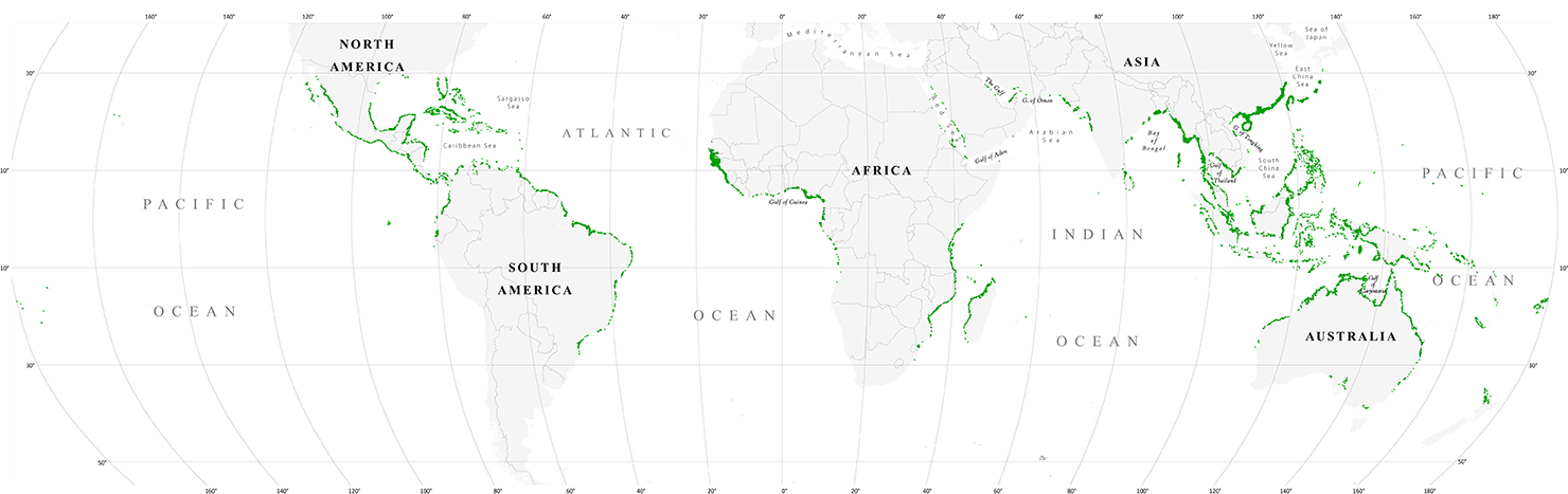
Landsat 7 data, together with data from its predecessor Landsat 5, provided the most comprehensive assessment ever of Earth’s mangroves in 2010.
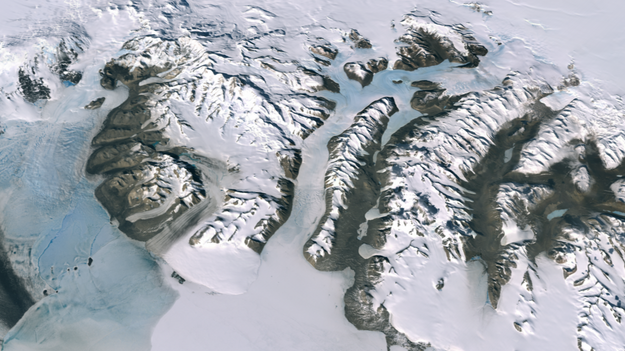
And for the International Polar Year 2007-2008, data from more than 1,000 Landsat 7 images were used to create the Landsat Image Mosaic of Antarctica (LIMA)—what was then the most detailed satellite mosaic of Antarctica.
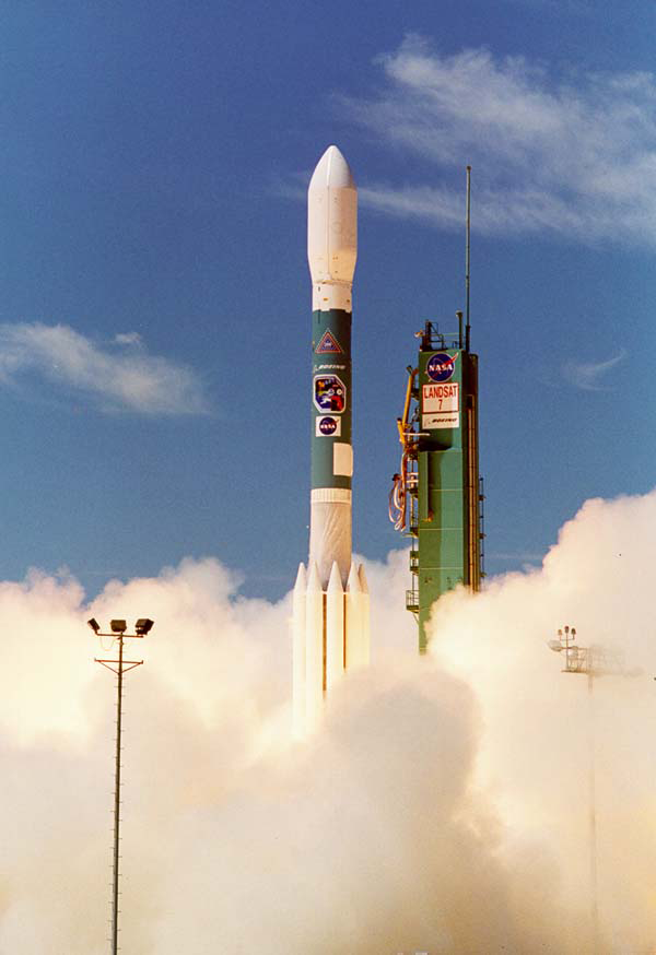
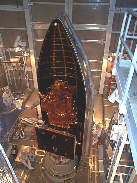
In the long and winding history of the Landsat Program, April 15, 1999 was an important day.
If we travel two decades back in time and rewind the 4,733,375,587.686 km that Landsat 7 has flown in that time, we arrive at a very different moment of spaced-based Earth observation.
The commercially-owned Landsat 6 satellite had failed to reach orbit six years earlier. Landsat 5 was 12 years past its design life and operated by a for-profit entity that charged upwards of $4000 per image and collected international data only when there was an immediate customer.
A building consensus about the critical role of Earth observation data for global change research in the early 1990s, had led the National Space Council to recommend that a Landsat 7 be built and operated by the U.S. government to ensure a continuous global data archive of medium-resolution data for the long-term monitoring of Earth’s land surface. This was codified with the 1992 U.S. Land Remote Sensing Policy Act.
Until the launch of Landsat 7 on that spring morning, technological challenges coupled with the failed Landsat commercialization had curtailed the systematic global coverage envisioned by the Landsat Program’s founders.
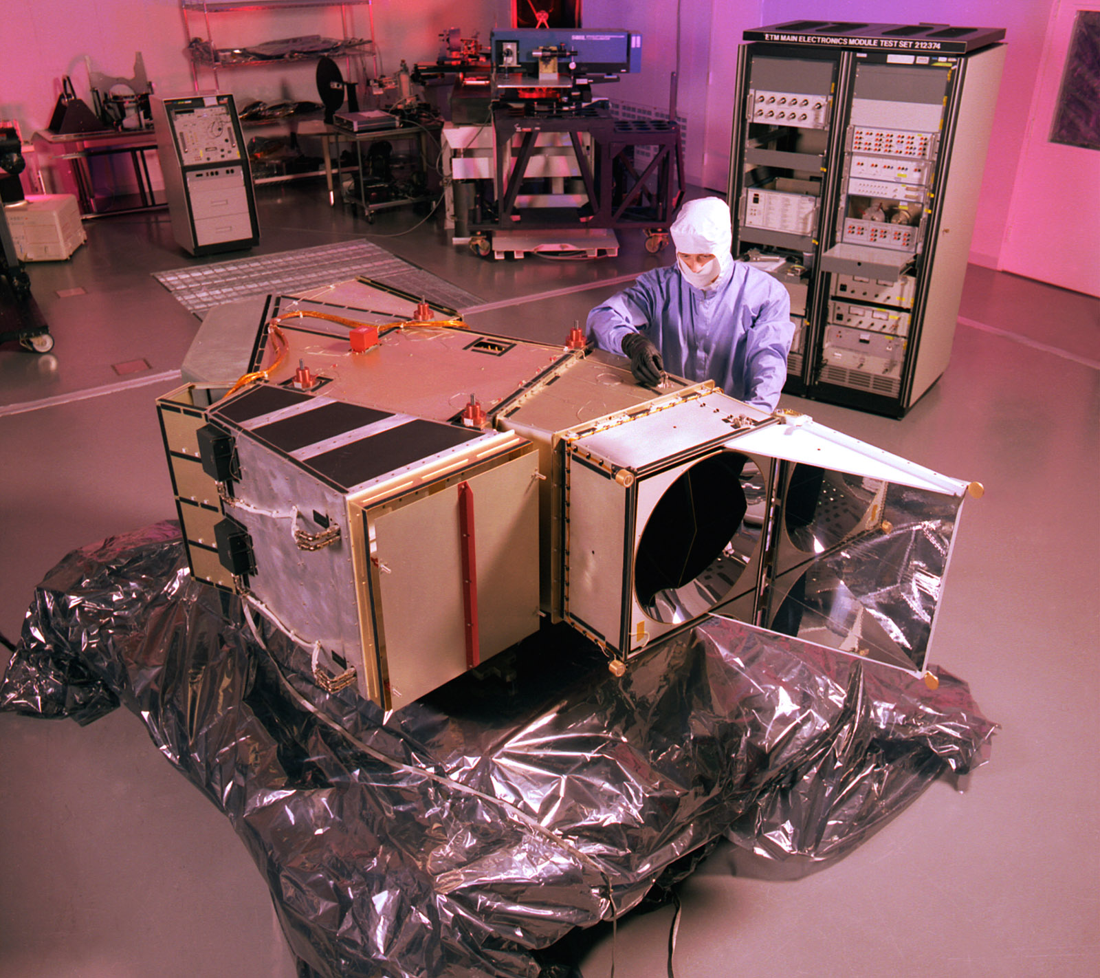
When Landsat 7 launched on April 15, 1999, the Enhanced Thematic Mapper Plus (ETM+) instrument onboard was the most sophisticated Landsat sensor yet. The ETM+ carried a new 15 meter panchromatic band and had a thermal band with a spatial resolution refined to 60 meters (from the 120-meters of Landsats 4 and 5).
It also carried a new solid-state data recorder—one of the first to fly on a civilian mission.
For the first time in the Landsat program history, Landsat 7 was equipped with hardware that could reliably store large amounts of imaged data onboard for later download when a ground station was in range.
The first-generation Landsat satellites carried massive 76-pound tape recorders with lots of moving parts, 600 yards of magnetic tape, and an inability to function for the length of a mission. Because of these repeated failures, the second-generation Landsat satellites eschewed onboard recorders, relying instead on relay satellites, but relay costs and the satellites’ commercialization worked against global coverage.
Landsat 7’s state-of-the-art solid-state recorder together with a strategic global image acquisition plan enabled the best global coverage the program had ever known.
The LIMA project lead, Robert Bindschadler, penned in a 2001 journal article that “The revolutionary concept of systematic collection of Landsat 7 data timed to optimize anticipated scientific applications will make possible a global monitoring of the cryosphere with a data set heretofore only available in limited regions.”
Today, Landsat 7 adds approximately 475 scenes to the data archive each day.
Data: Getting it as good as it gets
Landsat 7 also offered improved geometric and radiometric calibration compared to its predecessors. Onboard, Landsat 7 added partial- and full-aperture solar calibrators. On the ground, Landsat 7 was the first Landsat mission to incorporate a data-trending image assessment system into the operational ground system.
During its ascent into orbit, Landsat 7 collected data as it flew under Landsat 5. This enabled the cross-calibration of Landsats 5 and 7 (in 2013, Landsat 8 underflew Landsat 7 for the same reason). Additionally, a team of calibration scientists have also overseen in-the-field “vicarious” calibration efforts, which make certain that satellite measurements agree with physical ground measurements.
Careful data calibration ensures that the Landsat data record can show meaningful trends of land use and land cover change—even when the changes are subtle.
In May 2003, an image scanning mechanism on Landsat 7, known as the Scan Line Corrector, failed, leaving wedge-shaped gaps in the imagery—a net loss of 22% of each image.
As devastating as this failure was, the remaining data are, as USGS describes, “some of the most geometrically and radiometrically accurate of all civilian satellite data in the world.”
The landmark 2008 USGS decision to make all Landsat data free and open, and the subsequent trend towards best-pixel composite-based data analysis (instead of traditional scene-centered methods), has made these data gaps even less problematic.
All in all, Landsat 7 has made remarkable contributions to global studies for two decades now, and according to fuel-based predictions, it should be able to continue doing so until the launch of Landsat 9.
Did you know?
In the second it took you to read this line, Landsat 7 traveled ~7.499 kilometers.
The Landsat 7 Mission Operations Control Center is staffed by 14 engineers, seven days a week, 8 hours a day and someone is always on call and ready to respond if a ground or spacecraft anomaly occurs, 24/7.
References: Goward, Samuel N., Darrel L. Williams, Terry Arvidson, Laura E.P. Rocchio, James R. Irons, Carol A. Russell, and Shaida S. Johnston. 2017. Landsat’s Enduring Legacy: Pioneering Global Land Observations from Space. Bethesda, MD: American Society for Photogrammetry and Remote Sensing.
Wulder, Michael A., Thomas R. Loveland, David P. Roy, Christopher J. Crawford, Jeffrey G. Masek, Curtis E. Woodcock, Richard G. Allen, Martha C. Anderson, Alan S. Belward, Warren B. Cohen, John Dwyer, Angela Erb, Feng Gao, Patrick Griffiths, Dennis Helder, Txomin Hermosilla, James D. Hipple, Patrick Hostert, M. Joseph Hughes, Justin Huntington, David M. Johnson, Robert Kennedy, Ayse Kilic, Zhan Li, Leo Lymburner, Joel McCorkel, Nima Pahlevan, Theodore A. Scambos, Crystal Schaaf, John R. Schott, Yongwei Sheng, James Storey, Eric Vermote, James Vogelmann, Joanne C. White, Randolph H. Wynne, and Zhe Zhu. 2019. “Current status of Landsat program, science, and applications.” Remote Sensing of Environment 225:127-147. doi: https://doi.org/10.1016/j.rse.2019.02.015.
Article by Laura E.P. Rocchio, NASA Landsat Communication and Public Engagement Team
Related Reading:
+ Successful Maneuver Spells Beginning of the End for Landsat 7, USGS


