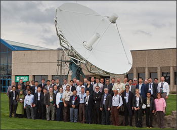
Source: USGS

This year’s Landsat Technical Working Group (LTWG#20) meeting was held in Sioux Falls, SD, USA, May 23-27, 2011. Participants from 17 countries, including members of the USGS and NASA Landsat and Landsat Data Continuity Mission (LDCM) Projects, represented 23 U.S. and international ground stations and discussed a wide range of technical topics. Special guest, Anne Castle, U.S. Department of the Interior (DOI) Assistant Secretary for Water and Science, welcomed the attendees and provided perspective on the key role they play in current and future international land imaging cooperation.
Landsat Project presentations included Landsat 5 and Landsat 7 mission statuses, Global Land Survey status, the Landsat Global Archive Consolidation initiative, operational Data Validation & Exchange (DV&E) status, and Calibration/Validation. The Landsat Project also hosted a technical workshop on Landsat 1-5 Multi-Spectral Scanner (MSS) Data Processing current progress and future plans. LDCM presentations included Project and Ground System status including plans and timelines for LDCM Ground System processing software availability, the LDCM Space-to-International Cooperator (IC) interface, and DV&E and Ground Station Certification. A Landsat Science Team update was also presented, providing information on several key application and research projects. NASA also provided attendees with an overview of the overall LDCM mission status. Concurrent with the typical LTWG agenda, the USGS also hosted a 3-day Ground System Technical Workshop for its International Cooperator attendees. The workshop covered both Landsat and LDCM (Landsat 8) ground system technical information such as requirements, interfaces, design, and implementation details.
Each International Cooperator briefed the group on the status of their ground systems including electronic data delivery capabilities and challenges, presented their future satellite mission(s), provided an overview of their data distribution model(s), and discussed current status of their Landsat Global Archive Consolidation activities.
International Cooperators and U.S. attendees included representatives from the following countries and organizations:
- Argentina (CONAE)
- Australia (GA-NEO)
- Australia (DCCEE)
- Brazil (INPE, AMS Kepler)
- Canada (CCRS, MDA)
- China (CEODE)
- Ecuador (CLIRSEN)
- Europe (ESA)
- Germany (DLR)
- Indonesia (LAPAN)
- Japan (RESTEC)
- Mexico (CONABIO)
- Russia (ScanEx)
- Saudi Arabia (KACST)
- South Africa (SANSA, PinkMatter)
- Sweden (SSC)
- Thailand (GISTDA)
- United States (DOI, USGS, NASA, Aerospace, Honeywell, Lockheed Martin, SeaSpace, SGT, Virtuoso)


