
Spotting Disruptions to Earth’s Vegetation
Using NASA data, researchers can track vegetation changes around the planet, not just in forests but also in grasslands and savannas like the Brazilian Cerrado.

NASA’s Brad Doorn Brings Farm Belt Wisdom to Space-Age Agriculture
From his South Dakota roots to leading NASA’s agricultural program, Brad Doorn’s mission has remained the same: help farmers feed the world.

Tony Willardson, Water Watcher
With Landsat-based ET embedded in more and more water rights and conservation tools, Willardson and the Western States Water Council are eager to see Landsat Next with its higher spatial resolution, more frequent observations, and additional spectral bands, built and launched.
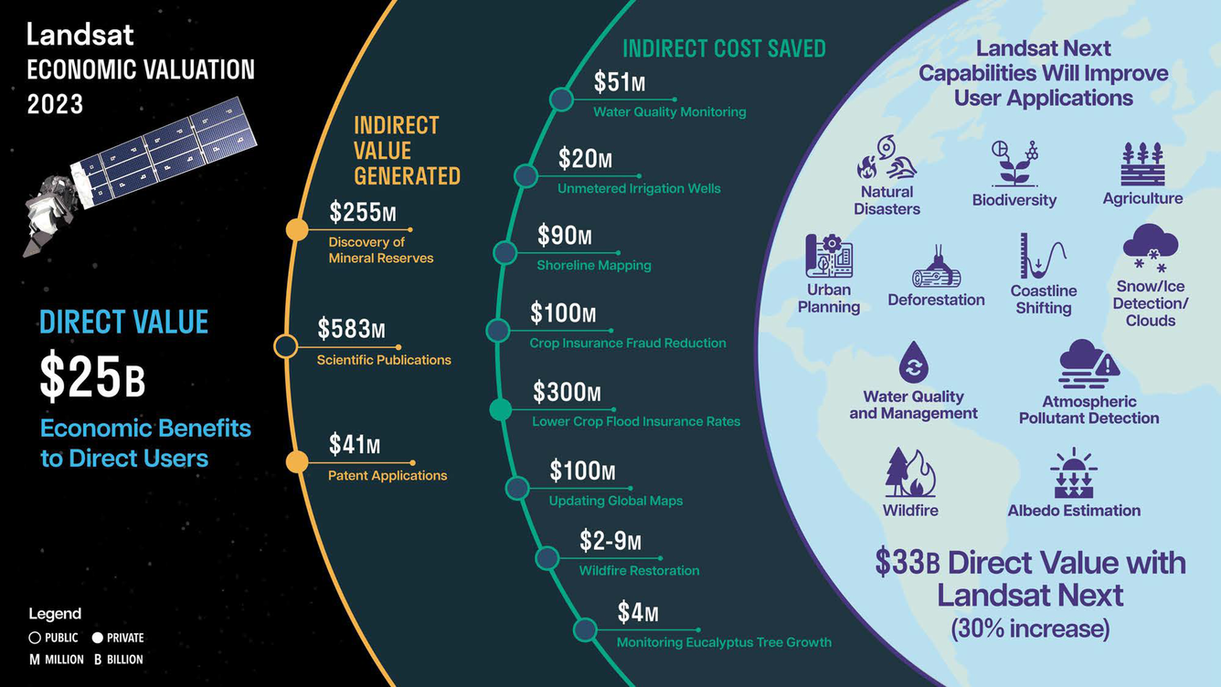
Landsat’s Economic Value increases to $25.6 Billion in 2023
A new report about the Landsat satellite program – a partnership between the U.S. Geological Survey and National Aeronautics and Space Administration – calculates its 2023 value at $25.6 billion—a marked increase from its 2017 estimate of $3.45 billion.

Landsat Observations Key Resource for Many Federal Agencies
In the FY23 Aeronautics and Space Report released on May 23, 2024, a multitude of Federal agencies report work informed by Landsat data.

Meat of the Matter: Colorado River Over-Consumed
More water is taken from the Colorado River than it has to give. Better water use accounting made possible by Landsat provides needed guidance for difficult water use decisions.