Landsat's Role in Understanding Climate Change
Long-term weather patterns averaged over 30 years or more make up our climate. Human well-being—our infrastructure and agriculture—depend on a reliable climate. This reliability allows farmers to plant seeds in the spring with confidence that temperatures and rainfall will sustain crops in the coming months. It allows communities to build and maintain roads, buildings, and drainage systems best suited to local conditions. Earth’s climate is controlled by the amount of energy that flows through the atmosphere, oceans, and land. By adding heat-trapping gases to the atmosphere—primarily carbon dioxide—people are increasing the amount of energy in the Earth system that would otherwise escape to space. This increase in energy is changing Earth’s climate, and consequently, the weather patterns that people rely on are shifting. Changes in long-term weather patterns have wide-ranging impacts on ecosystems and peoples’ lives. Designed to observe land and coastal ecosystems, Landsat instruments provide an unparalleled space-based record of the impact of climate change on Earth’s landscapes, the growth and loss of carbon- storing.
![tornado damage](https://landsat.gsfc.nasa.gov/wp-content/uploads/2019/07/tornado-damage-1.jpg)
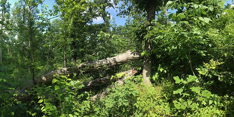
Tornadoes, Windstorms Pave Way for Lasting Plant Invasions
Landsat shows that large blowdown areas in southern Illinois forests are more heavily invaded by invasive species and slower to recover than smaller areas after a tornado.
![Landsat Ice Stream is found at the southern end of the Antarctic Peninsula](https://landsat.gsfc.nasa.gov/wp-content/uploads/2019/06/Ice_streams_named-small-768x1025-1.png)
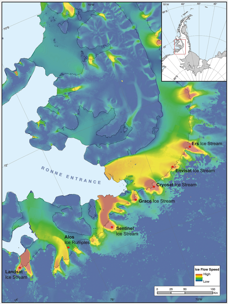
Introducing Landsat Ice Stream
Seven ice features in western Antarctica have been named for Earth-observation satellites, including one named for Landsat.
![The Elfin cloud forest on top of East Peak in the El Yunque National Forest of Puerto Rico](https://landsat.gsfc.nasa.gov/wp-content/uploads/2019/04/ElfinCloudForest.Puerto.Rico_.Maria_.Rivera-sm-1.png)
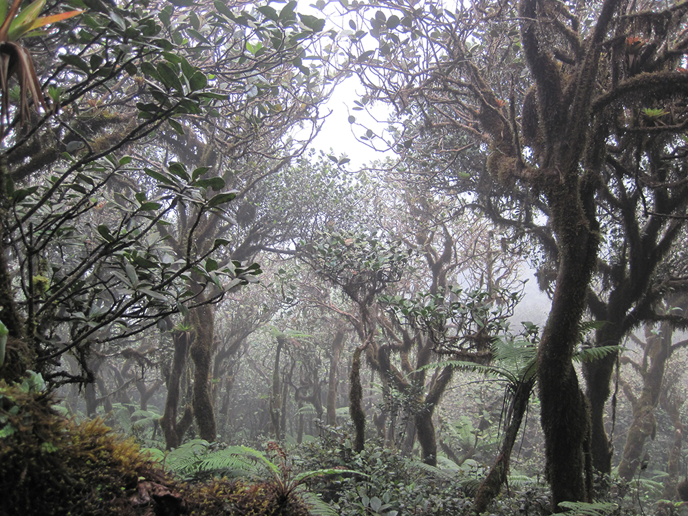
Neotropical Cloud Forests to Lose What Most Defines Them: Clouds
If greenhouse gas emissions continue increasing as they have been, 90% of Western Hemisphere cloud forests would be affected as early as 2060.
![how much ice has been lost from and gained by 19 different glacierised regions around the world](https://landsat.gsfc.nasa.gov/wp-content/uploads/2019/04/Global_glacier_mass_loss_1961_2016_large-1.jpg)
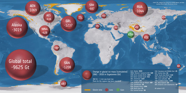
Glaciers Lose 9 Trillion Tons of Ice in Half a Century
An international team used classical glaciological field observations combined with a wealth of information from various satellite missions to painstakingly calculate how much ice has been lost or gained by 19 different glacierized regions around the world.
![Alaska's Yukon Flats](https://landsat.gsfc.nasa.gov/wp-content/uploads/2019/03/Yukon-Flats-Study-Area_1-1024x636-1.jpg)
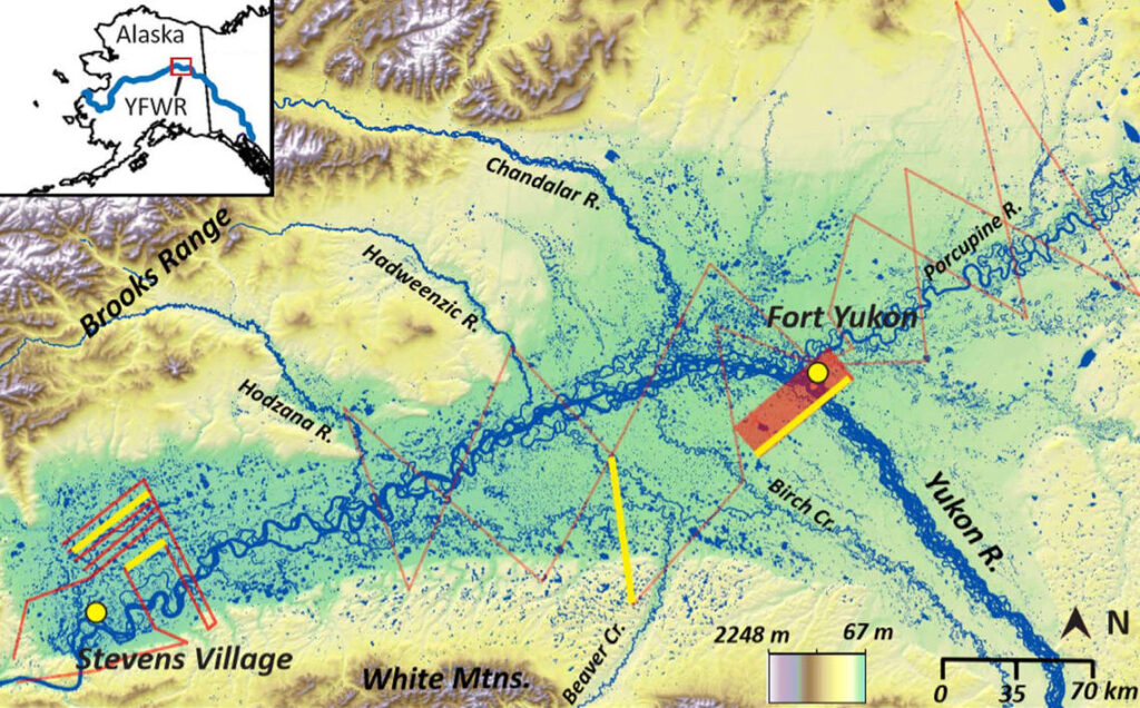
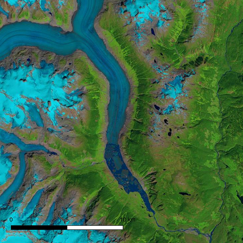
Landsat, Permafrost Data Offer Insight into Arctic Lake Dynamics
Remarkably little is known about the subsurface connections between the thousands of lakes scattered across ecoregions like Yukon Flats; this study sheds light on those lakes.
![Landsat image showing snout of Klinaklini Glacier in late summer 2018.](https://landsat.gsfc.nasa.gov/wp-content/uploads/2019/01/klinakliniglacier2018-1.jpg)
New Research Shows Significant Decline of Glaciers in Western North America
The first comprehensive assessment of glacier mass loss for all regions in western North America (excluding Alaskan glaciers) suggests that ice masses throughout western North America are in significant decline.