Landsat's Role in Understanding Climate Change
Long-term weather patterns averaged over 30 years or more make up our climate. Human well-being—our infrastructure and agriculture—depend on a reliable climate. This reliability allows farmers to plant seeds in the spring with confidence that temperatures and rainfall will sustain crops in the coming months. It allows communities to build and maintain roads, buildings, and drainage systems best suited to local conditions. Earth’s climate is controlled by the amount of energy that flows through the atmosphere, oceans, and land. By adding heat-trapping gases to the atmosphere—primarily carbon dioxide—people are increasing the amount of energy in the Earth system that would otherwise escape to space. This increase in energy is changing Earth’s climate, and consequently, the weather patterns that people rely on are shifting. Changes in long-term weather patterns have wide-ranging impacts on ecosystems and peoples’ lives. Designed to observe land and coastal ecosystems, Landsat instruments provide an unparalleled space-based record of the impact of climate change on Earth’s landscapes, the growth and loss of carbon- storing.
![Researchers from UCI and NASA JPL recently conducted an assessment of 40 years’ worth of ice mass balance in Antarctica, finding accelerating deterioration of its ice cover.](https://landsat.gsfc.nasa.gov/wp-content/uploads/2019/01/20190114_nu1-300x169-1.png)
Antarctica Losing Six Times More Ice Mass Annually Now Than 40 Years Ago
Antarctica experienced a sixfold increase in yearly ice mass loss between 1979 and 2017.
![Casey Youngflesh](https://landsat.gsfc.nasa.gov/wp-content/uploads/2018/12/20181212_nu2-1024x685-1.jpg)
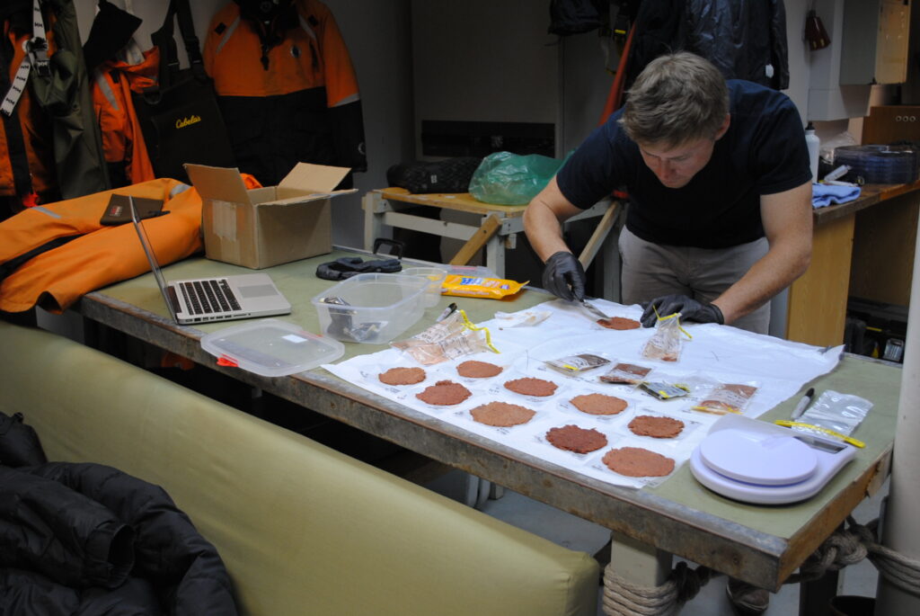
Determining Penguin Diet with Landsat (and Piles of Poo)
Scientists are now able to determine what penguins are eating from space.
![A conceptual figure showing fire impacts on annual vegetation evapotranspiration and its recovery after fires.](https://landsat.gsfc.nasa.gov/wp-content/uploads/2018/12/20181211_nu13-1024x572-1.png)
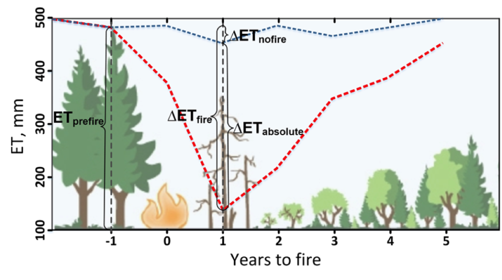
Understanding How Fire Alters the Water Use of Sierra Nevada Forests
Fires play an important role in regulating forest density, vegetation water use, and runoff.
![TIRS A-68](https://landsat.gsfc.nasa.gov/wp-content/uploads/2018/12/TIRSA68JuneAug2017_v2-1.gif)
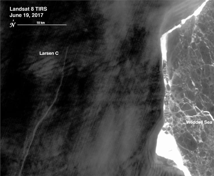
The Dynamic Nature of a Large Iceberg Calving Event
Iceberg A-68 calved from the Larsen C during a period of larger then average tidal cycles.
![A group of four glaciers in an area of East Antarctica called Vincennes Bay, west of the massive Totten Glacier](https://landsat.gsfc.nasa.gov/wp-content/uploads/2018/12/antarctica_velocity_highres_lbls-1.png)
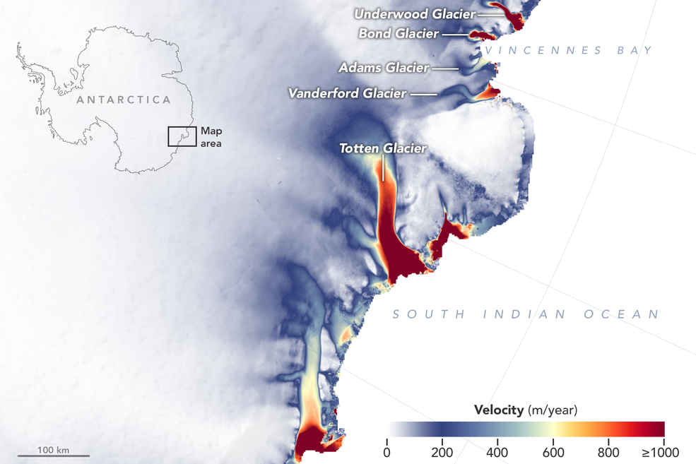
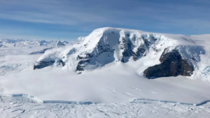
More Glaciers in East Antarctica Are Waking Up
New detailed NASA maps of ice velocity and elevation show that a group of glaciers spanning one-eighth of East Antarctica’s coast have begun to lose ice over the past decade, hinting at widespread changes in the ocean.
![A fjord in Greenland.](https://landsat.gsfc.nasa.gov/wp-content/uploads/2018/12/20181210_nu1-1.png)
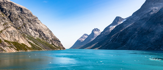
Mapping Circulation Patterns of Icy Fjords
“Great insight comes from thinking in multi-sensor and using several constellations together.”