Landsat’s Role in Managing Ecosystems and Biodiversity
Our world is made of complex networks of living things and physical elements that constantly interact and affect each other. Such networks are known as “ecosystems.” Healthy and economically important ecosystems such as temperate forests, wetlands, grasslands, coastal zones, coral reefs, and rainforests all play roles in human life. For example, farm and rangeland ecosystems must be healthy to produce the grains and livestock on which we depend as a nation. Marine ecosystems depend on the health of land ecosystems, because coastal areas provide habitat needed to support the productivity and diversity of aquatic organisms. Landsat has brought valuable capabilities to ecosystem studies. Landsat instruments measure reflected light in visible and infrared wavelengths. Because plants reflect little visible light and a lot of infrared light when they are healthy, the measurement of both types of light simultaneously gives scientists a way to assess plant health and density over a landscape. Measurements are detailed enough while still covering a wide area that ecologists can expand their interpretations of local events and processes, such as an insect infestation in a specific forest, to a regional scale. This helps them to gauge the health of larger ecosystems. Because Landsat data are accurately mapped to reference points on the ground and adjusted for topographic relief, they can be integrated with other geographic data sets and models to explore more complex studies of ecosystems and biodiversity across space and time.
![A field photo showing mangrove roots](https://landsat.gsfc.nasa.gov/wp-content/uploads/2022/03/20190507_nu2.png)
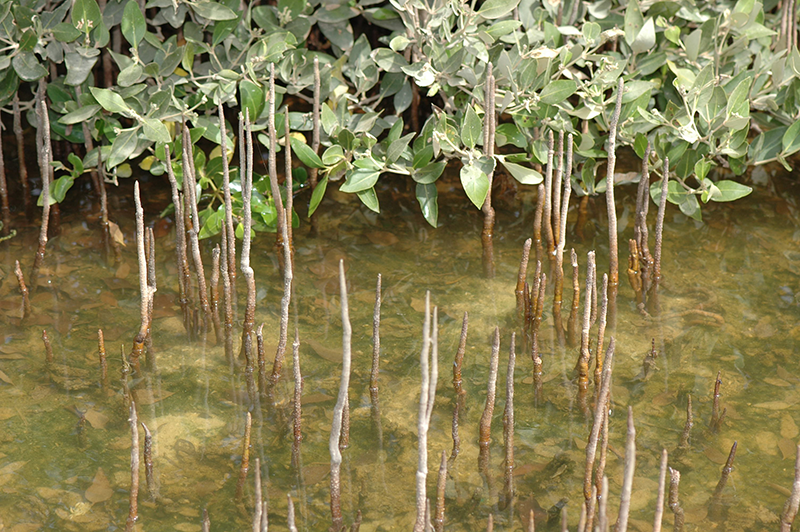
The Curious Case of Missing Mangroves in the Jubail Conservation
A group of researchers have used Landsat data to help solve a case of missing mangroves in Saudi Arabia’s Jubail Conservation.
![The Elfin cloud forest on top of East Peak in the El Yunque National Forest of Puerto Rico](https://landsat.gsfc.nasa.gov/wp-content/uploads/2019/04/ElfinCloudForest.Puerto.Rico_.Maria_.Rivera-sm-1.png)
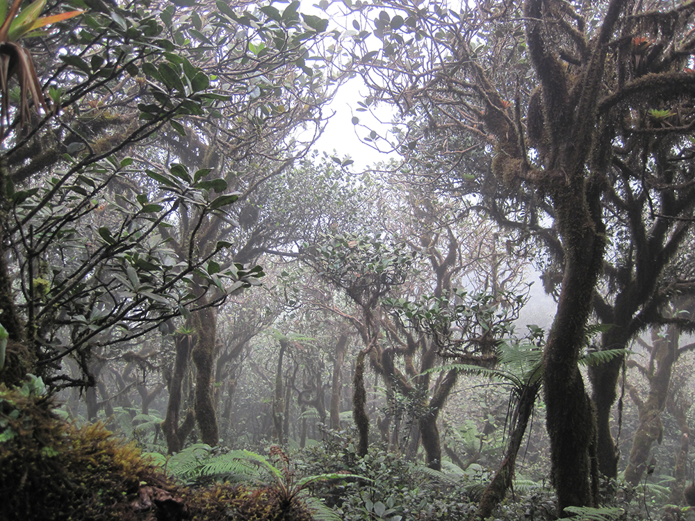
Neotropical Cloud Forests to Lose What Most Defines Them: Clouds
If greenhouse gas emissions continue increasing as they have been, 90% of Western Hemisphere cloud forests would be affected as early as 2060.
![Cattle rangeland](https://landsat.gsfc.nasa.gov/wp-content/uploads/2019/04/rangeland-crop-768x351-1.png)
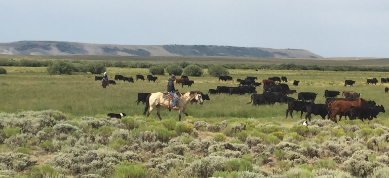
New Technologies for Range and Pasture Management
The Landsat-based Rangeland Analysis Platform and Green-Cast are valuable tools for ranchers adaptively managing their land.
![Huckleberry leaves in autumn](https://landsat.gsfc.nasa.gov/wp-content/uploads/2019/03/Huckleberry-landscape-1024x768-1.jpg)
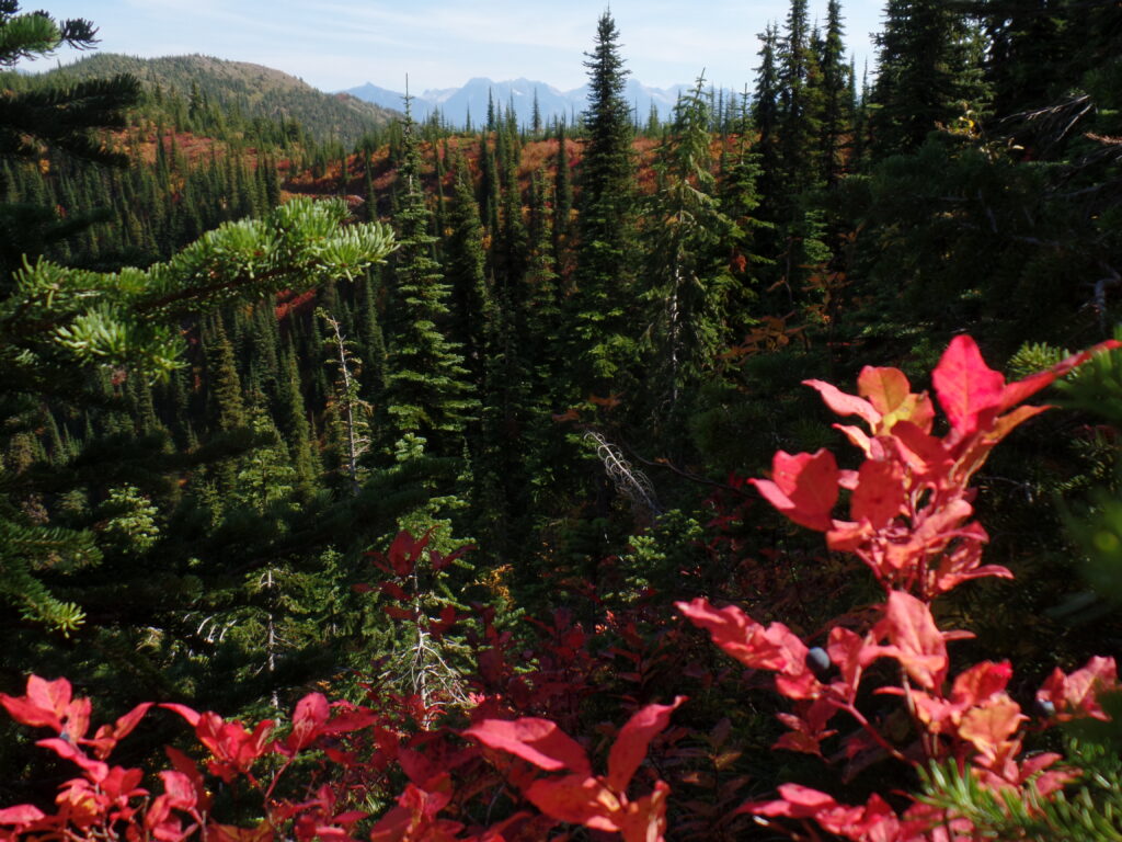
Huckleberry Bears: New Landsat-Aided Tool Maps a Key Food Source for Grizzlies
A Landsat-based approach to map huckleberry distribution across Glacier National Park could one day provide warnings of potential human-bear conflict areas.
![Sampling invertebrates within deep mudflats in Gladstone, Australia.](https://landsat.gsfc.nasa.gov/wp-content/uploads/2019/01/20190128_intertidal1-1.jpg)
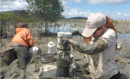
Loss of Intertidal Ecosystem Exposes Coastal Communities
The study used machine-learning to analyze more than 700,000 Landsat images to map changing global distribution of intertidal areas over a 30-year period.
![Vegetation phenology indicator of start of season (SOS), determined based on Landsat observations in five representative cities in the United States.](https://landsat.gsfc.nasa.gov/wp-content/uploads/2018/12/20181214_n7-1.png)
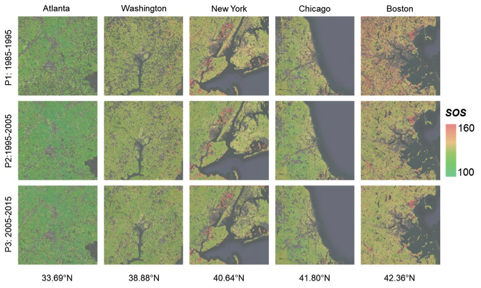
As Cities Grow, So Does the Urban Growing Season
New insights on how vegetation phenology in urban and surrounding areas respond to urbanization.