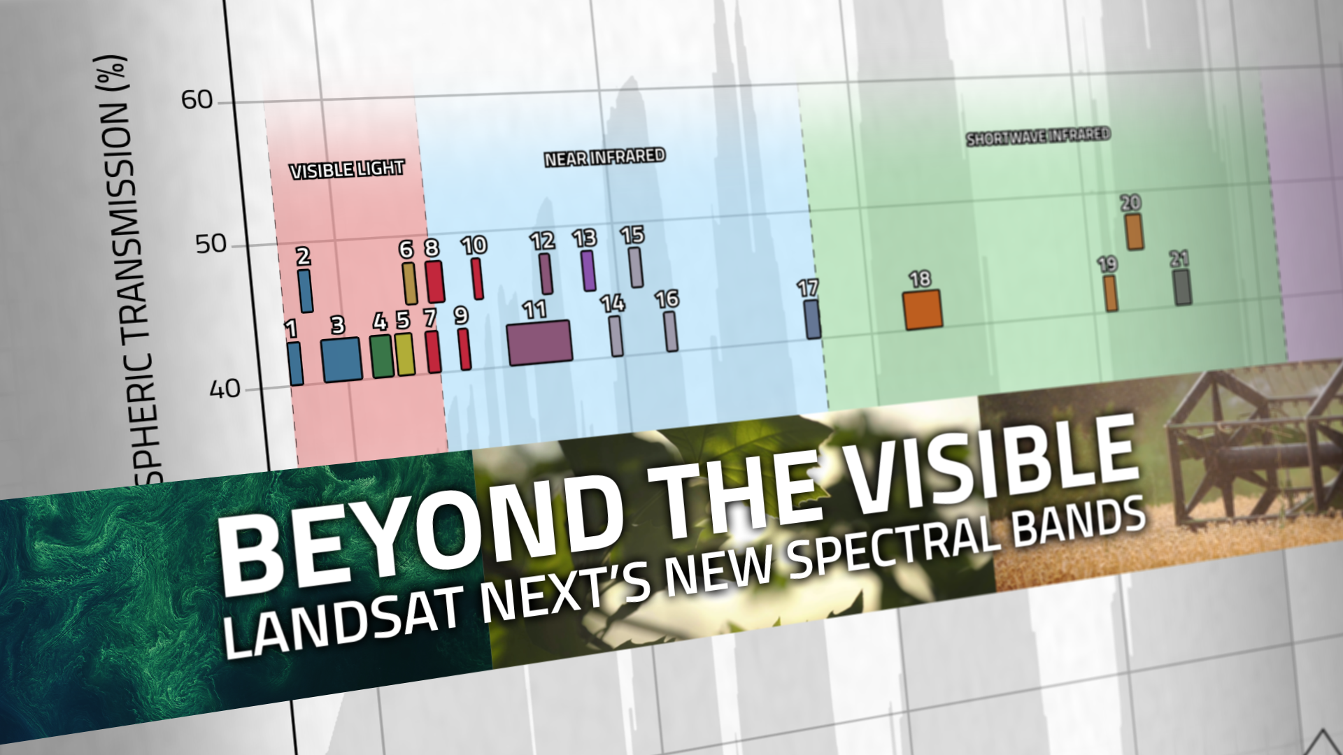
Landsat's Role in Managing Energy Resources
Energy is a growing necessity for people worldwide. As the demand for energy grows, Landsat plays an important role in identifying new energy sources and mitigating the human and environmental impact of energy development. Landsat is useful in the energy sector both because of its unparalleled decades-long record of Earth’s land and because of its ability to measure infrared and visible light. With more than 40 years of imagery, decision makers can monitor the environmental impact of mining and energy generation and track ecological recovery after operations end. Landsat’s ability to measure infrared light allows farmers and decision makers to gauge the health of biofuel crops and natural vegetation near dams and mining sites. The infrared and visible measurements together help energy companies identify minerals on the surface when plants are sparse.
![Members of Australia’s New South Wales Rural Fire Service monitor a fire in a remote region of the state that is also home to utility company transition lines. Credit: Indji Systems.](https://landsat.gsfc.nasa.gov/wp-content/uploads/2024/05/firms_auscrew_art.jpg)
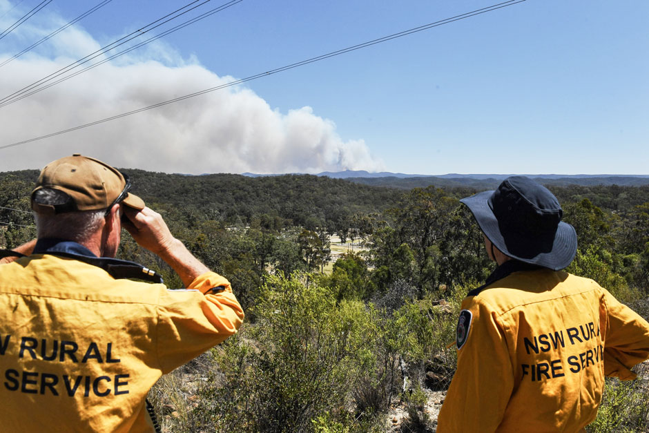
Spotted by Satellite: Situational Awareness in Fiery Times
The Australian company Indji Systems uses a variety of satellite data to provide real-time hazard monitoring and alerts to utility and renewable energy companies across Australia, North America and Europe.
![Landsat-8 nighttime thermal infrared image from April 2017](https://landsat.gsfc.nasa.gov/wp-content/uploads/2019/04/Landsat8_WestTernLake-1.jpg)
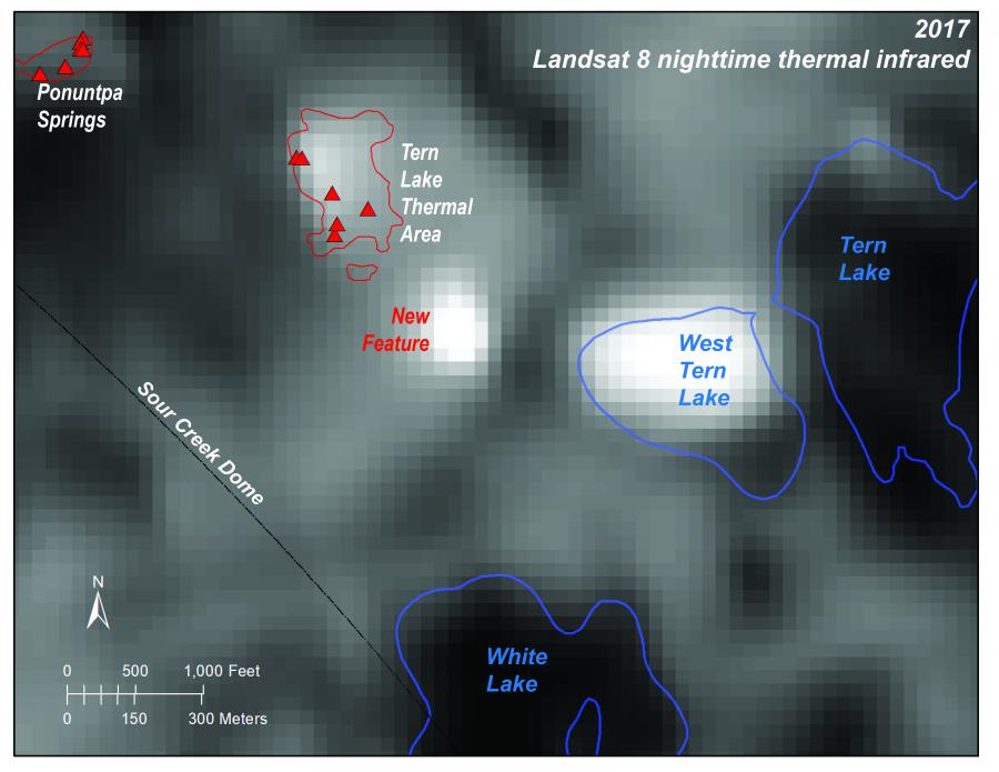
Discovering New Thermal Areas in Yellowstone’s Dynamic Landscape
Over the last 20 years, a new thermal area has developed in Yellowstone. Landsat 8 is on the case.
![Pennsylvania’s Tiadaghton State Forest with fall foliage](https://landsat.gsfc.nasa.gov/wp-content/uploads/2018/12/20181211_nu8-1.png)
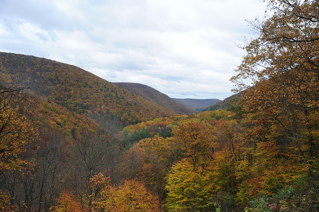
Monitoring Forest Health Amid Oil and Gas Extraction
Following changes in long-term forest health around oil and gas wells in the Pennsylvania State Forest.
![Lake Powell behind the Glen Canyon Dam](https://landsat.gsfc.nasa.gov/wp-content/uploads/2018/03/20180315_nu2-1024x640-1.png)
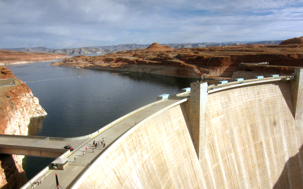
Land Under Water: Estimating Hydropower’s Land Use Impacts
A team of Norwegian-based researchers has developed an innovative way to describe how much land it takes to generate a kilowatt-hour of electricity from hydropower.
![Longwall mining machinery in a Colorado coal mine](https://landsat.gsfc.nasa.gov/wp-content/uploads/2015/12/20151216_agu7-1.png)
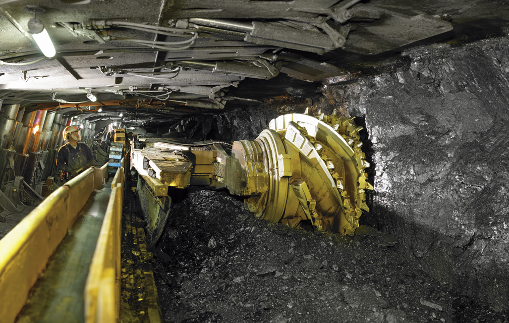
Assessing Longwall Mining Impacts on the Forests Above
Erin Pfeil-McCullough, a graduate student at the University of Pittsburgh, gave a talk at #AGU15 on insights that she has gained from her research to determine what impacts longwall mining has on forest canopies above as the ground subsides and local hydrology is altered.
![Illustration of the Landsat 9 spacecraft in orbit](https://landsat.gsfc.nasa.gov/wp-content/uploads/2021/10/landsat9_gulf_670_print_0.jpg)
Landsat Images Provide the Gold Standard for New Earth Applications
Images from Landsat satellites provided free to the public by the Department of the Interior’s U.S. Geological Survey were the starting points for “a new breakthrough” reported today by Time and announced