Landsat’s Role in Protecting Human Health
People have long recognized the connection between the environment and human health. Various animal and insect species from mice to mosquitoes serve as vectors that can transmit disease pathogens to people. Malaria is among the most deadly, preventable vector-borne diseases. About half of the world’s population (3.3 billion people) is at risk of contracting malaria from mosquitoes, according to the World Health Organization. Other human health problems such as cancer arise from exposure to pollutants in the environment. Finally, malnutrition can follow crop-destroying natural disasters such as drought or floods in poor regions. Landsat measurements can help decision makers pinpoint and minimize environmental health risks. With a spatial resolution of 30 meters, Landsat is well suited to mapping various components of changing landscapes, including agriculture and urbanization, that might pollute waterways. This level of detail can also show where water has accumulated in depressions to become breeding grounds for disease-carrying insect vectors. Landsat measures reflected light in both visible wavelengths and infrared wavelengths. This combination of measurements helps scientists gauge how healthy vegetation is, since growing plants generally absorb red light and reflect infrared light. Knowing the health of plants informs decision makers about cropland productivity and habitat conditions for disease-carrying insects and animals.

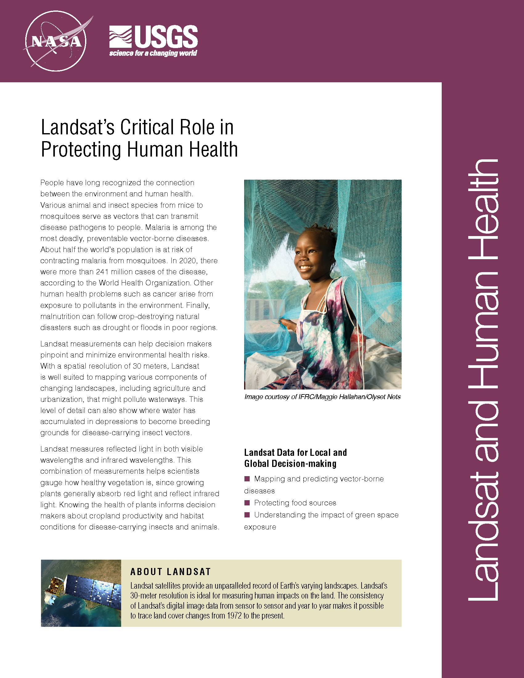
Loss of Intertidal Ecosystem Exposes Coastal Communities
The study used machine-learning to analyze more than 700,000 Landsat images to map changing global distribution of intertidal areas over a 30-year period.

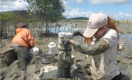
As Cities Grow, So Does the Urban Growing Season
New insights on how vegetation phenology in urban and surrounding areas respond to urbanization.

Retrieving Secchi Depth with Landsat 8
Landsat 8 allows for the acquisition of spectral data for monitoring water quality from lakes and drinking water reservoirs across the United States.

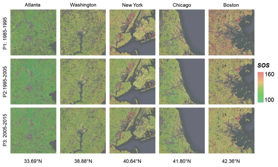
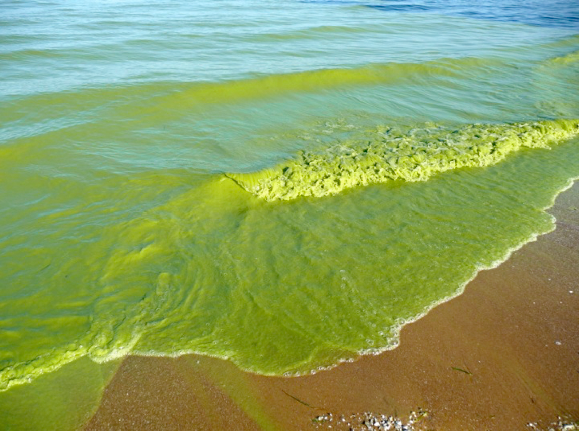
Satellites on Toxic Algae Patrol
Increasingly, water managers are turning to satellites like Landsat to monitor inland waters.
Finding Baltimore’s Mosquito Hotspots with Help from Landsat
High levels of residential abandonment and unchecked vegetation growth in low-income neighborhoods are strong indicators of mosquito prevalence. Higher income neighborhoods are also susceptible to mosquito-borne disease due to the presence of irrigated vegetation, which creates mosquito-friendly habitat.

How Landsat Data Led to a Breakthrough for Lake Erie Toxic Algal Blooms
With the growing frequency and magnitude of toxic freshwater algal blooms becoming an increasingly worrisome public health concern, Carnegie scientists Jeff Ho and Anna Michalak, along with colleagues, have made new advances in understanding the drivers behind Lake Erie blooms and their implications for lake restoration.