

Landsat Reveals Vanishing River Ice
The extent of wintertime river ice has declined by 2.5 percentage points globally over the past three decades.

Landsat Provides “Complete Perspective” of Wetland Loss in China
Intertidal wetlands significantly contribute to China’s environmental and ecological diversity, but are facing unprecedented pressures from anthropogenic development, as well as the threat of future sea level rise.
Hydropower Dams Cool Rivers in the Mekong River Basin, Landsat Shows
Researchers used Landsat satellites to track changes in surface water temperature for the Sekong, Sesan and Srepok rivers. Within one year of the opening of a major dam, downstream river temperatures during the dry season dropped by up to 3.6ºF.
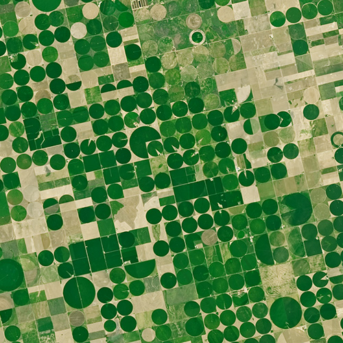
Landsat: Farming Data From Space
With Landsat data, farmers can find new ways to grow more crops with less water.
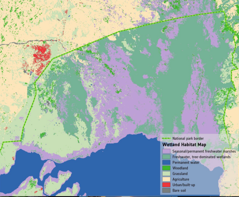
Space Key to Wetland Conservation
Wetlands worldwide are vanishing at an alarming rate. New satellite-informed maps produced by ESA’s GlobWetland Africa project show how satellite observations can be used for the effective use and management of wetlands in Africa.
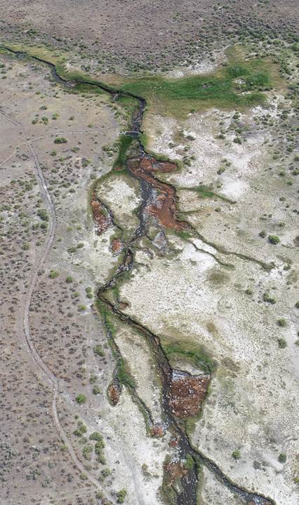
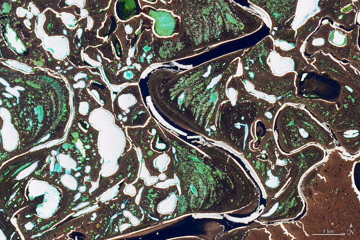
When a River Runs Through Drylands
There is a dance between the vegetation that thrives along a river’s edge and the availability of water; with Landsat, that relationship is now being understood in ways not previously possible.
