
Dr. Christine Albano is a ecohydrologist at the Desert Research Institute in Reno, Nevada. Here is what Christine shared with us about the work she presented on Thursday afternoon at #AGU19:
Using the Landsat Archive to Assess Multi-Decadal Changes in Riparian Vegetation in Western U.S. Drylands
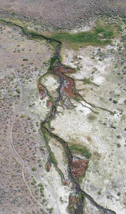
What are the major findings of this research?
After adjusting for the role of interannual variations in precipitation and evapotranspiration, approximately 25% of riparian vegetation in Nevada has significantly increased in vegetation vigor between 1985 and 2018 and approximately 15% has decreased.
Declining lake levels, changes in livestock grazing management, biocontrol of invasive riparian plants, and declining groundwater levels may be contributing to some of these observed changes.
In addition, we found that riparian areas in more complex upland terrain were more likely to exhibit increases in vegetation vigor than those in wide valley bottoms or flat terrain, which exhibited both large increases and large decreases in vegetation vigor over the study period.
What are the implications of your findings?
Our results highlight places where human impacts or disturbances have resulted in substantial changes in riparian vegetation over the past three decades and can help natural resource managers target areas in need of management attention and/or evaluate the long-term effects of their management actions.
Positive trends in riparian vegetation vigor in upland regions indicates increasing water use by plants that may result in decreased surface flows or groundwater availability in lowland regions.
What insight did you gain from NASA/USGS Landsat that would have been difficult to ascertain otherwise?
By combining the 34-year record provided by Landsat with climate data, we can now quantify relations between water availability and vegetation dynamics in ways that were not previously possible. This allows us to more readily tease apart the role of climatic fluctuations from human-driven changes in these systems.
Co-authors:
Mark B Hausner
Desert Research Institute
Justin L Huntington
Desert Research Institute
Daniel McEvoy
Desert Research Institute
Kenneth McGwire
Desert Research Institute Reno
Funding for this work was provided by the USGS Landsat Science Team (2018-2023) and the Bureau of Land Management.
Further Reading:
+ Landsat at the 2019 AGU Fall Meeting
Anyone can freely download Landsat data from the USGS EarthExplorer or the LandsatLook Viewer.


