
 Abdoulatif Abass Saley is a mining geology engineer in the Geosciences Department of the School of Mining Industry and Geology in Niamey, Niger Here is what Abdoulatif shared with us the work presented week at #AGU19:
Remote-sensing mapping (Landsat) of abandoned mining wastes over time by artisanal gold mining in Koma Bangou (Liptako, Niger)
What effect has artisanal gold mining at the Koma Bango site in Niger had on the surrounding land and vegetation over the last ten years?
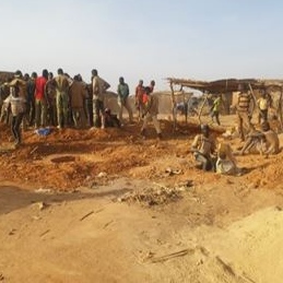
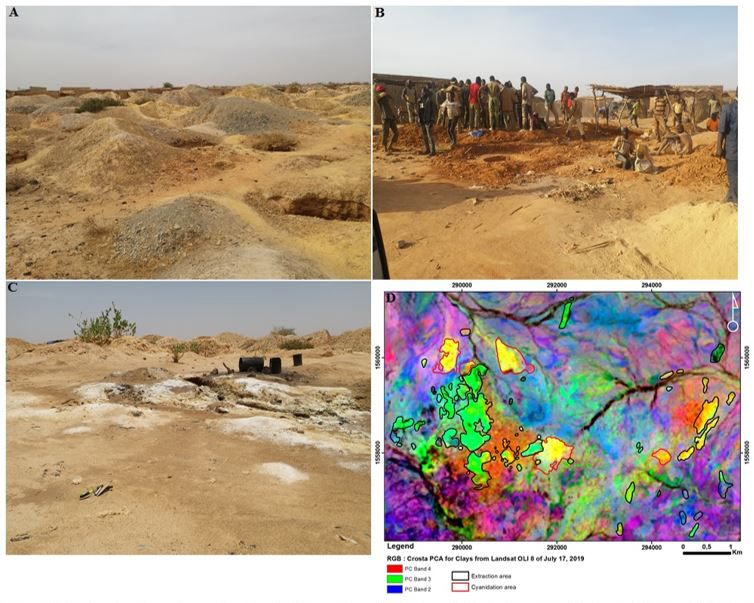
During the last ten years there has been a significant land degradation on the artisanal gold mining site of Koma Bangou in Niger.
This results fistly from the increase in the number of gold miners and extraction wells occupying more and more large areas and from the introduction since 2009 of chemical treatment of gold by cyanidation which also occupies large areas. The combination of these factors leads to the destruction of vegetation for housing construction, gold mining and cyanidation.
The digging of extraction wells leads to the weakening of the lands by underground voids and cavities making. The piles of waste rock discharges from gold mining and piles of cyanide wastes are abandoned on site haphazardly around extraction wells and dwellings and occupy more and more space thus changing the site topography and also constituting major factors of environmental pollution and insecurity.
Why is it important to know about these changes?
It is important to know the changes on this artisanal gold mining site to well monitor and manage how the land is used and to prevent and remedy the environmental impacts of this artisanal mining activity. This helps policy makers and mine administrators in the planning of gold panning activities. It also helps to inform those in power by sharing information with civil society and mining operators on gold panning and its impacts on the environment.
Are there socioeconomic implications of these changes?
In Niger, artisanal gold mining contributes to the socioeconomic development for populations and government. It involves more than 450.000 persons who pay artisanal gold mining taxes and more than 2.700.000 peoples depend on it. Gold panning produces between two and ten tons of gold per year, which represents 2.90% of Niger mining sector exports. This mining sector corresponds to 22.66% of government revenue and contributes 10% of GDP.
Why was NASA/USGS Landsat data useful for this study?
Landsat data were used in this study to track the evolution of artisanal gold mining since its inception in 1984, to determine the vegetation cover influenced by this artisanal gold mining and to identify the richness of waste in some minerals such as hydroxyls,
clays, carbonates, iron oxides and ferrous minerals. Landsat images are free to all users, accessible, easy to process, have good geolocation in Sahelian areas and have good spectral resolution to highlight geological entities in Niger Liptako area.
Co-authors:
David Baratoux
French Research Insitute for Sustainable Development
Lenka Baratoux
IRD
Ernest Kouassi Ahoussi
University Felix Houphouët-Boigny
Alphonse Yao
Institut National Polytechnique Houphouët-Boigny (INP-HB)
Fabrice Colin
French Research Institute for Sustainable Development
Kouame Jean Kan
Félix Houphouët-Boigny University
Bamory Kamagaté
University of Man
Ouattara Zié
University of Man
Gouedji Gnamba Emmanuel Franck
University of Man
Acknowledgment from Abdoulatif:
My thanks go to the International Mixed Laboratory for Responsible Mining Activity in West Africa (LMI-MINERWA) and French National Research Institute for Sustainable Development (IRD) who financed my AGU Fall meeting participation.
Further Reading:
+ Landsat at the 2019 AGU Fall Meeting
Anyone can freely download Landsat data from the USGS EarthExplorer or the LandsatLook Viewer.


