
Landsat Observations Key Resource for Many Federal Agencies
In the FY23 Aeronautics and Space Report released on May 23, 2024, a multitude of Federal agencies report work informed by Landsat data.

In the FY23 Aeronautics and Space Report released on May 23, 2024, a multitude of Federal agencies report work informed by Landsat data.
Merging data from multiple satellites, OPERA can help government agencies, disaster responders, and the public access data about natural and human impacts to the land.
UCONN remote sensing experts used Harmonized Landsat Sentinel-2 imagery to quickly assess damage caused by the storm’s aftermath, providing spatially-relevant situational awareness that could aid rescue efforts.
A new analysis found that between 34,000-38,000 could have been reduced with local increases in green vegetation in US metropolitan areas from 2000-2019.
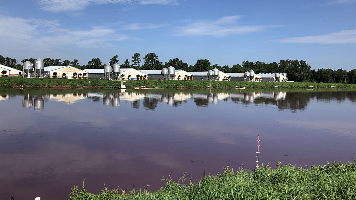
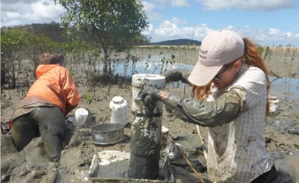
Researchers at North Carolina State University have developed an automated technique that uses Landsat to determine when swine waste lagoons were constructed and how they may have affected environmental quality.
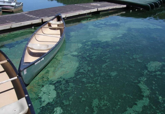
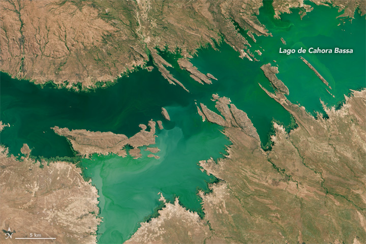
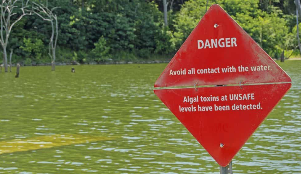
Harmful algal blooms pose a health risk to fish and other wildlife as well as humans; satellites, including Landsat, are helping public health officials keep people safe.
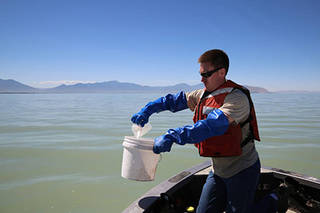
Landsat helps water resource managers know where to look for dangerous algal blooms in Utah lakes.
The SERVIR team has developed models for groundwater demand based on Earth observations for parameters like rainfall and surface water from satellite missions.
Landsat shows some of the ways in which COVID-19 is changing the environment.
Satellite images are helping to reveal how COVID-19 lockdown measures are impacting food security, urban surface heat, water quality and aquatic ecosystems, and more in NASA-funded studies.

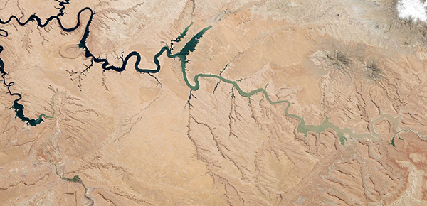
Using 30 years of Landsat data, researchers have found that the volume of glacial lakes worldwide has increased by about 50% since 1990.
The use of satellite data by environmental managers tracking harmful algal bloom outbreaks along lakefronts and coasts can result in earlier detections that yield significant savings on healthcare, lost work hours and other economic costs.

Study of two metro areas finds where parks, trees and other green spaces are located.

How the fields of epidemiology and remote sensing intersect to help the public.
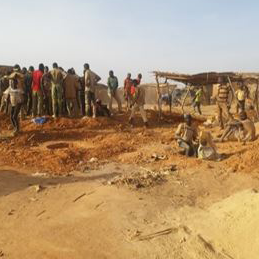
Landsat helps monitor changes in artisanal gold mining areas, enabling land managers to prevent and remedy environmental impacts.
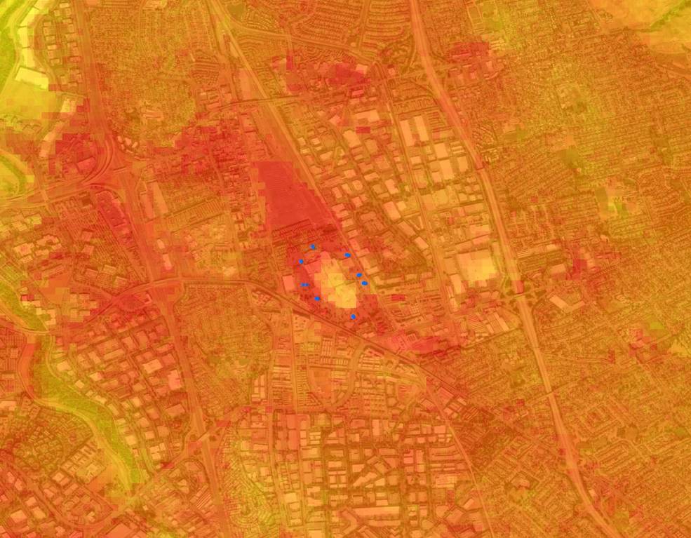
Socio-economically vulnerable populations are at a higher risk of experiencing urban heat effects.
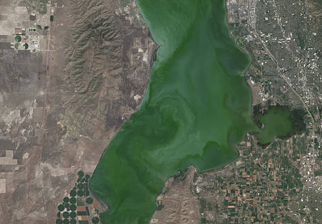
The intensity of summer algal blooms has increased over the past three decades, according to a first-ever global survey of dozens of large, freshwater lakes.

A new investigative report published by NPR has found that it’s hotter in cities’ low income areas.
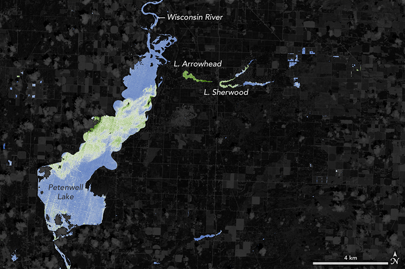
With limited resources to dedicate to monitoring for harmful algal blooms, water managers are looking to new technologies from NASA and its partners to detect and monitor potential hazards in lakes and reservoirs.

The prolonged presence of green space is intrinsic for a healthy society a new nationwide Danish study finds.
It started as an algorithm to detect clouds in satellite imagery, but now the software is being used for everything from increasing food security in the developing world to guiding futures trading on Wall Street.
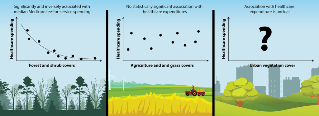
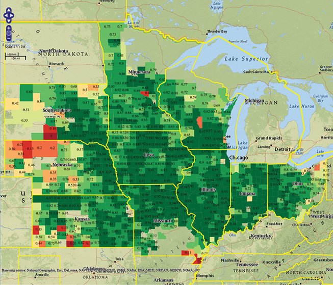
Each 1 percent of a county’s land that was covered in forest was associated with an average Medicare expenditure savings of $4.32 per person per year.
The study used machine-learning to analyze more than 700,000 Landsat images to map changing global distribution of intertidal areas over a 30-year period.
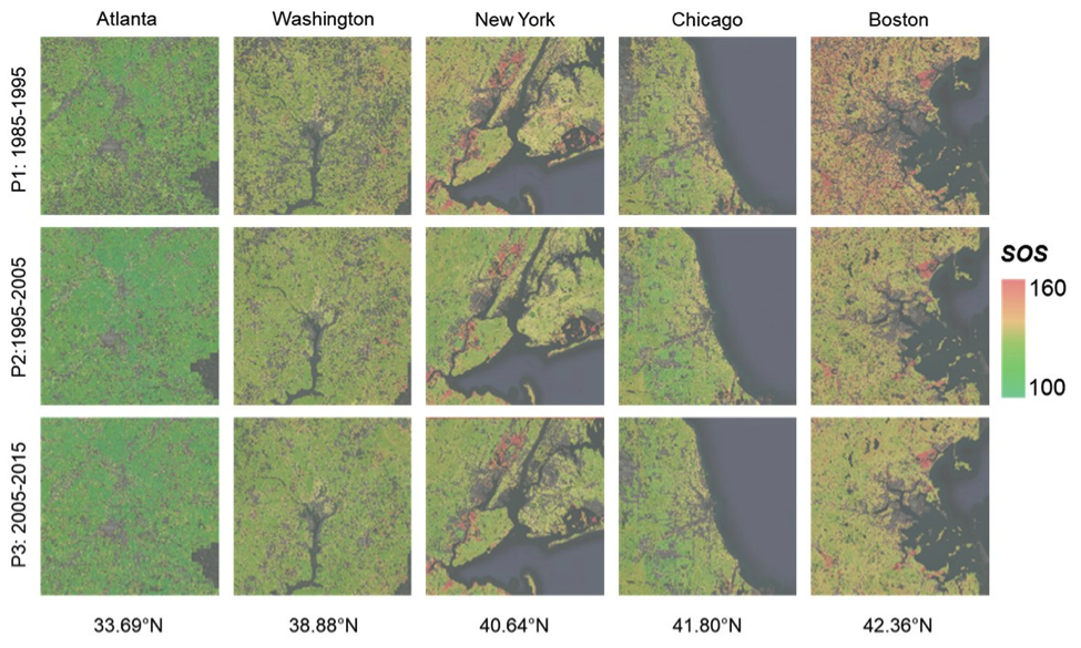
New insights on how vegetation phenology in urban and surrounding areas respond to urbanization.

Landsat 8 allows for the acquisition of spectral data for monitoring water quality from lakes and drinking water reservoirs across the United States.
Increasingly, water managers are turning to satellites like Landsat to monitor inland waters.
When algae blanket a lake’s surface, loss of sunlight and—eventually—oxygen, smothers aquatic life.
Using data from Landsat and Sentinel-2, UNESCO is providing freshwater quality information at the global scale.
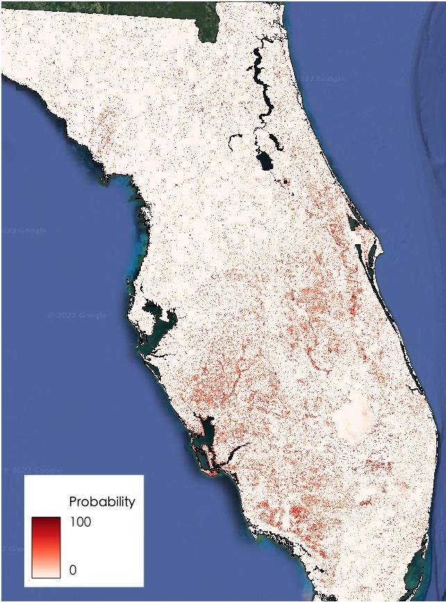
High levels of residential abandonment and unchecked vegetation growth in low-income neighborhoods are strong indicators of mosquito prevalence. Higher income neighborhoods are also susceptible to mosquito-borne disease due to the presence of irrigated vegetation, which creates mosquito-friendly habitat.
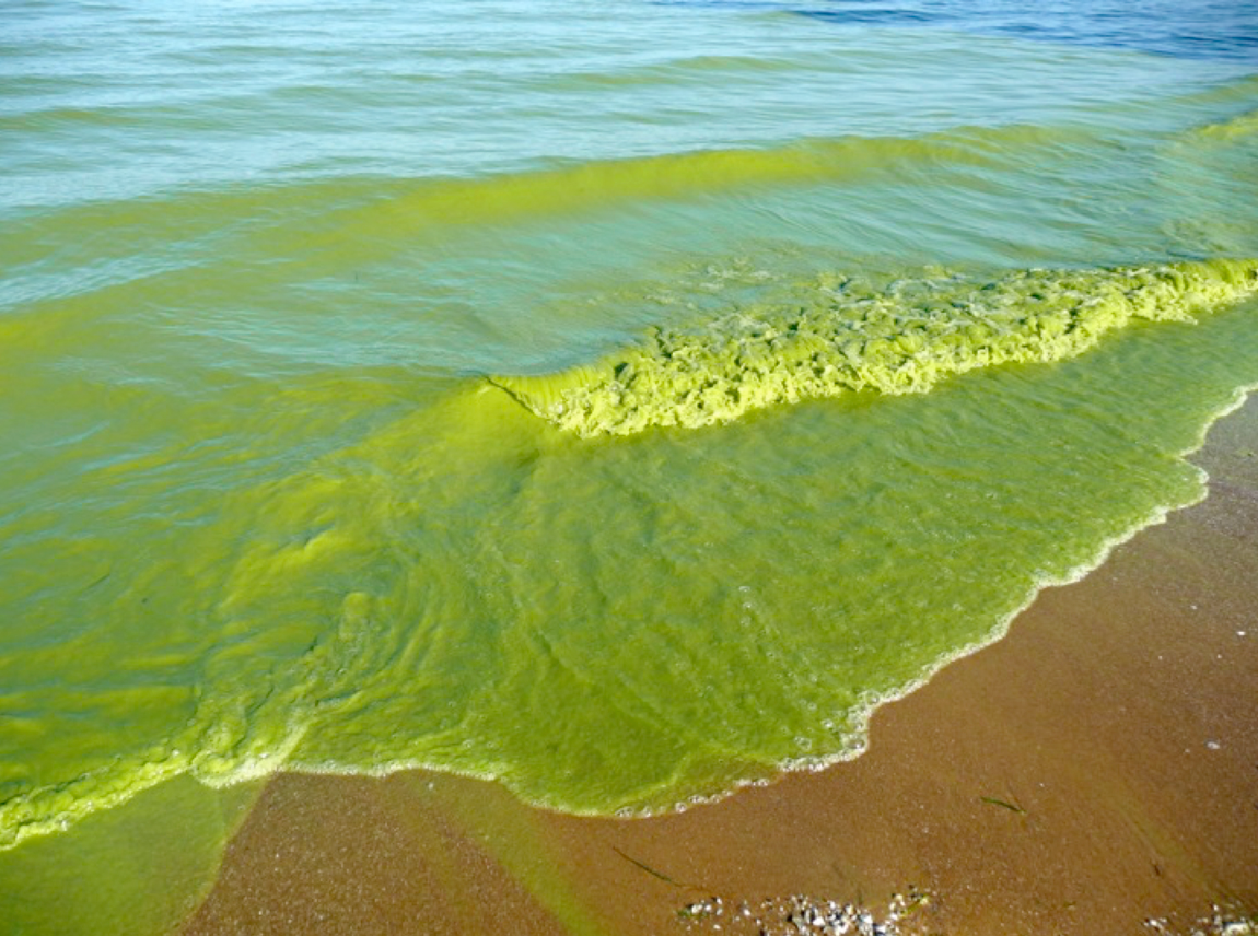
With the growing frequency and magnitude of toxic freshwater algal blooms becoming an increasingly worrisome public health concern, Carnegie scientists Jeff Ho and Anna Michalak, along with colleagues, have made new advances in understanding the drivers behind Lake Erie blooms and their implications for lake restoration.
Understanding the relationship between land use and river flows in the Yarmouk basin.
We recently spoke with veterinary epidemiologist Todd Kelman from the University of Davis, California about his avian flu research. Todd has incorporated Landsat data into his research and we wanted to know more.
When a Los Angeles water treatment plant had to discharge treated water closer to shore than usual in the fall of 2015 due to repair work, NASA satellite observations helped scientists from the City of Los Angeles and local research institutions monitor the Santa Monica Bay for any impacts. For the city, it was an opportunity to assess the use of satellites in guiding a substantial monitoring effort. For NASA, it was an opportunity to refine the use of satellite assets to study a coastal environment.
