
By Erin Frick, Cary Institute of Ecosystem Studies
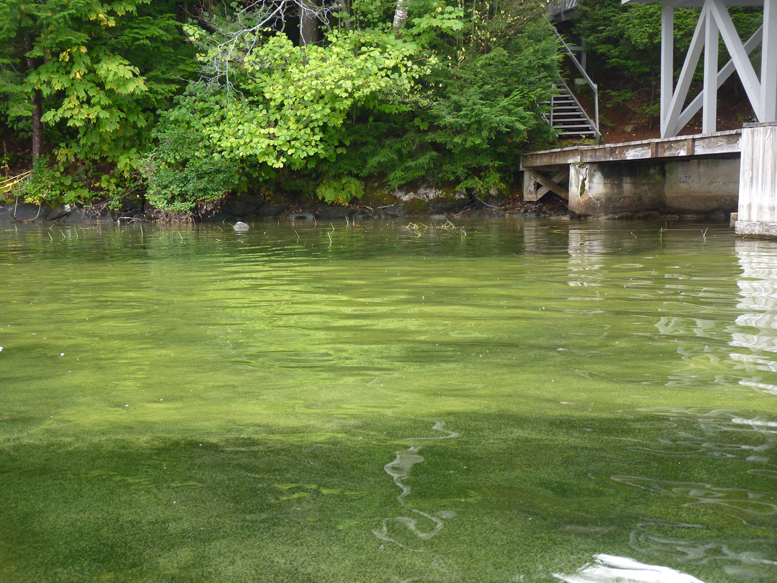
Road runoff, lawn treatments, and agricultural chemicals fuel algal growth in water bodies. When algae blanket a lake’s surface, loss of sunlight and–eventually–oxygen, smothers aquatic life. The result: scummy ponds that look like putting greens and smell like decomposition.
Concerns aren’t only aesthetic. Harmful algal blooms (known as HABs) can become toxic to humans and wildlife, making water quality monitoring a concern for municipalities and businesses that rely on clean lakes and the ecosystem services they provide. Timing is important; HABs can occur quickly and present a sudden threat to lake users.
The study is the product of lead author Jonah Boucher’s Research Experiences for Undergraduates (REU) project at the Cary Institute of Ecosystem Studies. He explains, “In the same way that predicting severe weather is in the best interest of public safety, forecasting algal blooms can help managers warn swimmers and other lake users to avoid contact with the water. Predictions can also inform treatments which, if swiftly implemented, could prevent a bloom.”
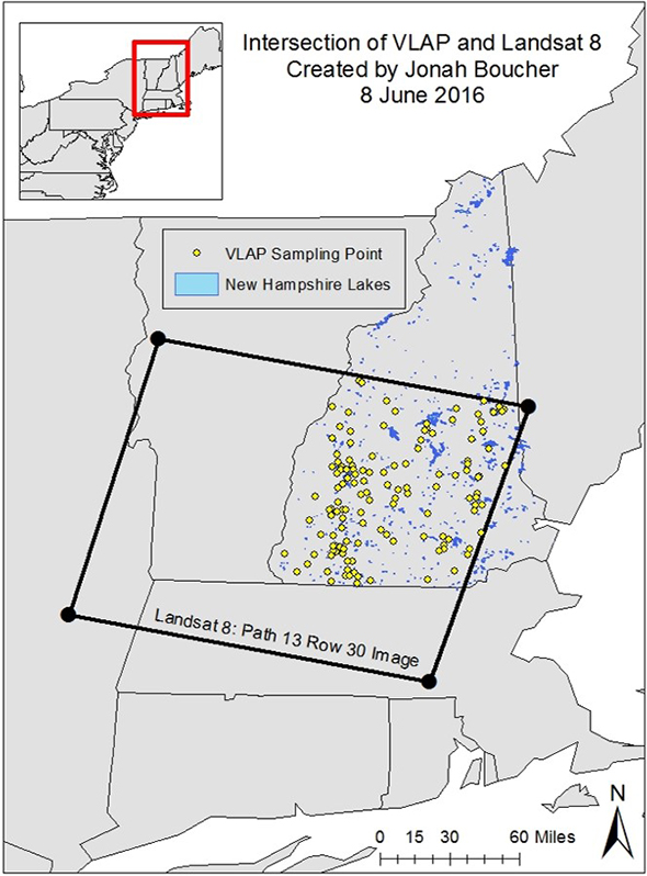
Accurate prediction requires geographically broad, high-frequency data sets. Lake association volunteers collect data on many lakes in the northeastern US; however, periodic sampling on scattered lakes does not provide enough data to identify regional trends and forecast blooms. The solution lies in pairing in-the-lake observations with satellite data.
Boucher says, “Traditional algae monitoring involves collecting water samples and sending them for analysis, which is time and labor-intensive, or relying on readings from expensive lake-based sensors. By refining algorithms that infer the presence of chlorophyll from satellite data, it becomes possible to measure and monitor algae at an unprecedented scale.”
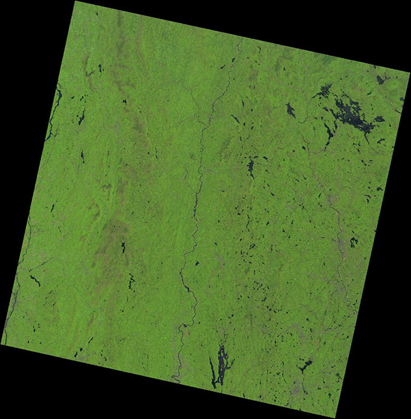
Since the 1970s, NASA’s Landsat satellites have collected images of the Earth’s surface. These satellites are equipped with instruments that detect electromagnetic wavelengths, organized into spectral ‘bands’. These bands correspond with reflectance values, which provide information on surface and near-surface features such as photosynthetic activity and temperature. Landsat 8 is the program’s most recent mission.
Kathleen Weathers, co-author on the study, REU mentor, and Senior Scientist at the Cary Institute, says, “Each Landsat 8 spectral band detects a specific wavelength range, defined with a particular application in mind. For example, Band 2, which detects blue wavelengths, can be used to distinguish deciduous from coniferous vegetation. A combination of bands can be used to infer chlorophyll in aquatic ecosystems. These applications rely on the fact that different surfaces on the Earth have different reflectance and absorbance properties, depending on their composition of spectrally-active compounds.”
The team used the USGS EarthExplorer website to collect Landsat 8 images of regions of Maine and New Hampshire that have lakes with active volunteer monitoring programs. These images are comprised of data-rich pixels which hold information about the surface of the Earth. Through statistical processing, this information can reveal estimates of chlorophyll-a concentrations in lakes.
Researchers have developed a variety of algorithms which establish different mathematical relationships between Landsat 8’s reflectance bands to estimate chlorophyll concentrations. In this study, the team tested six such algorithms to determine which produce chlorophyll-a estimates that most closely match those obtained from direct lake sampling.
Boucher explains, “The most effective algorithms combine specific band reflectance data into a number that correlates with on-the-ground data. Algorithms that are simple yet regionally and seasonally robust are ideal. Sensitivity to seasonal variability in atmospheric interference is also important.”
Remote sensing is not a perfect system. Cloud cover, haze, dust, and other particles suspended in the atmosphere present challenges to collecting the clear, high-quality data required to detect algal blooms. However, Landsat is continually adapting its instruments to overcome these obstacles.
“Because Landsat 8 is able to distinguish real surface reflectance information from atmospheric noise created by clouds and dust, algorithm outputs are now better able to correlate with in-lake measurements,” says Hamid Norouzi, a remote sensing specialist, co-mentor, and co-author of the study. “Landsat 8 also includes a new band designed to detect water bodies, such as the lakes we focused on in this study.”
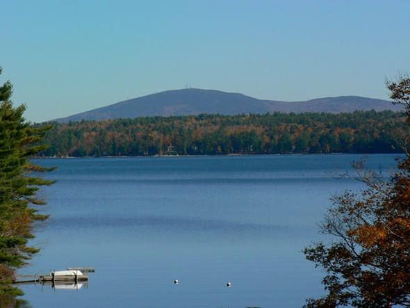
In-lake sampling is still the most reliable way to monitor water quality, but there are thousands of lakes in the northeastern US alone which do not have volunteer monitoring groups or are too difficult to access for sampling.
“Despite water pollution management efforts throughout the region, toxic algae blooms remain a threat to human and ecosystem health. We need to put rapid detection and response measures in place. With increasing improvements in satellite technology and finely-tuned methods of mathematical processing, forecasting algal blooms is within our reach. This study brings us one step closer,” says Weathers.
Boucher adds, “New satellite data are being generated daily, providing ample opportunities to expand this work. For example, there are over a dozen non-cloudy summer images of our study region that have been taken by Landsat since our data collection for this study. These images would more than double the amount of data available for establishing correlations between satellite and lake-based measurements, and finessing predictive methods for forecasting algal blooms with greater accuracy.”
Reference
Boucher, Jonah, Kathleen C. Weathers, Hamid Horouzi, and Bethel Steele. 2018. “Assessing the effectiveness of Landsat 8 chlorophyll a retrieval algorithms for regional freshwater monitoring.” Ecological Applications:1–11.


