Landsat’s Role in Managing Water Resources
Water is essential for life. A third of Earth’s populace has unreliable access to clean water. With current population growth and environmental trends, the U.N. Environmental Program estimates that 1.8 billion people will face water scarcity by 2025. Water means survival for people and other species we rely upon to thrive, making proper stewardship of our water resources vital. Good decisions require good data. Since 1972 the Landsat series of satellites has been providing such data. Landsat-based decisions on how to manage limited water resources have impacted millions of people worldwide. From finding water for refugees in arid nations to reducing pollution in our national waterways, Landsat enables decisions that directly help people.
Global Mangrove Mapping with Landsat
The area of mangrove wetlands around the world has been declining over recent decades.
Measuring the Wide World of Rivers
Using Landsat to measure river widths around the world.
USGS Video: Landsat in Action—Changing Forest Phenology with Andrew Elmore
Elmore delves into the changing phenology of forests and how that impacts the amount of carbon dioxide going into the atmosphere.
Floating Forests: Citizen Scientists are Mapping Giant Kelp with Landsat
Learn more about the huge citizen science kelp mapping endeavor called Floating Forests.
What Lies Beneath: Mapping Benthic Habitats with Landsat
A method for mapping coral reefs or other benthic habitats over time.
![mapping wetlands with Landsat](https://landsat.gsfc.nasa.gov/wp-content/uploads/2017/12/20171213_agu1-1.png)
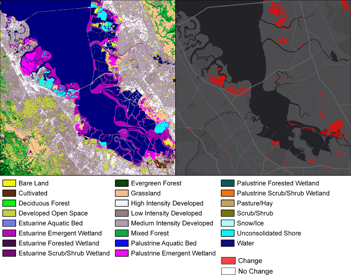
How Much Swamp Are We Talking Here? Towards Better Mapping of Coastal Wetlands
Ways to better estimate the greenhouse gas contributions of wetlands.