
Presentation Title
Remote sensing depth invariant index parameters in shallow benthic habitats for bottom type classification
What is the major finding of this research?
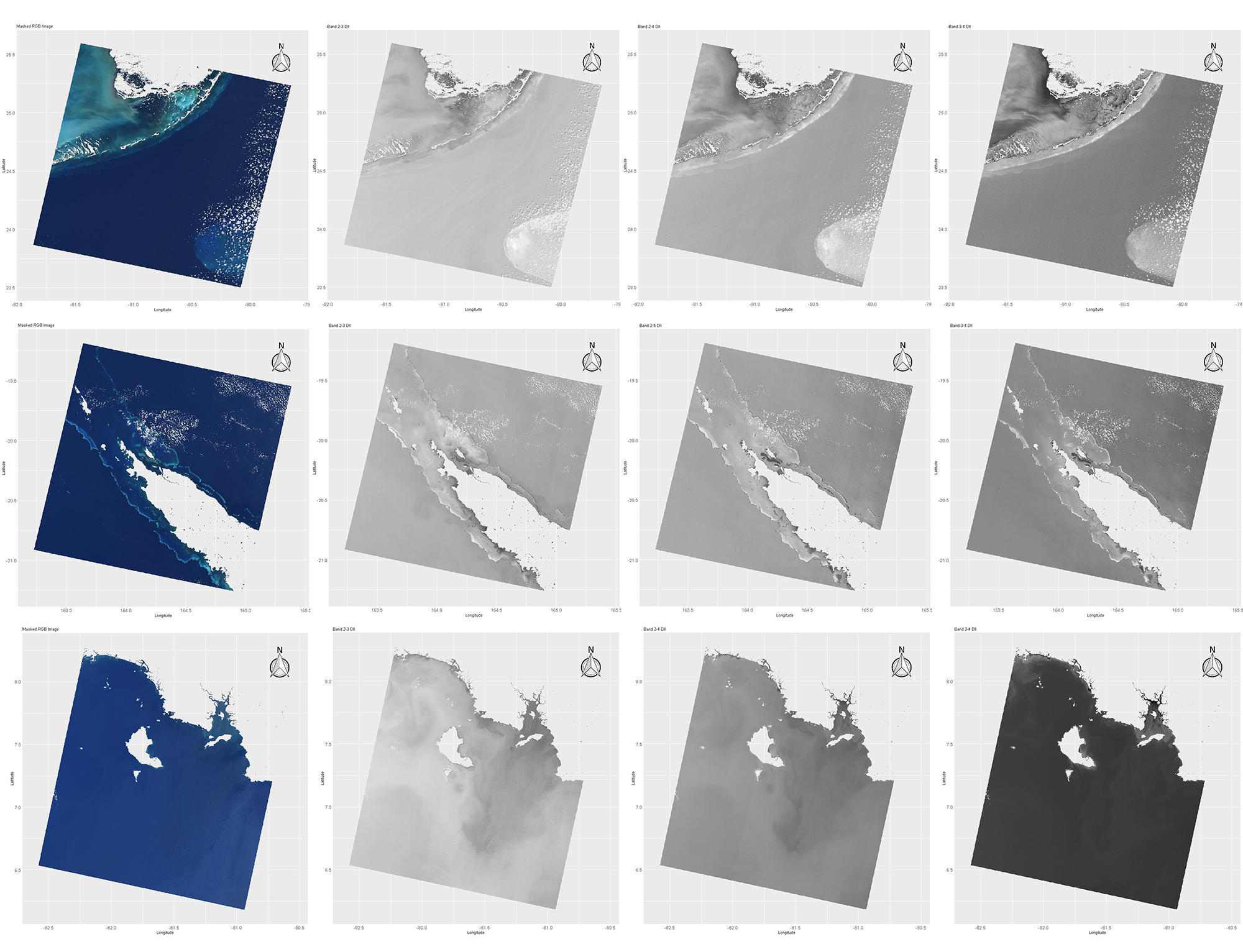
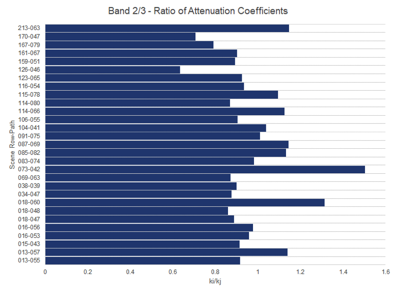
It is widely understood that better mapping of marine habitats will be achieved when depth-invariant preprocessing of digital spectral data using multispectral classification; hence, water column correction is accurately applied for imagery with several water-penetrating spectral bands (e.g. Landsat TM). This research builds on exiting methodologies (Lyzenga, 1978) by evaluating how water column correction can be generalized to Landsat 8 scenes across the globe. We developed a robust, flexible and scalable methodology that can be deployed for different regions globally. After evaluating the resulting hyper parameters, we believe that our major finding is a model that generalizes well for benthic zones around the planet and therefore can be used to evaluate scenes over time and on a global scale.
What are the implications of your findings (and why is it helpful to map benthic habitats)?
The major implication of our findings is the ability to perform global surveys of coral reefs or other benthic habitats over time. For any given day/image the intensity of sunlight in all bands will be the same over the entire scene which means that if we consider the whole scene and chose only those pixels for which the bottom reflectivity is the same, e.g. coral or any other habitat, then all those pixels will have the same depth invariant index value. Therefore, the implications of our findings suggest that we can apply depth invariant indexing to multiple sites and over time. The ability to get a global depth invariant signal of benthic habitats will allow us to deploy a classifier and quantify the subsurface groundcover within these scenes with a focus on detecting coral reefs. Whereas in the past subsurface change detection has been performed on many in situ scenes, we aim to scale the approach and perform analysis that spans both time and region.
What insight did you gain from Landsat that would have been difficult to ascertain otherwise?
The Landsat images are fundamental to our research. They provide a consistent source of data to which we can apply our algorithm both over time and around the globe. Without the Landsat missions, a survey of this magnitude to collect data across time and region would be completely infeasible.
Are there plans to extend this research and create benthic habitat maps for larger geographic areas?
Yes! Our objective is to expand the scope of our research not just to other scenes and geographic areas but also over time using historical Landsat missions.
Co-authors:
Justin Gapper
Chapman University
Hesham Mohamed El-Askary
Chapman University
Erik Linstead
Chapman University
Related Reference:
+ El-Askary, H., S. H. Abd El-Mawla, J. Li, M. M. El-Hattab, and M. El-Raey. 2014. “Change detection of coral reef habitat using Landsat-5 TM, Landsat 7 ETM+ and Landsat 8 OLI data in the Red Sea (Hurghada, Egypt).” International Journal of Remote Sensing 35 (6):2327-2346. doi: 10.1080/01431161.2014.894656
Further Reading:
+ Growth of Hurghada, Egypt, NASA’s Earth Observatory
+ Landsat at #AGU17
Anyone can freely download Landsat data from the USGS EarthExplorer or LandsatLook.

Be Part of What’s Next: Emerging Applications of Landsat at AGU24
Anyone making innovative use of Landsat data to meet societal needs today and during coming decades is encouraged to submit and abstract for the upcoming “Emerging Science Applications of Landsat” session at AGU24.


