Water Resources

Landsat’s Role in Managing Water Resources

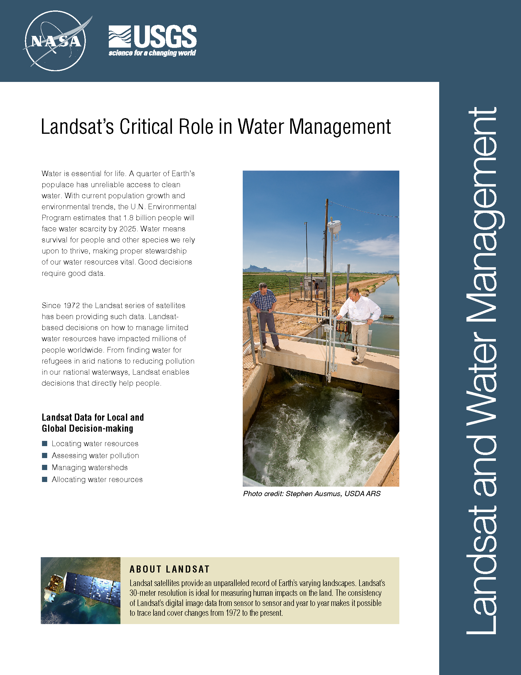
Water is essential for life. A third of Earth’s populace has unreliable access to clean water. With current population growth and environmental trends, the U.N. Environmental Program estimates that 1.8 billion people will face water scarcity by 2025. Water means survival for people and other species we rely upon to thrive, making proper stewardship of our water resources vital. Good decisions require good data. Since 1972 the Landsat series of satellites has been providing such data. Landsat-based decisions on how to manage limited water resources have impacted millions of people worldwide. From finding water for refugees in arid nations to reducing pollution in our national waterways, Landsat enables decisions that directly help people.
Landsat and Water: Using Space to Advance Resource Solutions

A recent White House-led assessment found that Landsat is among the Nation’s most critical Earth observing systems, second only to GPS and weather. A new USGS study, Landsat and Water — Case Studies of the Uses and Benefits of Landsat Imagery in Water Resources, provides examples of why Landsat is so valuable.

Read More »

Landsat Aids Forest Service Research

Ensuring the health and sustainability of the nation’s forests requires scientifically credible and timely information about the extent, location, health, and ownership of these forests and the possible effects of global climate change. Forest managers and policy makers need detailed data to assess sustainability, to make important business decisions, to evaluate wildlife habitat, and for many other things. The Northern Research Station’s Forest Inventory and Analysis (FIA) team provides information on northeastern, midwestern, and Great Plains forests.

Read More »

Tracking Giant Kelp From Space

Citizen scientists worldwide are invited to take part in marine ecology research, and they won’t have to get their feet wet to do it. The Floating Forests project, an initiative spearheaded by scientists at UC Santa Barbara and UCLA, is calling on would-be researchers to examine 30 years of satellite photographs of coastal kelp-dominated areas around the globe to help identify their various sizes and locations.

Read More »

Landsat's Role in Water Resource Management

Water availability and allocation are issues gaining a great deal of attention, particularly in arid climates. Increases in population growth and recent droughts bring urgency to measuring and monitoring water use in areas such as the western United States, where the majority of the water has already been allocated.

Read More »

At the Beach with Landsat 8

Scientists with the Michigan Tech Research Institute are tracking the spread of Chladophora, a hair-fine algae that attaches to shallow water rocks, or the shells of dead invasive zebra and quagga mussels. Occasionally, due to storms in the Great Lakes, the algae slough off the rocks, and cover the beach in a green decaying mess.

Read More »

Landsat and Water—Case Studies of the Uses and Benefits of Landsat Imagery in Water Resources

The Landsat program has been collecting and archiving moderate resolution earth imagery since 1972. The number of Landsat users and uses has increased exponentially since the enactment of a free and open data policy in 2008, which made data available free of charge to all users. Benefits from the information Landsat data provides vary from improving environmental quality to protecting public health and safety and informing decision makers such as consumers and producers, government officials and the public at large. Although some studies have been conducted, little is known about the total benefit provided by open access Landsat imagery.

Read More »