
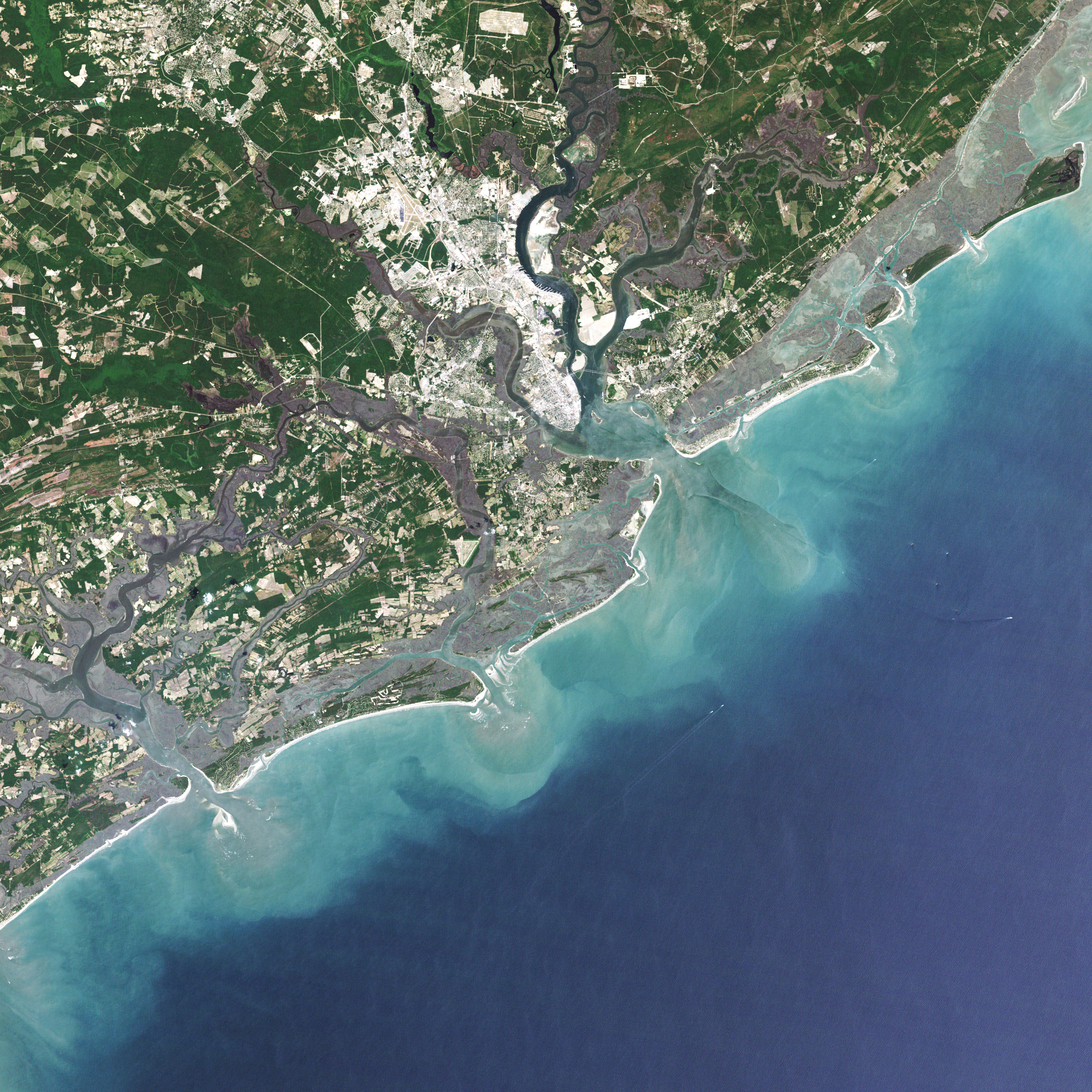
Landsat Sees Dr. Beach’s Top 10 Beaches of 2021
For over 30 years, Dr. Beach, aka Dr. Stephen Leatherman, a professor and coast geomorphologist at Florida International University, has created a Top 10 Beach list based on criteria including water and sand quality, safety, and management. You can find his 2021 picks here and see how Landsat views them as well.
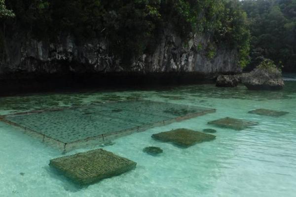
Planning the Future of Palau Fish Stocks with Satellites
In Micronesia, the nation of Palau is building sustainable aquaculture farms in the ocean with the help of satellites.
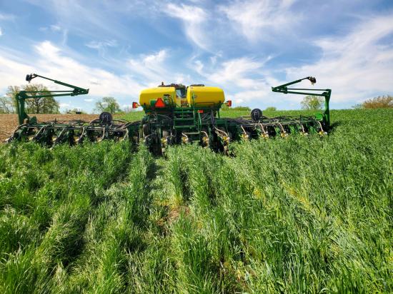
Shoring up the Corn Belt’s Soil Health
Soil is the foundation of our food systems, and sustainable farming depends upon healthy soil, which has impacts far beyond the field on air, water and climate.

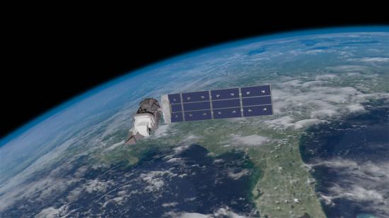
Landsat 9 at Work
For five decades, we have relied on Landsat’s high-quality, science-quality observations to understand and protect our home planet.
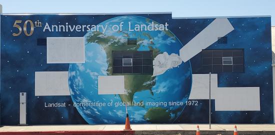
History within the Mural
A mural celebrating Landsat’s 50 year history is being painted in Lompoc, California.
NASA Invites Media to Launch of Landsat 9 From the West Coast
Information about media accreditation for the upcoming launch of the Landsat 9 satellite.

Remembering John Dwyer, a Longtime Landsat Stalwart
Dwyer was an explorer of new technologies and of data. Well-versed on both the science and system development sides of remote sensing, he was a natural fit at EROS.
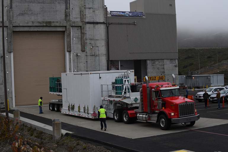
Landsat 9 Arrives at Vandenberg Space Force Base in Preparation for Launch
The Landsat 9 satellite has arrived at the VSFB on the central coast of California.
NASA Invites Media to Launch of Landsat 9 From the West Coast
Information about media accreditation for the upcoming launch of the Landsat 9 satellite.
Remembering John Dwyer, a Longtime Landsat Stalwart
Dwyer was an explorer of new technologies and of data. Well-versed on both the science and system development sides of remote sensing, he was a natural fit at EROS.
Landsat 9 Arrives at Vandenberg Space Force Base in Preparation for Launch
The Landsat 9 satellite has arrived at the VSFB on the central coast of California.

NASA Invites You to Create Landsat-Inspired Arts & Crafts
Get ready to do some Landsat-inspired crafting and art making as we get closer to Landsat 9’s upcoming September launch.
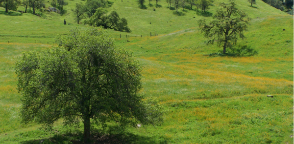
California’s Iconic Blue Oak Woodlands Threatened by Hotter, More Frequent Droughts
California’s blue oak woodlands have decreased by more than 1,200 square kilometers.
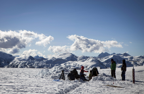
Mountaintop Glacier Ice Disappearing in Tropics Worldwide
Mountaintop glacier ice in the tropics of all four hemispheres covers significantly less area than it did just 50 years ago.
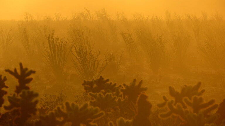
Landsat Shows Plant Die-Offs in Southern California Driven by Climate Change
Landsat data stretching back 40 years show that vegetation loss is most stark in desert ecosystems already on edge of habitability.

Spotting Brittany’s ‘Green Tides’ from Space
‘Green tides’ of algae have wreaked havoc across the coastlines of Brittany, France, for half a century due to high levels of agricultural runoff. With efforts to reduce these underway, a new technique using over three decades of satellite images highlights the extent of the continuing problem.
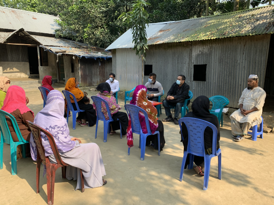
South Asian Farmers Fine Tune When to Water with Landsat
Putting NASA and USGS satellite information at farmers’ fingertips leads to less water use and better crop yields in South Asia.
NASA Invites Media to Launch of Landsat 9 From the West Coast
Information about media accreditation for the upcoming launch of the Landsat 9 satellite.
Remembering John Dwyer, a Longtime Landsat Stalwart
Dwyer was an explorer of new technologies and of data. Well-versed on both the science and system development sides of remote sensing, he was a natural fit at EROS.
Landsat 9 Arrives at Vandenberg Space Force Base in Preparation for Launch
The Landsat 9 satellite has arrived at the VSFB on the central coast of California.
NASA Invites You to Create Landsat-Inspired Arts & Crafts
Get ready to do some Landsat-inspired crafting and art making as we get closer to Landsat 9’s upcoming September launch.
California’s Iconic Blue Oak Woodlands Threatened by Hotter, More Frequent Droughts
California’s blue oak woodlands have decreased by more than 1,200 square kilometers.
Mountaintop Glacier Ice Disappearing in Tropics Worldwide
Mountaintop glacier ice in the tropics of all four hemispheres covers significantly less area than it did just 50 years ago.
Landsat Shows Plant Die-Offs in Southern California Driven by Climate Change
Landsat data stretching back 40 years show that vegetation loss is most stark in desert ecosystems already on edge of habitability.
Spotting Brittany’s ‘Green Tides’ from Space
‘Green tides’ of algae have wreaked havoc across the coastlines of Brittany, France, for half a century due to high levels of agricultural runoff. With efforts to reduce these underway, a new technique using over three decades of satellite images highlights the extent of the continuing problem.
South Asian Farmers Fine Tune When to Water with Landsat
Putting NASA and USGS satellite information at farmers’ fingertips leads to less water use and better crop yields in South Asia.
