
Source: Plymouth Marine Laboratory
May 15, 2021 • ‘Green tides’ of algae have wreaked havoc across the coastlines of Brittany, France for half a century due to high levels of agricultural runoff. With efforts to reduce these underway, a new technique using over three decades of satellite images highlights the extent of the continuing problem.
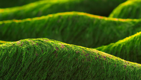
Nitrogen from commonly used farm fertilizers can run off land into rivers and the sea, flooding the areas with excess nutrients. Ulva and other macroalgae then grow rapidly, leading to coastal blooms that can damage marine biodiversity, and impact the tourism economy by covering ‘idyllic’ beaches in green. Further, when these blankets of Ulva decay, they release high concentrations of hydrogen sulphide gas, so green tides can even turn deadly.
Reports of green tides around Brittany date back to the 1970s, and more recent attempts to tackle the problem make use of modern solutions like aerial photography for accurate monitoring. This, however, can be cost-prohibitive. A replicable low-cost approach could benefit Brittany and the many other areas around the world dealing with increasing macroalgae blooms.
Freely available imagery collected by Earth Observation satellites have been used previously to detect vegetation across beaches, shorelines and on the surface of the ocean. This approach would, therefore, offer huge potential for keeping an eye on Brittany’s coastline and green tides.
Louise Schreyers, now a PhD student co-supervised between Associate Professor Tim van Emmerik from Wageningen University and Dr Lauren Biermann at Plymouth Marine Laboratory, decided to look into the issue after her MSc study with École Normale Supérieure de Lyon. She used the joint NASA/USGS Landsat satellites, which collects freely available imagery from low-earth orbit every sixteen days.
Using an open Google Earth Engine script with this satellite data, Ms Schreyers was able to detect and quantify green tide areas at four highly affected beaches in Northern Brittany. Using historical images from the Landsat satellites, a mean green tide coverage could be calculated monthly and annually from 1984 to 2019.
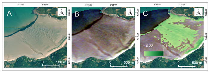
The team found that, despite ongoing efforts to reduce agricultural runoff, three of the four studied sites showed no reduction in green tides, indicating a clear need for further changes to policy and practice to address the issue.
Schreyers said: “This study shows clearly that levels of nitrogen input to rivers and the sea are still too high to reduce green tides in Northern Brittany.
“Using free satellite data is a fantastic way to get a clear idea of the situation, and it also offers future options to go further, like using the Sentinel-2 satellites which provide even higher spatial resolution images every two days. I hope that being able to clearly ‘see’ these geographically vast events over time may help researchers, farmers, and policy makers meaningfully address an age-old problem.”
Reference:
Schreyers, Louise, Tim van Emmerik, Lauren Biermann, and Yves-François Le Lay. 2021. “Spotting Green Tides over Brittany from Space: Three Decades of Monitoring with Landsat Imagery.” Remote Sensing 13 (8):1408.


