

As farmers and backyard gardeners alike know, plants grow best when they are watered just right, not too little, not too much. A growing number of South Asian farmers are now optimally irrigating their crops thanks to University of Washington engineers, cell phones, and satellite data—including Landsat. The farmers are simultaneously maximizing yield and conserving water, in other words, watering just right.
With farmers’ livelihood, water sustainability, and food security all at stake in South Asia, ending overwatering is vital. Dr. Faisal Hossain, a professor in the Department of Civil and Environmental Engineering at the University of Washington, and his team decided to harness open satellite data to empower local farmers to water wisely.
In research published this March in Water Resources Research Hossain and colleagues demonstrate that a staggering amount of groundwater savings can be made when Landsat satellite-based irrigation advice is sent directly via text to farmers who are overwatering crops in the places where groundwater depletion is the worst. They estimate that billions of gallons of ground water could be potentially saved in irrigation districts of Northern India and Eastern Pakistan with widespread use of these SMS advisories—an astounding water savings of 85% per dry season (specifically, it was estimated that 80 million cubic meters of water could be saved in India and 150 million in Pakistan for a typical irrigation district during the dry season).
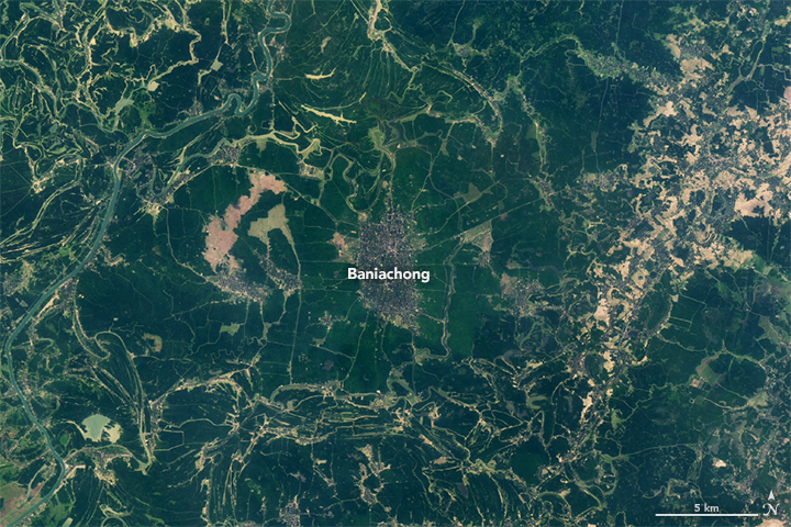
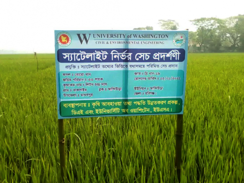
In January, the Landsat text-based advisory system, known as the operational Irrigation Advisory System, or IAS, was expanded to farmers in Northeastern Bangladesh through the country’s Department of Agricultural Extension.
How the Targeted Irrigation Advisory System Works
The University of Washington team is working closely with water and agriculture bureaus of South Asia to decrease wasteful irrigation practices. To figure out which farmers to contact, the team came up with a multistep process. First, they turned to satellite gravimetry data to get a qualitative synopsis of current groundwater conditions. With the use of Terrestrial Water Storage information from the Gravity Recovery and Climate Experiment (GRACE) satellite, the IAS geographically identifies regions where groundwater depletion trends are the most alarming and persistent.
Then Landsat comes into the picture. Landsat enables the identification of fields that are being excessively irrigated. Landsat’s spatial resolution, 100 m for thermal infrared bands, 30 m for visible, near infrared, and shortwave infrared bands, is the highest resolution, publicly available data set that includes all the spectral information needed for the IAS irrigation tracking.
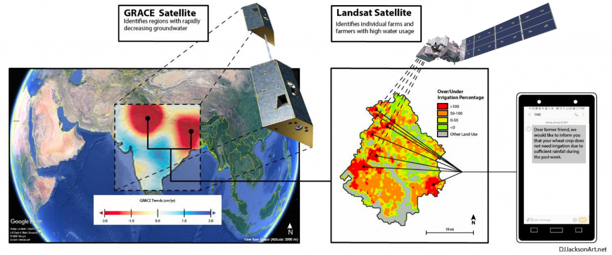
To figure out which farms are overwatering, the amount of water needed by a crop is calculated (using a method developed by former Landsat Science Team member Rick Allen and colleagues for the UN Food and Agriculture Organization). Then, using Landsat’s thermal infrared (TIR) data, the actual amount of water used by crops is calculated (i.e., each field’s evapotranspiration). When the amount of water used is 20%+ higher than the amount needed (taking into consideration weather conditions and crop growth stage) the farmers of those fields are flagged to receive IAS texts.
“The tracking of over-irrigated areas for targeting irrigation advisory texts was completely dependent on Landsat TIR data,” explains lead author Indira Bose, a former University of Washington engineering graduate student, now at Wolf Water Resources in Oregon.
Growing the Seed of an Idea
In 2015, the Pakistan Council of Research in Water Resources reached out to Hossain, an engineer and a water specialist, and asked if he could help them create a satellite-based method to track water usage using publicly available resources.
Hossain, initially turned to weather data and NASA’s MODIS data sets, writing code for the Pakistani water agency to more easily use the data. The impact of that work on farmers—better yields, less money spent on diesel for water pumping—plus the measurable water conservation, supercharged Hossain to keep improving the IAS, adding more detailed information from Landsat, and bringing it to more farmers.
“I think this is a human right issue for farmers to have free access to science-based best practices,” Hossain asserts.
My father was a farmer too until high school. I grew up hearing stories of farmers and learning how they practice farming that is handed down from one generation to another.”
That connection to farmers proved priceless, it helped Hossain gain farmers’ trust that satellites and cellphones could provide insights to supplement their deep generational experience.
The IAS, initially tested with 700 farmers in Pakistan in 2016, has now expanded to over 100,000 farmers in Pakistan, India, and most recently Bangladesh.
Substantial water savings—tracked with Landsat ET measurements—can be seen after IAS-implementation, and the IAS program is poised to keep expanding. Bangladesh, the world’s fourth largest rice producer, is evaluating the Landsat-based IAS for possible integration into its countrywide ag advisory system in 2022 (known as the Agro-Meteorological Information System Development Project, or AMISDP).
Significantly, Hossain’s IAS concept can be transferred to any place in the world where there is unsustainable irrigation.
“If we want to talk about water sustainability, we have to make agricultural water use as efficient as possible by growing more with less water,” Hossain says. “Even if we can improve by just 1%, it translates to huge savings in water, more than what entire nations consume for domestic needs.”


