
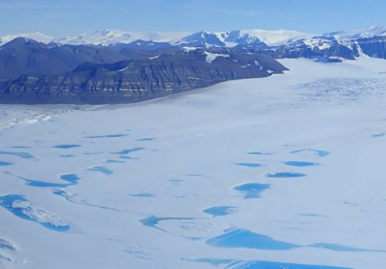
Extreme Melt on Antarctica’s George VI Ice Shelf
Antarctica’s George VI Ice Shelf experienced record melting during the 2019-2020 summer season.
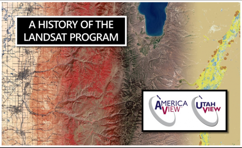
Mapping Landsat’s Long History
UtahView’s Ellie McGinty has created a Google Earth Web Map showcasing Landsat’s history.
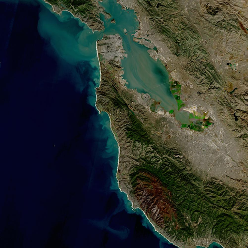
A Harmonious New Dataset
The Harmonized Landsat Sentinel-2 dataset has been provisionally released. Come explore Landsat 8 and Sentinel-2 data… together.
Alert System Shows Potential for Reducing Deforestation, Mitigating Climate Change
Landsat-based Global Forest Watch alerts seem to be helping slow down forest loss in Africa.

Landsat Featured on Recent NOVA Now Podcast
Landsat 9 Project Scientist Jeff Masek from NASA Goddard was interviewed for NOVA Now.
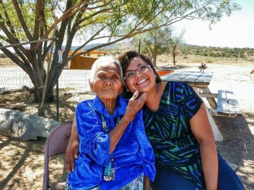
Connecting The Drops: Managing the Navajo Nation’s Water Resources with Satellites and Indigenous Knowledge
The NASA-funded Navajo Nation Drought Project has built a cloud-based web application that uses Landsat and Sentinel-2 data, among others, to improve drought reporting and management in the Navajo Nation.
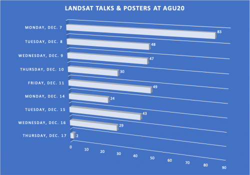
Landsat at #AGU20
This year over 350 presentations share work conducted with Landsat data.
Landsat 9—Continuing the Legacy
This new four-part video series shares the history of Landsat, how Landsat 9 works, how Landsat data gets from the satellite to the ground, and how Landsat data can be used with other data to support a wide range of research and applications. Enjoy!
A Harmonious New Dataset
The Harmonized Landsat Sentinel-2 dataset has been provisionally released. Come explore Landsat 8 and Sentinel-2 data… together.
Alert System Shows Potential for Reducing Deforestation, Mitigating Climate Change
Landsat-based Global Forest Watch alerts seem to be helping slow down forest loss in Africa.
Landsat Featured on Recent NOVA Now Podcast
Landsat 9 Project Scientist Jeff Masek from NASA Goddard was interviewed for NOVA Now.
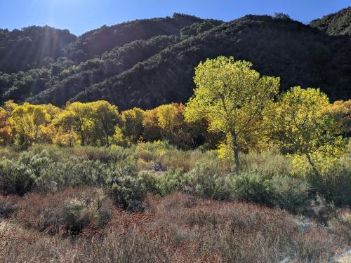
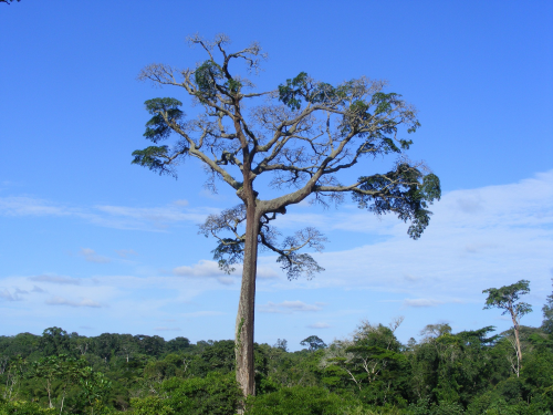
A Well-Rooted Study
Using Landsat to keep an eye on the trees offers an effective way to monitor groundwater along river corridors in the Southwest.
Connecting The Drops: Managing the Navajo Nation’s Water Resources with Satellites and Indigenous Knowledge
The NASA-funded Navajo Nation Drought Project has built a cloud-based web application that uses Landsat and Sentinel-2 data, among others, to improve drought reporting and management in the Navajo Nation.
AGU Panel Explores Environmental Impacts of the COVID-19 Pandemic, as Observed from Space
Landsat shows some of the ways in which COVID-19 is changing the environment.
Landsat at #AGU20
This year over 350 presentations share work conducted with Landsat data.
Landsat 9—Continuing the Legacy
This new four-part video series shares the history of Landsat, how Landsat 9 works, how Landsat data gets from the satellite to the ground, and how Landsat data can be used with other data to support a wide range of research and applications. Enjoy!
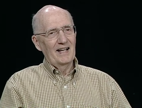
Remembering David Landgrebe
November 30, 2020 • This month, the world lost a giant in the world of quantitative remote sensing. David A. Landgrebe passed away on November 21, 2020 at the age of
A Harmonious New Dataset
The Harmonized Landsat Sentinel-2 dataset has been provisionally released. Come explore Landsat 8 and Sentinel-2 data… together.
Alert System Shows Potential for Reducing Deforestation, Mitigating Climate Change
Landsat-based Global Forest Watch alerts seem to be helping slow down forest loss in Africa.
Landsat Featured on Recent NOVA Now Podcast
Landsat 9 Project Scientist Jeff Masek from NASA Goddard was interviewed for NOVA Now.
A Well-Rooted Study
Using Landsat to keep an eye on the trees offers an effective way to monitor groundwater along river corridors in the Southwest.
Connecting The Drops: Managing the Navajo Nation’s Water Resources with Satellites and Indigenous Knowledge
The NASA-funded Navajo Nation Drought Project has built a cloud-based web application that uses Landsat and Sentinel-2 data, among others, to improve drought reporting and management in the Navajo Nation.
AGU Panel Explores Environmental Impacts of the COVID-19 Pandemic, as Observed from Space
Landsat shows some of the ways in which COVID-19 is changing the environment.
Landsat at #AGU20
This year over 350 presentations share work conducted with Landsat data.
Landsat 9—Continuing the Legacy
This new four-part video series shares the history of Landsat, how Landsat 9 works, how Landsat data gets from the satellite to the ground, and how Landsat data can be used with other data to support a wide range of research and applications. Enjoy!
Remembering David Landgrebe
November 30, 2020 • This month, the world lost a giant in the world of quantitative remote sensing. David A. Landgrebe passed away on November 21, 2020 at the age of
