News Archives
In Focus: A Peek at Landsat 9's OLI-2 Instrument During Focal Plane Integration
Ball Aerospace recently shared some photos of its technicians working on OLI-2 in the cleanroom during focal plane integration.
Satellites Reveal Major Shifts in Global Freshwater
Earth’s wet land areas are getting wetter and dry areas are getting drier due to a variety of factors, including human water management, climate change and natural cycles.
![Tom Patterson / Cape Lookout NP](https://landsat.gsfc.nasa.gov/wp-content/uploads/2018/05/TPpreviewcard.jpg)
National Park Service Cartographer Tom Patterson Talks Landsat
National Park Service cartographer Tom Patterson’s mapmaking process often incorporates information from Landsat.
Landsat 9 Project On Track, U.S. General Accounting Office Assesses
The U.S. General Accounting Office reported on the Landsat 9 satellite project status as part of its 10th annual Quick Look at NASA’s major projects.
Watching A Quarter Century of North American Forest Dynamics with Landsat
Annual maps of the lower-48 United States produced from Landsat satellite data illustrate how these dynamic systems changed from 1986-2010.
![The spring-fed Wood River in the upper Klamath River Basin in southern Oregon](https://landsat.gsfc.nasa.gov/wp-content/uploads/2022/01/20180426_nu1.png)
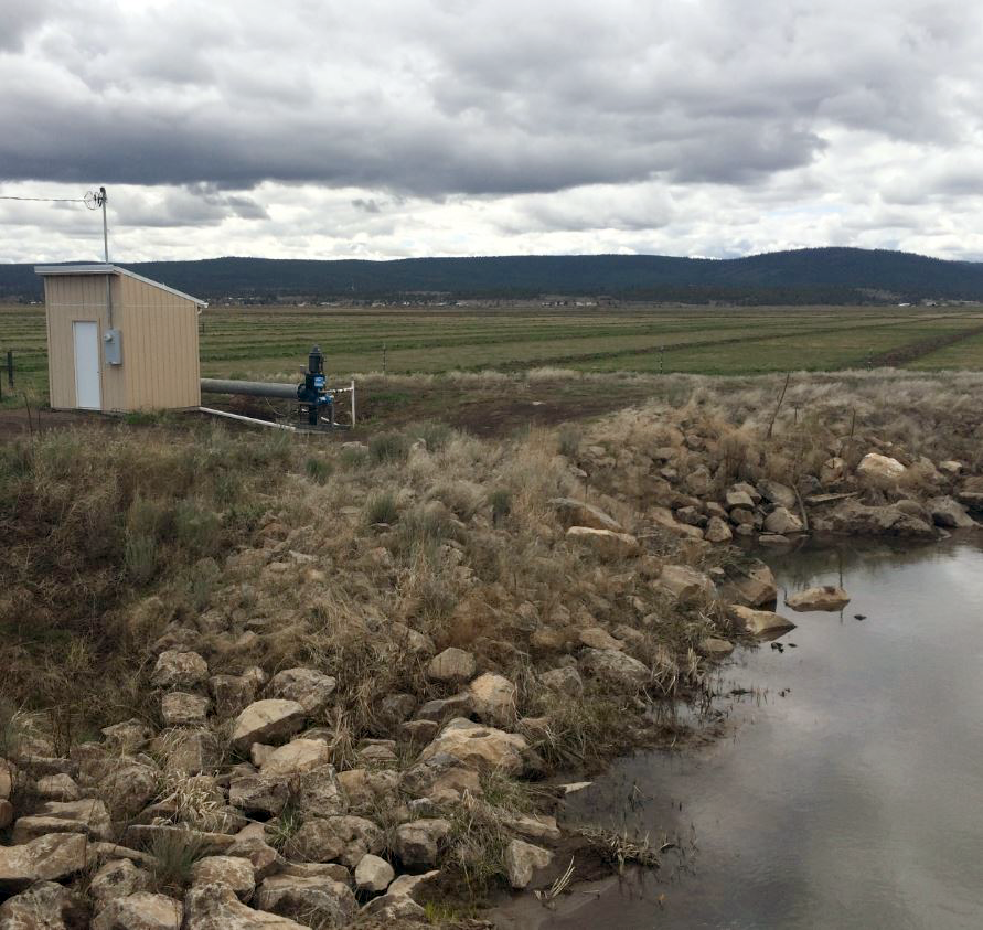
Solving the Riddle of Water Use in the Upper Klamath Basin
When it comes to water, when does less really mean more?
Landsat 9 Successfully Passes Its Critical Design Review
Review board gives high praise to Landsat 9 project for its mission status.
Recent Russian Arctic Glacier Loss Doubles From the Previous 60 Years
Geophysicists examining glacier changes in the Russian Arctic have found that the rate of ice mass loss has nearly doubled over the last decade when compared to records from the previous 60 years.
News Archives
Landsat 9 Spacecraft Passes Latest Critical Design Review
The Landsat 9 spacecraft component successfully completed a rigorous Critical Design Review (CDR) demonstrating that the program meets all technical performance measures and requirements.
Does a Bear Smile in the Woods? Citizen Scientists and Satellites Find Out
NASA satellites are helping Wisconsin develop a clearer picture of its diverse and abundant fauna.
Assessing the Impact of Hurricanes on Puerto Rico’s Forests
Scientists at Berkeley Lab have produced a rapid mapping of the disturbance intensity across Puerto Rico’s forests with the help of Google Earth Engine and Landsat 8.
TIRS-2 Testing: A Landsat 9 Instrument Takes Shape
The TIRS-2 build, as with any science-grade space-based instrument, involves lots of testing.
USGS Video: Landsat In Action—Landsat's Calibration and Validation
Engineers and scientists from both Landsat and Sentinel missions talk about working together to calibrate observation data and validate its quality to improve the science using these resources.
USGS Video: Landsat in Action—Forestry Research with Warren Cohen
Warren Cohen from the USDA Forest Service talks about the value of Landsat’s long history of observations in monitoring and assessing forests.
Artist Grayson Cooke Explores the Forces that Shape Earth with Landsat
Q&A conducted by Laura E.P. Rocchio Grayson Cooke Artist “Open Air” is a media project of Australia-based artist Grayson Cooke that features Landsat 8 imagery as it explores how time
New Study Brings Antarctic Ice Loss Into Sharper Focus
A NASA study based on an innovative technique for crunching torrents of satellite data provides the clearest picture yet of changes in Antarctic ice flow into the ocean.
Landsat 9 Cryocooler Delivered Ahead of Schedule
Ball Aerospace delivered the TIRS-2 Flight Cryocooler for the Landsat 9 TIRS-2 instrument ahead of schedule to NASA’s Goddard Space Flight Center.