

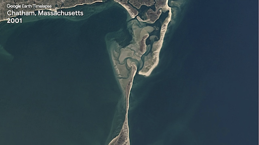
TIME-lapse TRAVEL
Travel to Cape Cod in Massachusetts and watch how 36 years of Landsat images can animate this ever changing coastline.
Did You Know?
Did you know that Landsat 8 passes over your favorite beach every 16 days?
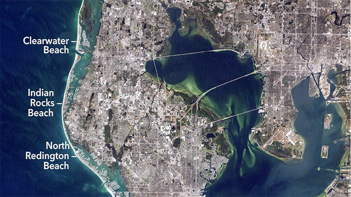
At the Water’s Edge
Discover how Landsat helps map and monitor beaches and coastal waters.


For over 30 years, Dr. Beach has created a Top 10 Beach list based on criteria including water color, sand softness, wave size, water temperature, and more.

What’s your favorite beach?
+ Landsat Sees Top 10 Beaches
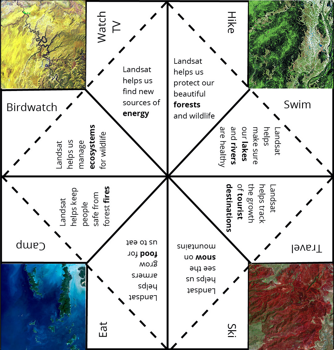
What do you like to do for Summer Fun? Download this Fortune Teller and find out how Landsat helps people manaage, protect, and preserve some of your favorite summer vacation places on the planet.

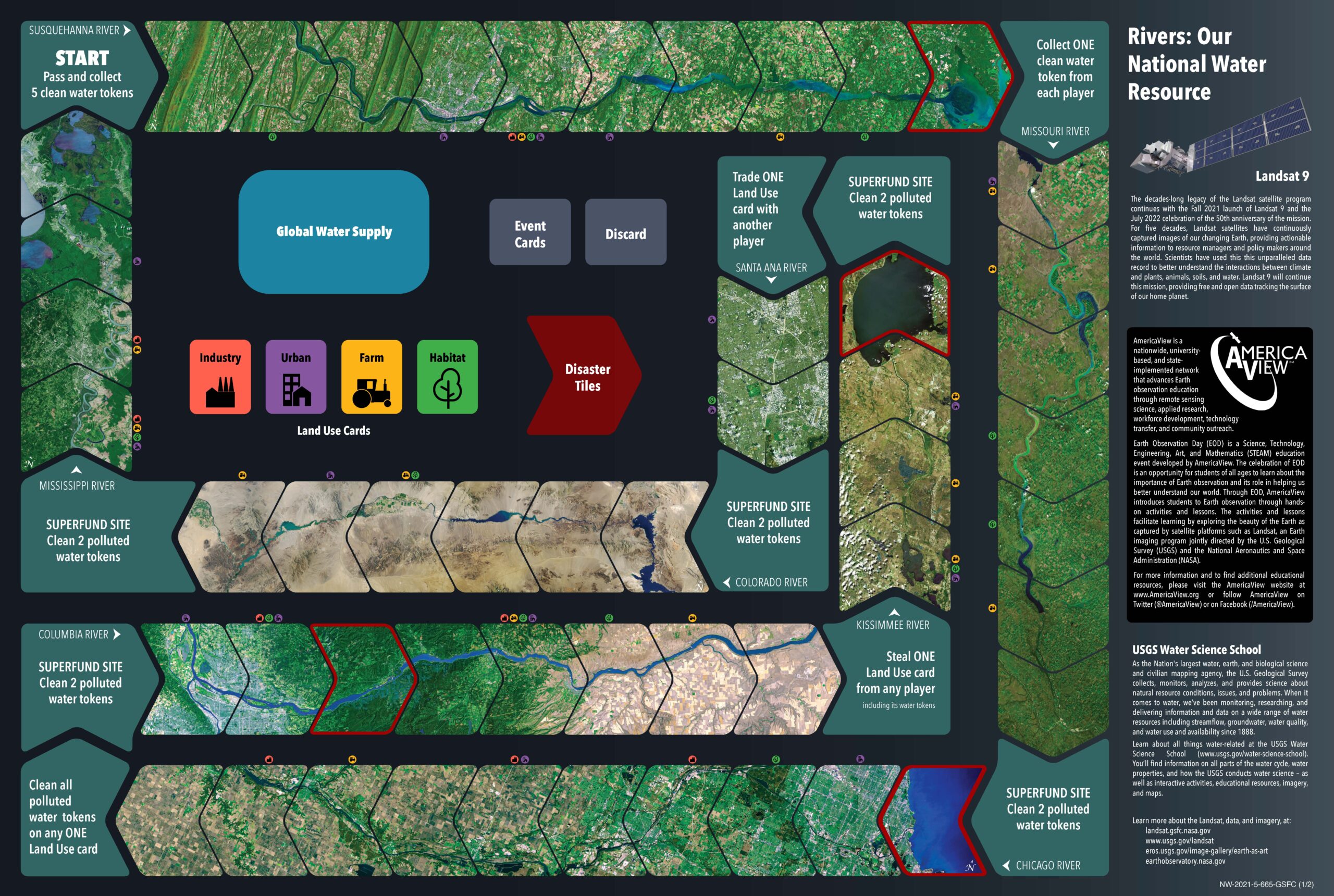
Try your hand at cleaning our nation’s waterways, learning how water is used in different places and industries, and trying to avoid disaster!
What do you like to do for Summer Fun? Download this Fortune Teller and find out how Landsat helps people manaage, protect, and preserve some of your favorite summer vacation places on the planet.
Try your hand at cleaning our nation’s waterways, learning how water is used in different places and industries, and trying to avoid disaster!

 Credit: Kate Ramsayer/NASA
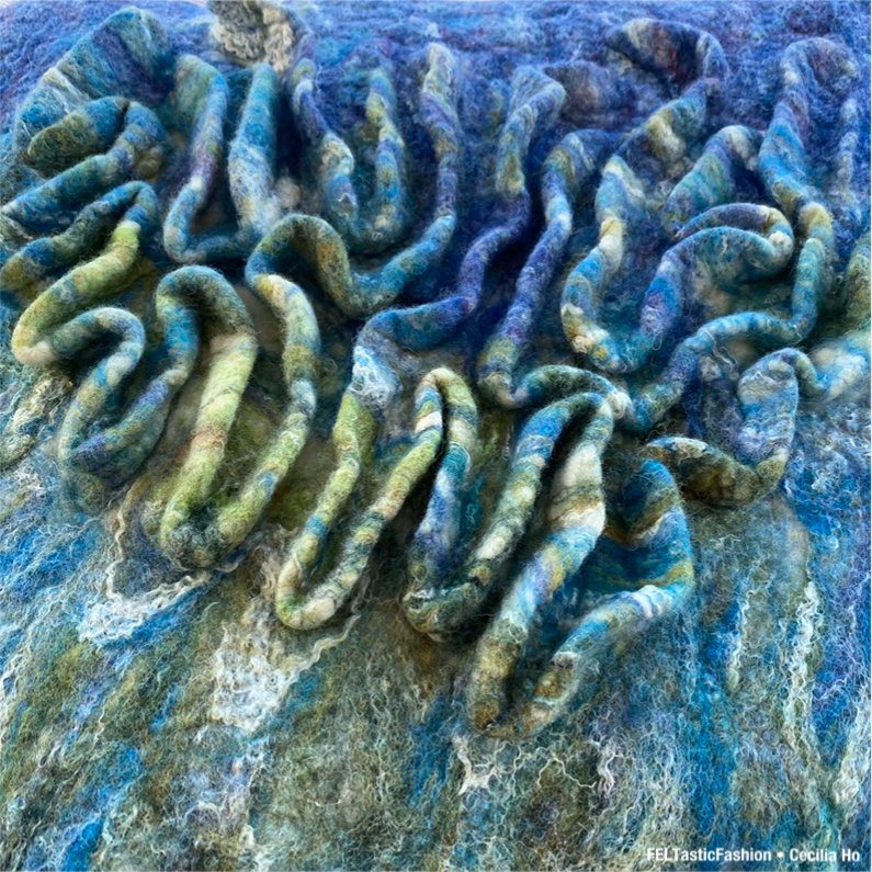 Credit: Cecilia Ho/FELTastic Fashion
Credit: Kate Ramsayer/NASA
Credit: Cecilia Ho/FELTastic Fashion Postcard from Camp
Collect all nine postcards from Camp Landsat at Week 3: Beaches & Reefs! Landsat images show us how shorelines around the world change from year to year. Did you know that beaches are dynamic, living landscapes? The front of this postcard features a natural-color Landsat 8 image of the Bahamas, acquired February 15, 2020.

EOKids
Explore the shore with EO Kids’ Barrier Islands: Sands & Lands in Motion. Learn about Earth’s changing shorelines, especially barrier islands.