

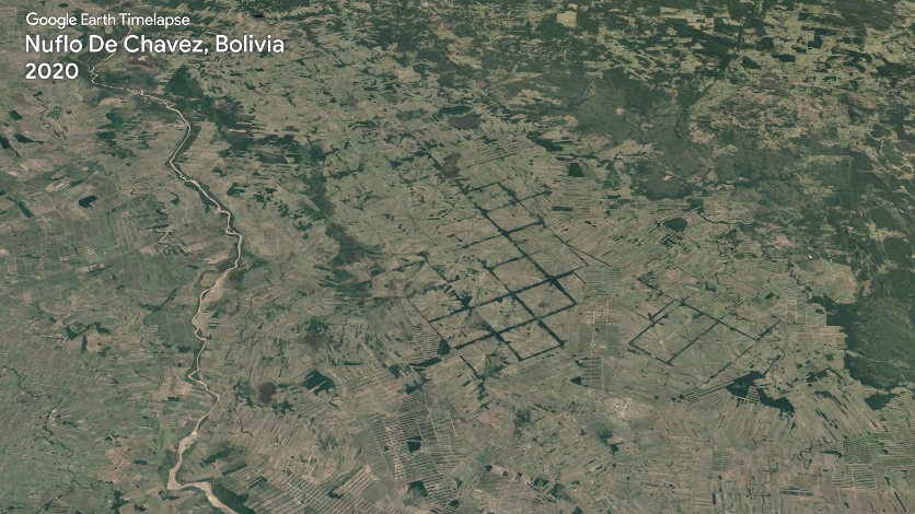
TIME-lapse TRAVEL
See how new farms have created pinwheel patterns & rectangular shapes in Bolivia’s rainforest over four decades.
Did You Know?
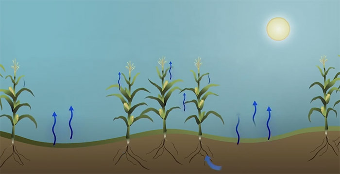
Did you know that plants and soils “sweat” like people, and Landsat can indirectly measure that “sweat” from space?
+ Landsat & Evapotranspiration
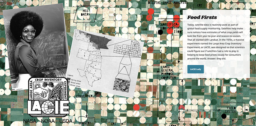
From Farm to Mess Hall
Find out how Landsat sees our food sources and helps farmers conserve resources by watering and fertilizing their crops wisely.
Make your own collage with fun Landsat colors and patterns.

Play the Lands of Landsat game and discover how Landsat helps study farms, cities, parks, forests, and islands.
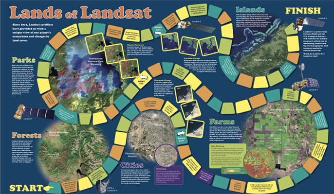
Play the Lands of Landsat game and discover how Landsat helps study farms, cities, parks, forests, and islands.
This embroidery craft was inspired by a Landsat image of Canola fields in Canada.
Create your own Landsat inspired craft and share with
#LandsatCraft.


This embroidery craft was inspired by a Landsat image of Canola fields in Canada.
Create your own Landsat inspired craft and share with
#LandsatCraft.
Why Satellites Rock
Collect all nine postcards from Camp Landsat starting with Week 2: Farms & Food! Data from Landsat are used by the U.S. Department of Agriculture to monitor dozens of crops. The front of this postcard features a natural-color Landsat 8 image of Garden City, Kansas, acquired August 8, 2017. Center pivot irrigation systems create the circular patterns in crop land.

EO Kids
Farmers use a number of different methods to irrigate crops, and some of them result in pretty interesting shapes. EO Kids looks at what water has to do with different types of farming practices, and how these practices look from space. Learn more in The Shape of Farming: Water for Crops.