
As described by WisconsinView:
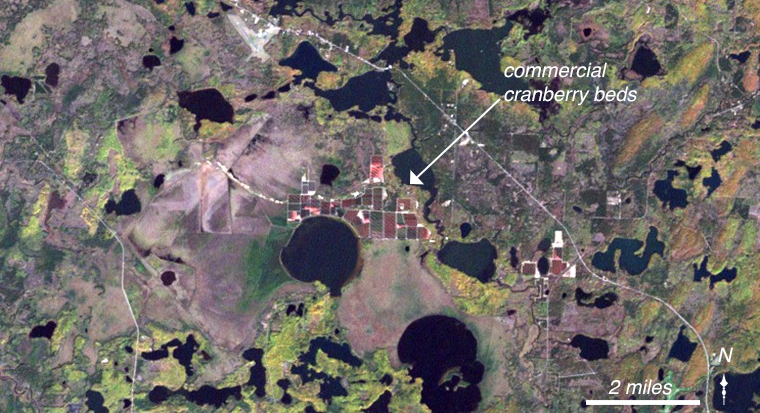
Little Trout Lake and Ike Walton Lake (on the edge of this image) are surrounded by Powell Marsh, a vast non-forested peatland wetland complex. Linear patterns within Powell Marsh are primarily caused by old drainage ditches, and indicate the complex hydrology of this wetland. Extensive commercial cranberry beds are located on the northern shore of Little Trout Lake. Cranberries are harvested in the early autumn, typically by flooding the beds in which they are grown and causing the bright red berries to float to the surface.
Happy Thanksgiving!
Further Reading:
+ Wisconsin Landsat Satellite Imagery via WisconsinView
+ The Thanksgiving Recipes Googled in Every State, The New York Times

Landsat & LCLUC: Science Meeting Highlights
Outreach specialists from the Landsat Communications and Public Engagement team participated in community engagement efforts at the joint NASA and University of Maryland Land Cover Land Use Change (LCLUC) meeting.


