Landsat Next Defined

Landsat Next Defined

Landsat Next is on the horizon—the new mission will not only ensure continuity of the longest space-based record of Earth’s land surface, it will fundamentally transform the breadth and depth of actionable information freely available to end users. Take a look at the new capabilities that will define the next Landsat mission.

Read More »

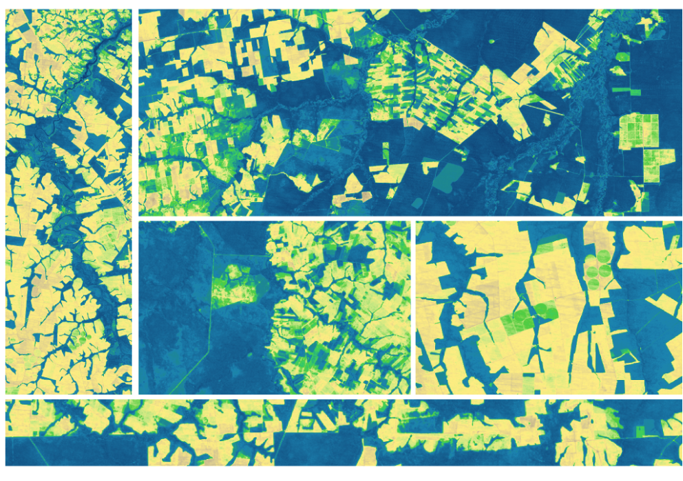
Expanding OpenET Across Amazon Basin

The research teams who help sustain the largest freshwater reserve in the world are developing a new tool to promote more resilient farming systems in Brazil. The goal is to help farmers better handle changes in the water cycle, deal with droughts, and adapt to a changing climate.

Read More »
Landsat Next Defined

Landsat Next Defined

Landsat Next is on the horizon—the new mission will not only ensure continuity of the longest space-based record of Earth’s land surface, it will fundamentally transform the breadth and depth of actionable information freely available to end users. Take a look at the new capabilities that will define the next Landsat mission.

Read More »

Expanding OpenET Across Amazon Basin

The research teams who help sustain the largest freshwater reserve in the world are developing a new tool to promote more resilient farming systems in Brazil. The goal is to help farmers better handle changes in the water cycle, deal with droughts, and adapt to a changing climate.

Read More »

“Landsat is the only operational satellite that combines thermal and optical data at the spatial resolution needed to assess water use and water rights, which is often at the level of individual agricultural fields.”


“The resolution of Landsat imagery and the size of the Landsat database enables critical insight for scalable, high resolution flood detection in several key ways… This increased resolution is particularly critical in urban areas.”


“[W]e see—at least in the commercial sector—that these missions really depend on Landsat as a reference calibrated measurement to adjust or align their measurements to Landsat.”


“Without Landsat we would not have the record we have today about deforestation and changing agriculture across a vast and important biome.”


“We hope to accelerate innovation in climate research, humanitarian relief, and disaster preparedness efforts around the world by making Landsat data readily available near our flexible computing resources.”


“Landsat is providing better [surface] water data—not just at the state level or nationally, but globally”


“With applied conservation programs, we’re using that [Landsat] imagery to say here are the areas that we can prioritize for conservation management, and here are areas that maybe we can let go. It’s a very powerful tool for getting conservation to happen.”


“With its superhuman sight, and decades of archived imagery, Landsat provides us with the ability to see through time, to track the vegetal movement which is beyond our normal sight and to see it for what it really is: a titanic unfolding of active and intentional life.”


“Landsat is currently the only satellite program to provide a consistent, cross-calibrated set of records stretching back over more than four decades, which in turn means the program occupies a key position in the provision of terrestrial essential climate variables.”


“To make accurate machine learning models of major crops, we needed decades of satellite imagery from the entire globe. Thanks to Google Earth Engine hosting the entire Landsat archive publicly on Google Cloud, we can focus on algorithms instead of worrying about collecting petabytes of data. Earth observation will continue to improve with every new satellite launch and so will our ability to forecast global food supply.”


“With a launch in 2023, Landsat 9 would propel the program past 50 years of collecting global land cover data. That’s the hallmark of Landsat: the longer the satellites view the Earth, the more phenomena you can observe and understand.”


“Landsat’s thermal data is critical for tracking water use in the western United States, where rainfall can be short in supply and managing water resources is critical to ensuring a sustainable supply for farmers, cities, and natural ecosystems.”


“The spectrum of observations will be more finely divided with the next Landsat satellites; that will allow for even greater and more precise differentiation of the types of land cover on the surface of Earth.”


“A 35-year dataset in marine biology is really hard to find… But we need long-term data to understand climate change and how it impacts populations. This was an exponential increase in the amount of information available about kelp forests in Oregon.”


“NASA’s comprehensive study of Earth has provided much of the underlying understanding of current trends in the planet’s climate – including definitive measurements of rising sea levels, glacier retreat, ice sheet changes and the decline in the volume of the Arctic sea ice cap. Our satellites have provided global, long-term views of plant life on land and in the ocean. And our supercomputing power is allowing us to better understand how all the parts of the Earth system work together and he…


“Population in 1972… was around 4 billion people. When we launched Landsat 8 there was 7 billion people on the surface of the planet. Due to those factors our land use and land cover has changed dramatically and continues to change and we use the information and the images from the Landsat satellites to understand the change, to study the trends, and to predict the future.”


“I really believe that Landsat data made a change in how we perceive global change. All of the things we have done so far would not have been possible without the unique Landsat dataset”


“[Landsat] has transformed our understanding of Earth and allows us to better monitor and respond to changes on our planet.”


“I am a big fan of Landsat 8 satellite images as a resource when making maps.”


“Even though I have a book coming out about the Moon Landing, I’ll say it: Landsat is likely the greatest, most impactful, yet under-appreciated, accomplishment of the entire space age.”


“Landsat can see the surface—human settlements, forests, coastal systems. It helps us understand crucial areas of biodiversity on land, crop yields, how to manage our resources, how to protect them.”


“The availability of continuous data streams of high quality and free of charge satellite observations such as the Sentinels of the European Copernicus program and the Landsat missions, in combination with the emergence of automated methods for large data processing and data analytics, and the democratization of computing costs, offer unprecedented opportunities to efficiently monitor the changes and trends in urban development globally.”


“If you don’t know what Landsat (NASA/USGS) and Sentinel-1/Sentinel-2 (ESA) are, they are scientific Earth observation missions involving large, exquisitely calibrated satellites that capture imagery of the entire globe on a regular cadence. Landsat is celebrating its 50th anniversary this year. In fact, there have been 9 different satellites bearing the Landsat name over those five decades—Landsat 9 was launched last year! The data they produce is open and hosted freely for anyone to access. Pr…


Landsat 9 bw
Landsat 9 bw
Landsat 9 bw

The NASA/USGS Landsat Program provides the longest continuous space-based record of Earth’s land in existence. Landsat data give us information essential for making informed decisions about Earth’s resources and environment.