Search
Close this search box.

Month: December 2013

News Archive
San Francisco map 1894

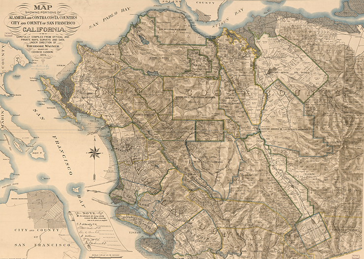
Northern San Francisco Bay, 1894

Maps often convey our relationship to the world. In this map of the northern San Francisco Bay and surrounding environs, the early development of the region is recorded in detail. The full and arduous title of this map is “Map showing portions of Alameda and Contra Costa counties, city and county of San Francisco, California, carefully compiled from official and private maps, surveys and data.”

Read More »

Taking Landsat to the Extreme

Landsat Science Team member Ted Scambos, a lead scientist at the National Snow and Ice Data Center (NSIDC), will present new satellite-derived measurements pointing to the coldest place on Earth this year at the AGU 2013 Fall Meeting in San Francisco, CA.

Read More »

Landsat Users Confirm Its Unique Value

Since 1972, the Landsat program has allowed scientists and analysts to observe the world beyond the power of human sight, monitor changes to the land, and detect critical trends in the conditions of natural resources.

Read More »