Search
Close this search box.

Month: August 2015

News Archive

Landsat Images Provided to the International Charter in August 2015

The Charter concept is this: a single phone number is made available to authorized parties providing 24/7 contact to a person who can activate the charter. Once activated, a project manager takes charge. The project manager knows what satellite resources are available, how to task them to collect data, and how to quickly analyze the collected data to create impact maps for first responders. These maps, provided to responders for free, often show where the damage is and where crisis victims are, allowing responders to plan and execute relief support.

Read More »
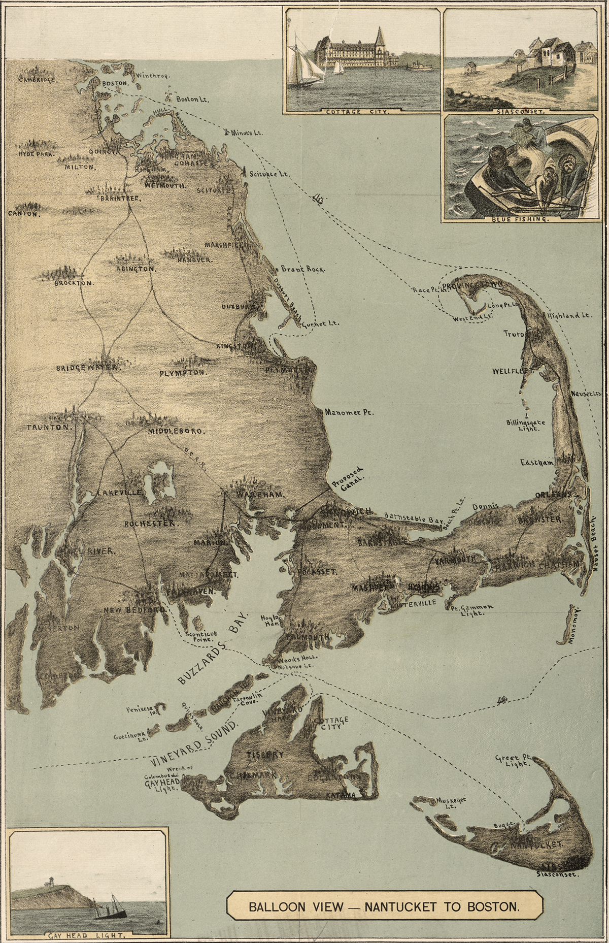
Cape Cod map 1885

Cape Cod, 1885

The sandy peninsula of Cape Cod, Massachusetts juts into the Atlantic Ocean with its characteristic crook and twirl in both images: “Balloon View–Nantucket to Boston” made in 1885, and a Landsat 8 satellite image made 129 years later in 2014. Aspirations to rise above the Earth and to record the Earth’s surface from there are a long-standing theme of human culture.

Read More »

Vegetation Essential for Limiting City Warming Effects

Cities are well known hot spots – literally. The urban heat island effect has long been observed to raise the temperature of big cities by 1 to 3°C (1.8 to 5.4°F), a rise that is due to the presence of asphalt, concrete, buildings, and other so-called impervious surfaces disrupting the natural cooling effect provided by vegetation. According to a new NASA study that makes the first assessment of urbanization impacts for the entire continental United States, the presence of vegetation is an essential factor in limiting urban heating.

Read More »

Improved Forest Disturbance Monitoring via an Algorithm Ensemble

Forest resource managers, natural resource policy makers, and global change scientists need comprehensive, consistent, and up-to-date information on trends in forest cover and condition. This information is essential for understanding carbon budgets, predicting fire behavior, quantifying biodiversity, and hydrologic modeling.

Read More »

Lakes On A Glacier

How deep is that icy blue water on Greenland’s ice sheet? Dr. Allen Pope, of the National Snow and Ice Data Center, is using data from the NASA/USGS Landsat 8 satellite to find out. In this video, Dr. Pope shares what he sees when he looks at a Landsat image of the Greenland ice sheet just south of the Jakobshavn Glacier.

Read More »